Aras River
The Aras River holds significant historical and geographical importance in the region. Rising in the mountains of Turkey, it serves as a vital international…
What is the historical significance of the Aras River in the region?
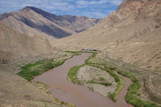
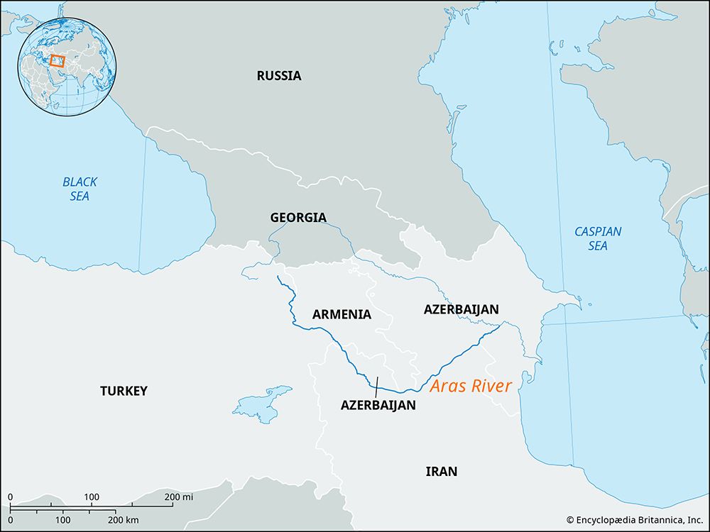
The Aras River holds significant historical and geographical importance in the region. Rising in the mountains of Turkey, it serves as a vital international boundary, separating Armenia and Azerbaijan to the north from Turkey and Iran to the south.1
Historically, the river valley has been a site of great prominence. Notably, the ancient city of Artaxata—the seat of the Artaxiad kings of Armenia from 180 BCE to 50 CE—was situated on an island within the river. Furthermore, the Aras River valley has been identified by some as the location of the legendary Garden of Eden.1
Beyond its historical legacy, the river plays a crucial role in the region’s physical geography. It is a major tributary of the Kura River, and its sediment is the primary contributor to the formation of the Kura-Aras delta as it flows toward the Caspian Sea.1
How long is the Aras River, and what are its major tributaries?
The Aras River has a total length of approximately 665 miles (1,070 km) before it joins the Kura River in Azerbaijan. Along its course, it serves as an international boundary for about 275 miles (440 km) between Armenia and Azerbaijan to the north and Turkey and Iran to the south.1
The river’s principal tributaries include:
- Arpa Çayı (Akhuryan): This tributary receives water from the Kars River and Lake Çıldır in Turkey.1
- Hrazdan: This river drains Lake Sevan in Armenia.1
- Qareh Sū: This stream flows from the Sabalān Mountains located in northeastern Iranian Azerbaijan.1
What are the main geographical features of the Aras River basin?
The Aras River basin is defined by several distinct geographical features as it traverses the complex terrain of the Caucasus region:
- Headwaters and Mountainous Terrain: The river originates in the Bingöl Mountains of Turkey, south of Erzurum. It flows eastward, passing south of the Lesser Caucasus range, which separates it from the Kura River for much of its upper course.14
- Valleys and Plains: After exiting the mountainous border regions, the river emerges into a broad valley. It eventually crosses the arid Mugan Steppe before reaching the Kura-Aras Lowland, an extensive depression where it joins the Kura River.14
- Delta Formation: The Aras is a swift-flowing, unnavigable river that serves as the primary source of sediment for the Kura-Aras delta, which extends toward the Caspian Sea.1
- Hydrological Connections: The basin includes significant drainage from high-altitude sources, such as Lake Sevan in [Armenia], which drains into the Aras via the Hrazdan River.12
What are some of the major cities or ancient settlements located along the Aras River?
The Aras River valley has long been a site of historical significance. While the river is primarily known for its natural geography and role as an international boundary, it is home to notable historical sites:
- Artaxata: Located on an island in the Aras, this ancient city served as the capital and seat of the Artaxiad kings of Armenia from 180 BCE to 50 CE.1
- Regional Context: The river flows near Erzurum, Turkey, where it originates in the Bingöl mountains. Throughout its course, the river passes through diverse landscapes, including the Mugan Steppe, before joining the Kura River in Azerbaijan.1
Beyond its historical settlements, the river valley has been the subject of various cultural traditions, with some historical interpretations suggesting the Aras River valley as the location of the legendary Garden of Eden.1
Sources
- Aras River — Encyclopædia Britannica
- Caucasus - Drainage — Encyclopædia Britannica
- Aras — Merriam-Webster
- Transcaucasia - Physiography — Encyclopædia Britannica
- Transcaucasia - Drainage — Encyclopædia Britannica
- Armenia - Drainage — Encyclopædia Britannica
Published on · 3 min read