Arkansas River
The Arkansas River flows for approximately 1,460 miles (2,350 km) from its source in the Rocky Mountains of central Colorado to its confluence with the…
How long is the Arkansas River, and what major cities does it pass through?
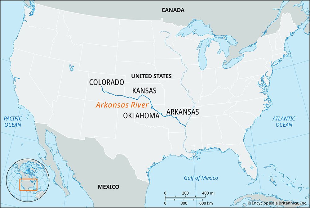
The Arkansas River flows for approximately 1,460 miles (2,350 km) from its source in the Rocky Mountains of central Colorado to its confluence with the Mississippi River.1
Throughout its course, the river passes through several major cities, including:
- Pueblo, Colorado
- Wichita, Kansas
- Tulsa, Oklahoma
- Fort Smith, Arkansas
- Little Rock, Arkansas1
The river serves as a vital waterway, with a portion of its lower reach improved by the Arkansas River Navigation System to support commercial shipping and hydroelectric power generation.2
What is the origin and course of the Arkansas River?
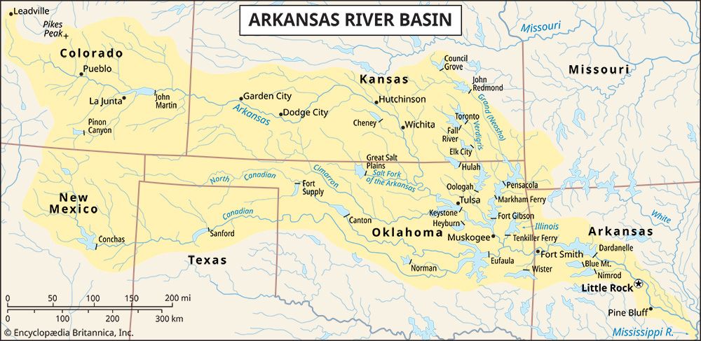
The Arkansas River originates in the Sawatch Range of the Rocky Mountains near Leadville, Colorado.1
From its source, the river flows generally east-southeastward for 1,460 miles (2,350 km) through Colorado, Kansas, Oklahoma, and Arkansas before joining the Mississippi River. Key features of its course include:1
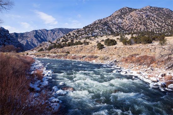
- Mountainous Upper Reach: The river descends 6,750 feet over its first 100 miles to Canon City, passing through the dramatic Royal Gorge.1
- Mid-Course: Between Canon City and Great Bend, Kansas, the channel is wide, shallow, and meanders through an arid, irrigated region.1
- Lower Course: Southeast of Great Bend, the river enters a more humid climate, widening significantly. In Oklahoma, it receives major tributaries, including the Cimarron, Verdigris, and Canadian rivers, before the Arkansas River Navigation System facilitates transport through to the Mississippi.1
What Native American tribes historically lived along the Arkansas River?
Several Native American tribes have historically inhabited the regions along the Arkansas River. Their presence and movements were often shaped by migration, trade, and pressure from colonial expansion.
- Quapaw: This Siouan-speaking people settled near the mouth of the Arkansas River after migrating from the Atlantic coast. They were a sedentary, agricultural society known for their fortified villages and skilled pottery.3
- Wichita: Originally living near the Arkansas River in present-day Kansas, the Wichita were a Caddoan-speaking people who practiced both farming and buffalo hunting. They were among the first Plains Indians encountered by the Spanish in the 16th century.4
- Arapaho: During the 19th century, the Arapaho lived along the Arkansas and Platte rivers. After 1830, they split into northern and southern groups, with the southern Arapaho residing along the Arkansas River and maintaining close ties with the Cheyenne.5
- Osage: While primarily associated with the Osage River and the Ozark Plateau, the Osage historically inhabited areas across Missouri, Kansas, Oklahoma, and Arkansas.67
These tribes experienced significant displacement due to 19th-century treaties and the forced relocation of many groups to Indian Territory (present-day Oklahoma).3564
How does the Arkansas River contribute to the Mississippi River system?
The Arkansas River serves as a major western tributary to the Mississippi River, playing a critical role in the drainage and sediment transport of the North American Great Plains.21
Its contributions to the system include:
- Drainage and Sediment Transport: Rising in the Rocky Mountains, the river acts as a conduit that removes significant silt loads from the rolling expanses of the Great Plains. Like other western tributaries, it helps funnel these sediments toward the lower Mississippi, contributing to the river’s massive alluvial plain.1
- Navigational Integration: The Arkansas River Navigation System transforms the river into a vital commercial artery. By utilizing a series of locks and dams, the system provides a navigable waterway that connects the river basin’s resources—such as agricultural products, lumber, and petroleum—directly to the Mississippi River.10
- Water Management: The river basin features numerous water-control projects, including multiple-purpose reservoirs, which help manage the flow and flooding that characterize the Mississippi’s western contributory network.102
Sources
- Arkansas River — Encyclopædia Britannica
- Arkansas River Navigation System — Encyclopædia Britannica
- Quapaw — Encyclopædia Britannica
- Arapaho — Encyclopædia Britannica
- Arkansas - Early inhabitants, exploration, and European settlement — Encyclopædia Britannica
- Osage — Encyclopædia Britannica
- Wichita — Encyclopædia Britannica
- Caddo — Encyclopædia Britannica
- Osage — Merriam-Webster
- Mississippi River - Physiography — Encyclopædia Britannica
Published on · 3 min read