Atchafalaya River
The Old River Control Structure and the Morganza Spillway are critical components of the flood-control system managed by the U.S. Army Corps of Engineers to…
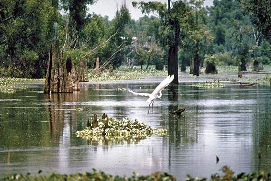
How do the Old River Control Structure and the Morganza Spillway work to manage the flow of the Atchafalaya River?
The Old River Control Structure and the Morganza Spillway are critical components of the flood-control system managed by the U.S. Army Corps of Engineers to regulate the flow of the Mississippi River and prevent it from permanently diverting into the Atchafalaya River basin.12
- Old River Control Structure: This system of dams, locks, and levees maintains the balance of water between the Mississippi and Atchafalaya rivers. Under normal conditions, it diverts approximately 25 percent of the Mississippi’s flow into the Atchafalaya River and the West Atchafalaya Floodway.1
- Morganza Spillway: Located north of Baton Rouge, this floodway is utilized during major flood events—such as those in 1973, 1993, and 2011—to relieve pressure on the Mississippi’s main-stem levees. When opened, it allows excess floodwaters to be diverted into the Atchafalaya River basin, protecting downstream cities like Baton Rouge and New Orleans from catastrophic inundation.312
How has the sediment deposition from the Atchafalaya River affected the Louisiana coastline?
The sediment carried by the Atchafalaya River plays a vital role in the dynamic evolution of the Louisiana coastline. As a major distributary of the Mississippi River, the Atchafalaya provides a shorter, more efficient route to the Gulf of Mexico, where it is actively building a new delta lobe in Atchafalaya Bay.36
While this sediment deposition promotes land growth in the Atchafalaya region, the broader Louisiana coast faces significant challenges. The state’s coastline is experiencing severe erosion, losing approximately 24 square miles of land annually by the end of the 20th century. This loss is largely attributed to the federal levee system, which confines the Mississippi River to a central channel, preventing the natural distribution of sediment that would otherwise nourish and sustain coastal wetlands. Consequently, areas deprived of this sediment are increasingly vulnerable to marine erosion and extreme weather events, such as Hurricane Katrina.76
What are some of the major cities or towns located along the Atchafalaya River?
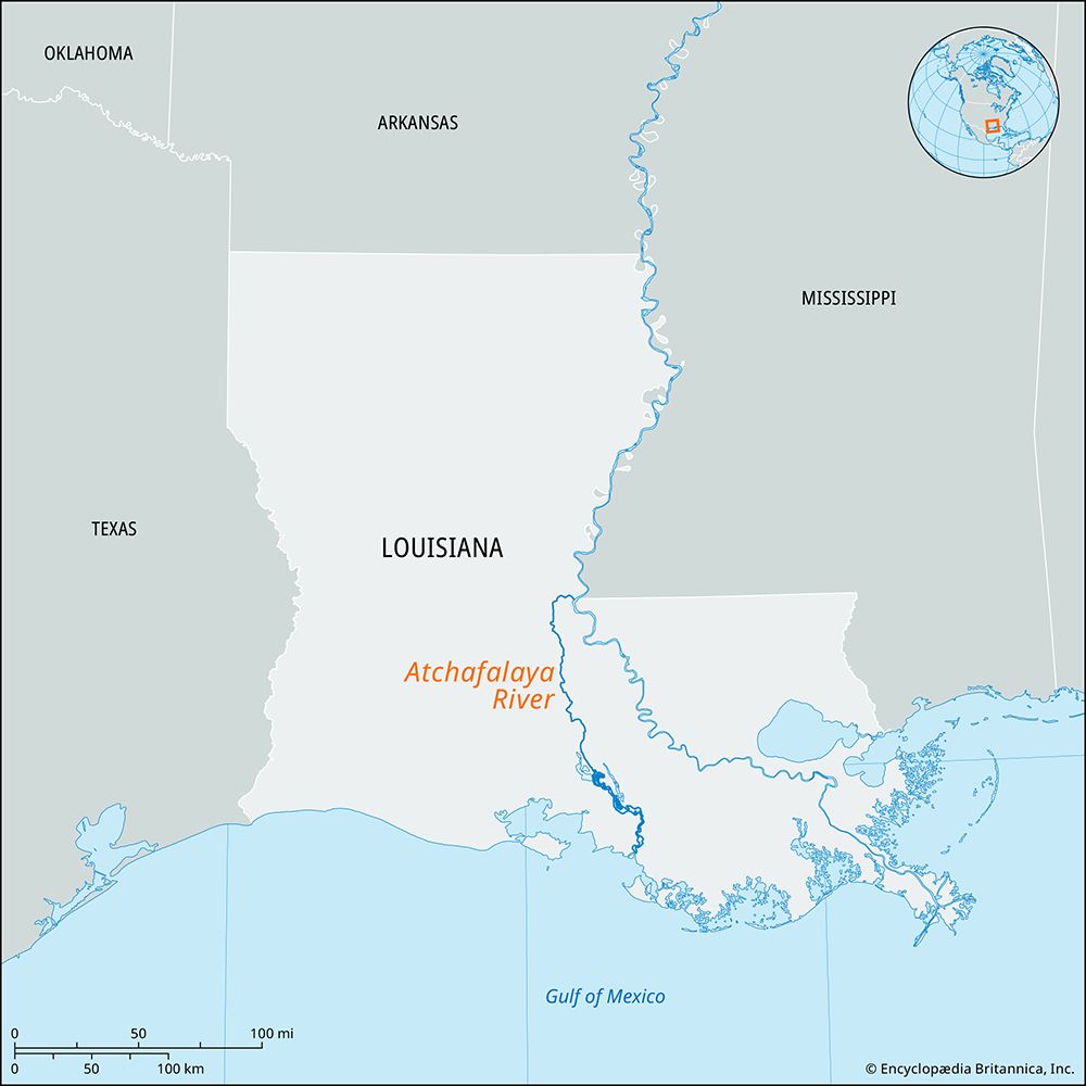
The Atchafalaya River flows through a largely rural and swampy basin in south-central Louisiana, which limits the number of major urban centers located directly along its banks.
The most prominent city situated on the river is Morgan City. Located in the southern portion of the river’s course, Morgan City serves as a significant hub where the Atchafalaya River intersects with the Gulf Intracoastal Waterway. This location is vital for regional navigation, connecting the river system to broader maritime routes and the Mississippi River network.37
Because the river primarily traverses the Atchafalaya Basin—a vast area characterized by floodways and wetlands—most other settlements in the region are smaller communities rather than major cities.3
What is the length of the Atchafalaya River, and how does it compare to other major rivers in the United States?
The Atchafalaya River flows generally south for approximately 140 miles (225 km) from its origin in east-central Louisiana to the Gulf of Mexico. When measured in conjunction with the Red River, its total length reaches 1,420 miles (2,290 km).3
Compared to other major rivers in the United States, the Atchafalaya is relatively short as an independent distributary. However, as part of the broader Mississippi-Red river system, it functions as a significant drainage artery. While the United States is home to massive river systems—such as the Mississippi River, which is among the longest in the world, and the Missouri River—the Atchafalaya is unique for its role in potentially capturing the flow of the Mississippi. Its drainage area covers 95,100 square miles (246,300 square km), reflecting its importance in the hydrology of the American South.39
Sources
- Bonnet Carre Spillway — Encyclopædia Britannica
- Mississippi River flood of 2011 — Encyclopædia Britannica
- Atchafalaya River — Encyclopædia Britannica
- Mississippi River - Flood control — Encyclopædia Britannica
- U.S. Army Corps of Engineers — Encyclopædia Britannica
- Louisiana - Drainage — Encyclopædia Britannica
- Atchafalaya Bay — Encyclopædia Britannica
- river - Deltas and time — Encyclopædia Britannica
- North America - Drainage — Encyclopædia Britannica
Published on · 3 min read