Atchafalaya Bay
Atchafalaya Bay is an arm of the Gulf of Mexico located along the southern coast of Louisiana, United States.
What is the geographical location of Atchafalaya Bay in the United States?
Atchafalaya Bay is an arm of the Gulf of Mexico located along the southern coast of Louisiana, United States.12
The bay extends southeastward for approximately 21 miles (34 km), stretching from Point Chevreuil to Point Au Fer on Point Au Fer Island. It is linked to Morgan City—situated 15 miles (24 km) to the north—by the Lower Atchafalaya River, which serves as a major distributary of the Mississippi River system. The area is also home to the Atchafalaya Delta Wildlife Management Area and contains significant natural gas and oil fields.12
How was Atchafalaya Bay formed, and what role does the Atchafalaya River play in its ecosystem?
Atchafalaya Bay was not formed by a single static event but is the result of the dynamic, shifting nature of the Mississippi River deltaic system. Over thousands of years, the Mississippi has constructed multiple deltaic lobes by shifting its course to find shorter, more efficient paths to the ocean.1
The Atchafalaya River acts as a major distributary that branches from the Mississippi, providing a route to the Gulf of Mexico that is approximately 300 kilometers shorter than the river’s current main course. This river currently carries about 30 percent of the Mississippi’s flow, transporting massive amounts of sediment into Atchafalaya Bay. This active sediment deposition is currently building a new delta lobe within the bay.13
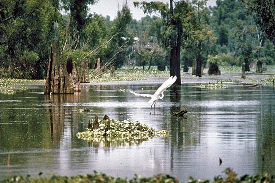
The ecosystem is defined by this constant growth; as the river deposits sediment, it creates new land and subdeltas, supporting diverse habitats such as those protected by the Atchafalaya Delta Wildlife Management Area. If the Mississippi’s flow were to be fully diverted into the Atchafalaya, this delta growth would accelerate significantly.21
How does Atchafalaya Bay contribute to the larger Mississippi River Delta system?
Atchafalaya Bay serves as a critical component of the Mississippi River deltaic system by acting as the primary site for the development of a new delta lobe. Because the Atchafalaya River provides a route to the ocean that is approximately 300 kilometers shorter than the Mississippi’s current main course, it naturally attracts a significant portion of the river’s flow and sediment load.23
Currently, the Atchafalaya carries about 30 percent of the Mississippi’s discharge into Atchafalaya Bay. This sediment deposition is actively constructing a new delta, which represents the next phase in the long-term evolution of the Mississippi deltaic system. While the current “bird-foot” delta is the most visible part of the system, it is geologically ephemeral; if the Mississippi’s flow were to be fully diverted into the Atchafalaya, the new delta in the bay would grow rapidly, while the abandoned bird-foot delta would face severe erosion due to a lack of sediment.3
How does the salinity of Atchafalaya Bay vary throughout the year, and what factors influence it?
The provided search results do not contain specific information regarding the seasonal variations of salinity in Atchafalaya Bay or the specific factors that influence those salinity levels. While the documents confirm that the Atchafalaya River discharges into Atchafalaya Bay and that the river’s flow is subject to significant seasonal fluctuations due to its connection to the Mississippi River system, the impact of these hydrological changes on the bay’s salinity is not detailed in the available data.124
Sources
- Atchafalaya Bay — Encyclopædia Britannica
- Atchafalaya River — Encyclopædia Britannica
- river - Deltas and time — Encyclopædia Britannica
- Mississippi River - Hydrology — Encyclopædia Britannica
Published on · 2 min read