Balsas River
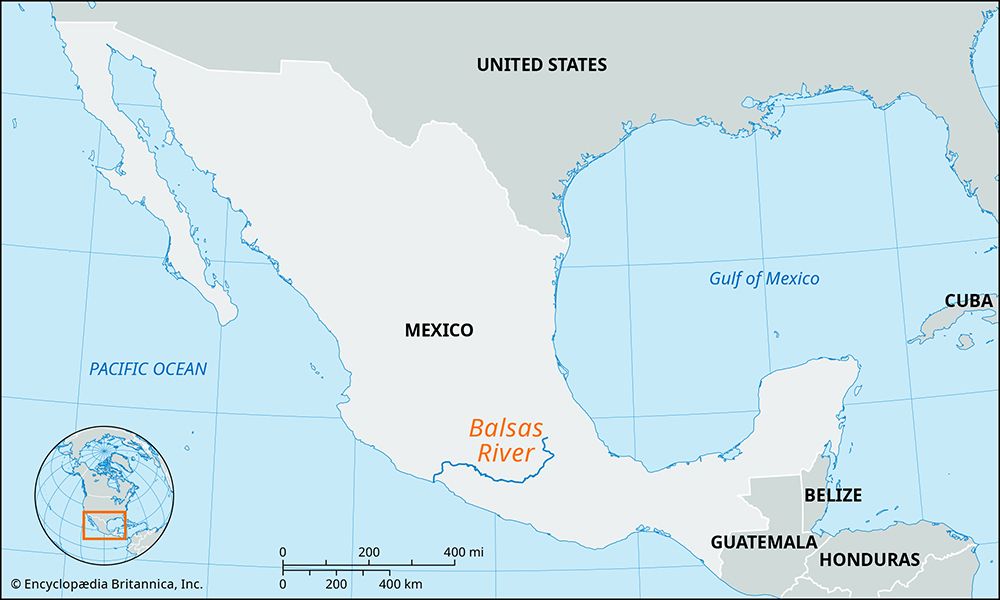
The Balsas River is one of the largest rivers in south-central Mexico. Originating as the Atoyac River at the confluence of the San Martín and Zahuapan…
What is Balsas River?
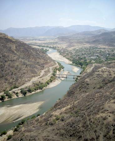
The Balsas River is one of the largest rivers in south-central Mexico. Originating as the Atoyac River at the confluence of the San Martín and Zahuapan rivers in Puebla, it flows southwest and west through the Balsas Depression into Guerrero state, where it is locally known as the Mezcala. The river eventually forms the border between Guerrero and Michoacán before emptying into the Pacific Ocean at Mangrove Point.1
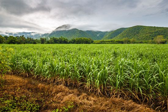
Spanning 479 miles (771 km), the river is unnavigable due to frequent rapids. However, it is vital for the region’s economy, serving as a major source for hydroelectric power and irrigation. The basin supports the cultivation of various crops, including corn, coffee, cotton, sugarcane, and tropical fruits.1
How is hydroelectric power generated from rivers?
Hydroelectric power is generated by converting the potential energy of falling or fast-flowing water into mechanical energy, which is then transformed into electricity.2
The process typically involves the following steps:
- Water Collection: Dams are used to impound rivers, creating a reservoir at a higher elevation. This elevation difference, known as the head, determines the potential power available.2
- Conveyance: Water is directed downward through large pipes or tunnels called penstocks toward a lower elevation.2
- Energy Conversion: As the water exits the penstocks, its force causes turbines to rotate. These turbines are connected to generators, which convert the mechanical rotation into electrical energy.2
- Transmission: Transformers increase the voltage of the generated electricity to make it suitable for long-distance transmission to power grids.2
While this process provides a renewable energy source, it is important to acknowledge that the construction of dams can cause significant environmental disruption, including the displacement of human communities and the destruction of habitats for migrating fish.324
What is the significance of the Balsas Depression in Mexican geography?
The Balsas Depression is a significant geographical feature in south-central Mexico that serves as the primary corridor for the Balsas River. This basin is essential to the region’s economic and agricultural landscape, providing the necessary environment for the cultivation of various crops, including corn, coffee, cotton, sugarcane, and tropical fruits.1
Beyond its agricultural utility, the depression is vital for energy production. The river, which flows through this basin, is extensively utilized for generating hydroelectric power, supporting the infrastructure needs of the surrounding states of Puebla, Guerrero, and Michoacán.1
What are some other major river systems in Mexico?
Due to its unique landforms and arid climate, Mexico has relatively few major river systems. The most significant ones include:
- Rio Grande (Río Bravo del Norte): Forming a large portion of the international border with the United States, this is the most important river in the arid northern plateau. Its major tributary, the Conchos River, is vital for irrigation and hydroelectric power.56
- Lerma-Santiago System: The Lerma River originates west of Mexico City and feeds into Lake Chapala, the country’s largest natural lake. The Santiago River then carries water from the lake northwest toward the Pacific Ocean.5
- Grijalva-Usumacinta System: Located in the southeast, this system drains the humid Chiapas Highlands. Together with the Papaloapan River, these rivers account for approximately two-fifths of the total volume of water in all Mexican rivers.5
- Pánuco River: This river and its tributaries, such as the Moctezuma, originate in the eastern Mesa Central and flow eastward through the Sierra Madre Oriental to the Gulf of Mexico.5
Sources
- Balsas River — Encyclopædia Britannica
- Did you know? — Merriam-Webster
- hydroelectric power — Encyclopædia Britannica
- dam - Rise of environmental and economic concerns — Encyclopædia Britannica
- Mexico - Drainage of Mexico — Encyclopædia Britannica
- Rio Grande - The economy — Encyclopædia Britannica
- Sierra Madre - Economy — Encyclopædia Britannica
- Mexico - Physiographic regions — Encyclopædia Britannica
Published on · 3 min read