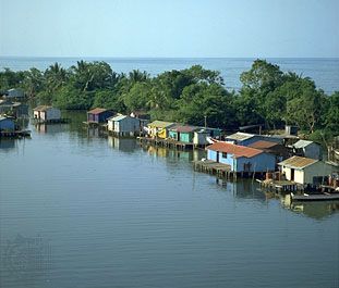
Gulf of Venezuela
The Gulf of Venezuela is an inlet of the Caribbean Sea situated between Venezuela and Colombia. It spans approximately 75 miles (120 km) from north to south…
What is Gulf of Venezuela?
The Gulf of Venezuela is an inlet of the Caribbean Sea situated between Venezuela and Colombia. It spans approximately 75 miles (120 km) from north to south and reaches a maximum width of 150 miles (240 km) from east to west. The gulf is geographically defined by the Guajira Peninsula to the west and the Paraguaná Peninsula to the east.1
Economically, the gulf serves as a vital shipping route for the petroleum-producing region of Lake Maracaibo. It connects to the lake via Tablazo Bay and a dredged channel, which allows oceangoing vessels to reach ports such as Maracaibo. Additionally, the western end of the Paraguaná Peninsula hosts a major refining center that processes a significant portion of the country’s domestic oil. The surrounding lowlands are characterized by minimal cultivation.123
How does Lake Maracaibo contribute to Venezuela’s economy?
Lake Maracaibo is a cornerstone of the Venezuelan economy, primarily serving as one of the world’s most significant petroleum-producing regions. Since the discovery of oil in 1917, the basin has become the source of approximately two-thirds of the country’s total petroleum output.4
The region’s economic importance is supported by several key factors:
- Oil Infrastructure: The productive area encompasses a vast strip along the eastern shore and extends deep into the lake, where thousands of derricks and an extensive network of underwater pipelines facilitate extraction.4
- Maritime Access: The dredging of a 35-foot-deep channel, completed in 1957, allows oceangoing tankers to navigate between the lake and the Gulf of Venezuela, enabling the efficient export of oil and natural gas.41
- Industrial Hub: The city of Maracaibo has evolved into a major oil metropolis and seaport. Beyond petroleum, the region supports a growing petrochemical industry, as well as manufacturing sectors including food, beverages, and construction.5
- Transportation: The Catatumbo River acts as a vital artery for transporting products from inland regions to the lake for further distribution.4
What is the significance of the Paraguaná Peninsula for oil refining?
The Paraguaná Peninsula is of critical importance to Venezuela’s economy, serving as the nation’s primary hub for oil refining. The peninsula’s significance is defined by several key factors:
- Refining Capacity: The refining center located on the western side of the peninsula handles more than two-thirds of Venezuela’s domestic oil refining.6
- Strategic Infrastructure: Large refineries at Amuay and Punta Cardón are connected to the oil fields at Lake Maracaibo via an extensive network of pipelines that transport both crude oil and natural gas.26
- Logistical Advantages: The peninsula’s coastal indentations provide natural deep-water access, allowing for the efficient use of deep-draft tankers to transport refined products to international markets.2
- Industrial Development: The growth of this refining capacity, particularly during the 1950s and 1960s, spurred the development of Punto Fijo, which emerged as the peninsula’s major urban and industrial center.2
How do shipping channels impact the environment of the Gulf of Venezuela?
The provided search results do not contain information regarding the environmental impact of shipping channels on the Gulf of Venezuela. While the records confirm that a 35-foot-deep channel was dredged to connect Lake Maracaibo to the gulf to facilitate the transport of petroleum and other goods, they do not address the ecological consequences of this infrastructure.145
Sources
- Gulf of Venezuela — Encyclopædia Britannica
- Venezuela - Industry — Encyclopædia Britannica
- Venezuela - Transportation — Encyclopædia Britannica
- Lake Maracaibo — Encyclopædia Britannica
- Maracaibo — Encyclopædia Britannica
- Paraguaná Peninsula — Encyclopædia Britannica
Published on · 2 min read