Albion
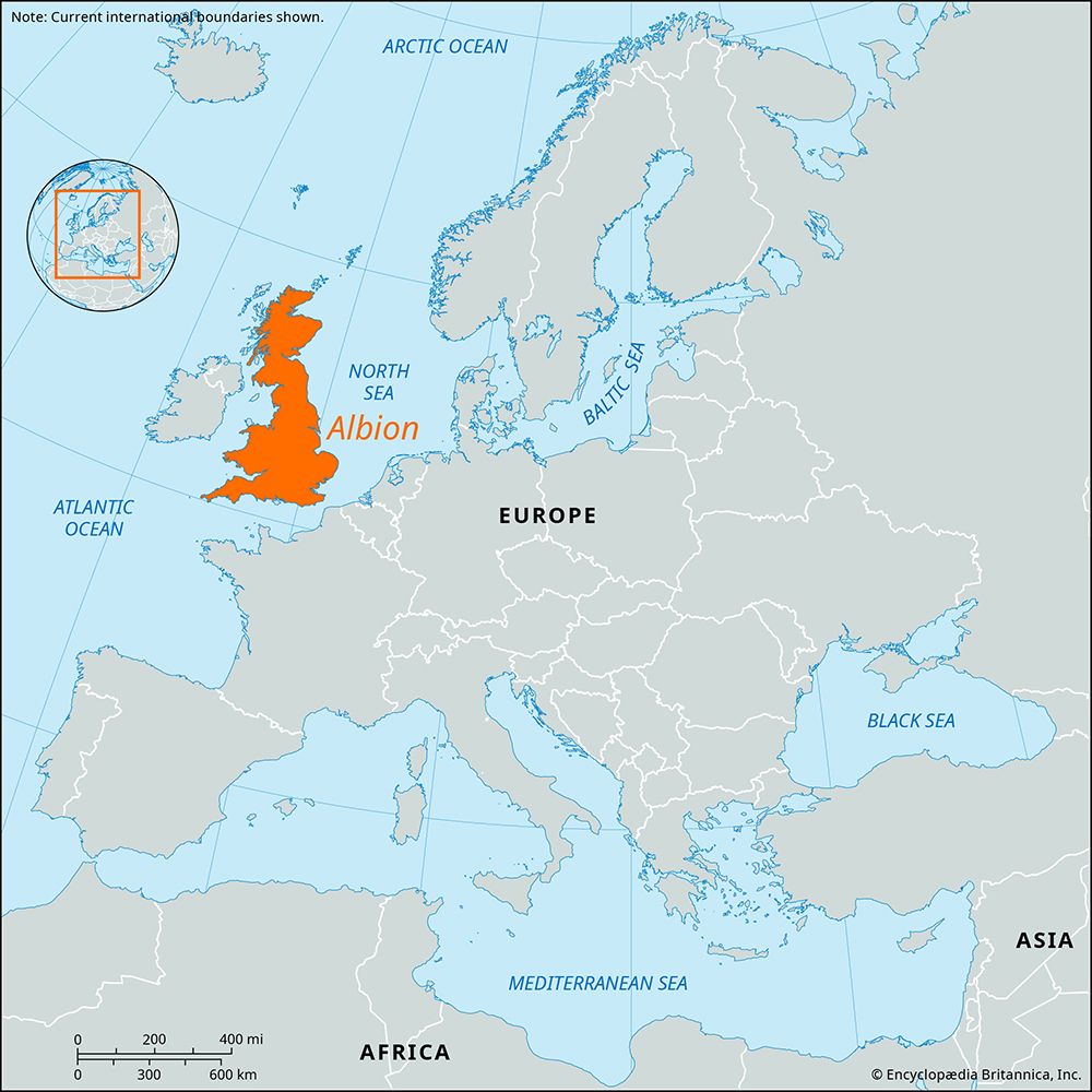
Albion is the earliest known name for the island of Britain. Ancient Greek geographers used the term as early as the 4th century BCE to distinguish the…
What is Albion?
Albion is the earliest known name for the island of Britain. Ancient Greek geographers used the term as early as the 4th century BCE to distinguish the island from Ireland and the smaller members of the British Isles.1
The name is often translated as “white land.” The Romans associated the term with the white chalk cliffs found at Dover, deriving the name from the Latin word albus, meaning “white”. While the name originated in antiquity, it remains a poetic or literary term used to refer to England or Great Britain today.12
Why are the white cliffs of Dover famous?
The white cliffs of Dover are iconic for their striking appearance and their historical role as a natural defensive barrier for England. Composed of soft chalk, these cliffs line much of the coast along the Strait of Dover, the narrowest point between England and the European mainland.345
Their fame is rooted in several key factors:
- Geological Significance: The cliffs are a prominent feature of the chalk uplands that define the region’s landscape.5
- Strategic Defense: Because of their location, the cliffs have long served as a symbol of national security. Dover Castle, which overlooks the English Channel from atop these heights, has defended the country since the beginning of the Common Era.65
- Military History: During the Napoleonic Wars and World War II, the cliffs were utilized for defense. A labyrinth of tunnels was carved into the chalk, serving as bombproof offices and the headquarters for the Dunkirk evacuation.6
How did ancient Greek geographers map the British Isles?
Ancient Greek geographers mapped the British Isles primarily through the pioneering explorations of Pytheas, a navigator and geographer from Massalia (modern-day Marseille) who flourished around 300 BCE. Pytheas was the first Greek to visit and describe the region, providing observations that formed the basis of early geographical knowledge of the area.7
His mapping efforts included:
- Direct Exploration: Pytheas claimed to have explored a large portion of Britain on foot. He visited the tin mines of Belerium (Land’s End, Cornwall) and documented local customs, such as the use of threshing barns and native drinks made from cereals and honey.7
- Mathematical Estimation: He utilized scientific instruments, including a sundial, to make calculations at the summer solstice. Through these observations, he estimated the circumference of Britain at 4,000 miles (6,400 km) and calculated the distance from northern Britain to Massalia with notable accuracy.7
- Navigational Observation: Pytheas noted the lengthening of days as he traveled northward and observed that the polestar was not at the true celestial pole. He also correctly identified that the Moon influences tides.7
While later Roman historians provided further frameworks for understanding Britain, Pytheas’s early accounts established the initial Greek understanding of the island’s position and extent.78
What are some other ancient names for European countries?
Many European countries and regions were known by different names in antiquity, often reflecting the languages and perspectives of the civilizations that documented them, such as the Greeks and Romans.
- Britain: The earliest known name for the island was Albion, a term used by ancient Greek geographers as early as the 4th century BCE. The name is often translated as “white land,” likely referencing the chalk cliffs of Dover.1
- Spain and Portugal: The entire Iberian Peninsula was known to the Romans as Hispania. Following the Roman conquest, it was divided into provinces, including Hispania Ulterior (covering modern Portugal and parts of Spain) and Hispania Citerior (covering northern and eastern Spain).13
- Germany: The region east of the Rhine and north of the Danube was referred to by the Romans as Germania.14
- Greece: While known as Greece today, the country was historically referred to as Hellas by the ancient Greeks themselves.15
These names often evolved through layers of historical influence, as seen in the toponymy of various regions where Celtic, Roman, and Germanic names were superimposed over one another as political power shifted.16
Sources
- Albion — Encyclopædia Britannica
- Albion — Merriam-Webster
- Strait of Dover — Encyclopædia Britannica
- Dover Castle — Encyclopædia Britannica
- Dover — Encyclopædia Britannica
- Dover — Encyclopædia Britannica
- Pytheas — Encyclopædia Britannica
- map - Maps and geography in the ancient world — Encyclopædia Britannica
- United Kingdom - Ancient Britain — Encyclopædia Britannica
- United Kingdom - The conquest — Encyclopædia Britannica
- Norway - Relief — Encyclopædia Britannica
- Icelandic literature - The Middle Ages — Encyclopædia Britannica
- Greece — Merriam-Webster
- Name - Place-names reflecting historical influences — Encyclopædia Britannica
- France — Merriam-Webster
- Hispania — Encyclopædia Britannica
- Germania — Merriam-Webster
- Germany — Merriam-Webster
- Name - European patterns of naming — Encyclopædia Britannica
- Roman Empire — Merriam-Webster
Published on · 3 min read