Allegheny Plateau
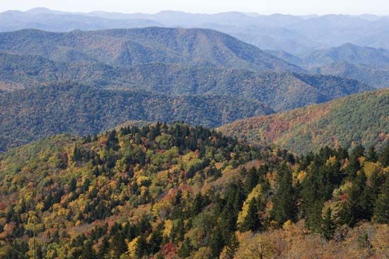
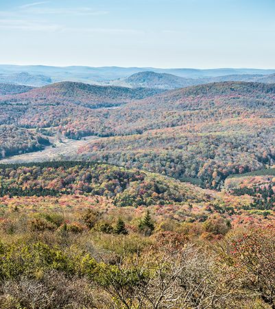
The Allegheny Plateau is the western section of the Appalachian Mountains in the United States. It extends southwestward from the Mohawk River valley in…
What is Allegheny Plateau?
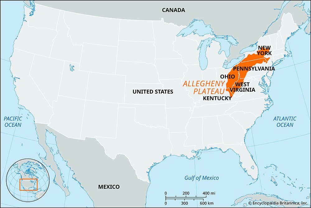
The Allegheny Plateau is the western section of the Appalachian Mountains in the United States. It extends southwestward from the Mohawk River valley in central New York to the Cumberland Plateau in southern West Virginia.1
Generally sloping toward the northwest, the plateau has been dissected by streams to form various mountain ranges, including the Catskill and Allegheny mountains. The region is primarily covered by hardwood forests and is drained by several major river systems, including the Susquehanna and the Ohio River.12
Historically, the discovery of coal spurred significant settlement in the area. Today, the regional economy remains heavily dependent on the extraction of coal, natural gas, and petroleum.1
How do the Appalachian Mountains differ from the Allegheny Plateau?
The Appalachian Mountains are a vast mountain system, while the Allegheny Plateau is a specific physiographic province located within the western section of that system.21
The primary differences lie in their geological structure and formation:
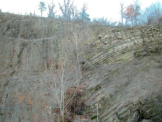
- Geological Structure: The Appalachian Mountains include various provinces, such as the Ridge and Valley province, which is characterized by folded, parallel ridges and narrow valleys created by tectonic pressure. In contrast, the rocks of the Allegheny Plateau remained essentially flat-lying during the region’s formation; the rugged, hilly terrain seen today is the result of stream erosion dissecting that original plateau surface.41
- Relationship: The Allegheny Plateau is a sub-region of the broader Appalachian system. Within this plateau, the eastern portion is often referred to as the Allegheny Mountains, which features higher elevations and more pronounced mountain ranges compared to the rest of the plateau.251
- Division: These regions are often separated by the Allegheny Front, a significant escarpment that acts as a major barrier to transportation and a drainage divide.41
What role did coal mining play in the development of this region?
Coal mining has been a defining, albeit complex, force in the development of the Appalachian region and the Allegheny Plateau. The discovery of rich coal beds spurred a massive influx of settlers, effectively ending the early isolation of these mountain areas and fueling the growth of major American industries, including steel and manufacturing.617
However, this development came at a significant cost:
- Labor and Social Conflict: The industry was marked by intense labor struggles, most notably between 1912 and 1921, leading to violent confrontations like the Battle of Blair Mountain. These conflicts highlighted the harsh realities of “company towns,” where corporations exerted near-total control over workers’ lives.89
- Environmental and Human Toll: Mining operations have caused extensive environmental damage, including water pollution from acid mine drainage and the topographical destruction caused by mountaintop removal. Furthermore, the industry has historically been hazardous, leading to severe health issues like black lung and frequent mining disasters.810
- Economic Instability: The region’s heavy reliance on coal created a boom-and-bust cycle. Declining demand and increased mechanization in the 20th century led to widespread job losses, out-migration, and persistent poverty in many coal-dependent communities.39
How were the rivers of the Allegheny Plateau formed?
The rivers of the Allegheny Plateau were primarily shaped by the interplay between tectonic uplift and the erosive power of water over millions of years. As the region experienced vertical uplift, the erosive capacity of existing rivers was reinvigorated—a process known as rejuvenation—leading to the creation of the deep, narrow valleys and gorges that define much of the landscape in West Virginia and western Pennsylvania.1
The formation of these river paths is often explained through two key geological concepts:
- Antecedence: Some rivers are considered “antecedent,” meaning they existed before the tectonic features (such as folds or ridges) were formed. As the land rose, these rivers maintained their courses by cutting downward at a rate that kept pace with the uplift, effectively carving canyons and water gaps through the rising structures.113
- Superimposition: Other rivers are “superimposed.” In this model, drainage patterns initially developed on a layer of younger, softer sediment. As the rivers cut through this cover and encountered the more complex, resistant rock structures buried beneath, they were “let down” onto the underlying folds and faults, maintaining their original paths regardless of the harder rock they encountered.1
Sources
- Allegheny Plateau — Encyclopædia Britannica
- Allegheny Mountains — Encyclopædia Britannica
- Allegheny — Encyclopædia Britannica
- Pennsylvania - Relief — Encyclopædia Britannica
- West Virginia - Relief — Encyclopædia Britannica
- West Virginia - Postwar period — Encyclopædia Britannica
- Appalachian Mountains - Economic growth — Encyclopædia Britannica
- West Virginia - Colonial period and Virginia’s dominion — Encyclopædia Britannica
- coal - In the New World — Encyclopædia Britannica
- coal - Hazards of mining and preparation — Encyclopædia Britannica
- West Virginia - Economy of West Virginia — Encyclopædia Britannica
- What Is the Importance of the Battle of Blair Mountain? - What were the immediate impacts? — Encyclopædia Britannica
- river - Formation of canyons and gorges — Encyclopædia Britannica
- Appalachian Mountains - Geology of the Appalachian Mountains — Encyclopædia Britannica
- West Virginia - Drainage and soils — Encyclopædia Britannica
Published on · 3 min read