Atacama Plateau
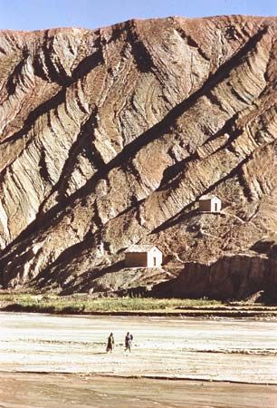
The Atacama Plateau is a high-altitude tableland situated at elevations of 11,000 to 13,000 feet, forming the southernmost portion of the Andean Altiplano.…
How does the Atacama Plateau’s location between the Andes and the Chilean Coast Range affect its climate?
The Atacama Plateau is a high-altitude tableland situated at elevations of 11,000 to 13,000 feet, forming the southernmost portion of the Andean Altiplano. Its climate is primarily defined by its extreme elevation and its position within the Andes Mountains, which act as a significant orographic barrier.123
While the nearby Atacama Desert to the west is characterized by extreme aridity caused by dry subsidence from the South Pacific high-pressure cell and the cooling influence of the Peru (Humboldt) Current, the plateau itself experiences a cold, desolate climate with average temperatures ranging from 47 to 49 °F (8.5 to 9.5 °C). The plateau is separated from the desert by the Cordillera Domeyko, which helps isolate the high-altitude interior from the coastal climatic influences. Consequently, the plateau is dominated by sparse, low-shrub vegetation, and its limited moisture is largely restricted to river valleys and salinas (salt flats) found within its intermontane basins.432
What are the unique geographical features of the Atacama Plateau?
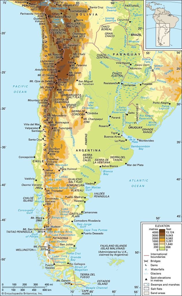
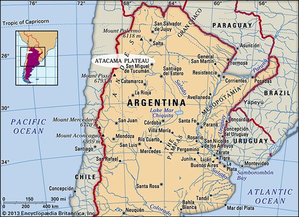
The Atacama Plateau is a cold, desolate tableland located in northwestern Argentina and adjacent regions of Chile, serving as the southernmost portion of the Andean Altiplano. Its unique geographical features include:
- Elevation and Dimensions: The plateau spans approximately 200 miles (320 km) from north to south and 150 miles (240 km) wide, with an average elevation ranging between 11,000 and 13,000 feet (3,300 to 4,000 m).6
- Intermontane Basins and Salt Flats: The region is characterized by dry, sandy, clay-filled basins that alternate with the peaks of the Cordillera Oriental. These basins contain large salt pans or salt flats known as salinas, such as the Atacama Salt Flat in Chile and the Antofalla, Hombre Muerto, and Arizaro in Argentina.6
- Topographic Dissection: Along its eastern margin, the plateau is deeply dissected by narrow river valleys and broader valleys called quebradas, which historically served as vital colonial routes into the Andes.6
- Boundaries: It is separated from the Atacama Desert to the west by the Cordillera Domeyko.6
What are some of the major astronomical observatories located in the Atacama Plateau, and why is it an ideal location for stargazing?
The Atacama region is widely considered one of the premier locations on Earth for astronomical observation due to its exceptionally clear skies, high altitude, and extreme aridity. The combination of minimal cloud cover and low atmospheric water vapor—particularly at high elevations—allows for superior clarity when observing radiation from distant galaxies and the formation of celestial bodies.91011
Several major observatories are located in this region, operated by international partnerships:
- Atacama Large Millimeter/submillimeter Array (ALMA): Situated on the Chajnantor plateau at an altitude of 5,000 meters (16,500 feet), this radio telescope system consists of 66 parabolic dishes. It is designed to detect radiation at millimeter and submillimeter wavelengths, providing insights into the early universe and the formation of extrasolar planets.112
- Very Large Telescope (VLT): Located at the Paranal Observatory at an altitude of 2,600 meters, this facility features four 8.2-meter telescopes that can function individually or as a giant interferometer.2
- Las Campanas Observatory (LCO): Established in 1969, this site hosts several optical reflecting telescopes, including the two 6.5-meter Magellan telescopes.9
- La Silla Observatory: Operated by the European Southern Observatory, this site features six optical telescopes.2
What natural resources are found in the Atacama Plateau, and how are they utilized?
The Atacama Plateau, a high-altitude Andean tableland, contains several natural resources that have historically supported local communities and regional economies:
- Salt: The plateau is characterized by numerous intermontane basins containing large salt pans, or salinas. Salt is actively produced from these deposits, most notably from the Salinas Grandes in the northern portion of the plateau.2
- Livestock Products: The region’s sparse population, consisting primarily of Indian and mestizo communities, relies on the production of wool and skins derived from sheep and llamas.2
- Agricultural Produce: While the region is largely desolate, inhabitants utilize the river valleys to cultivate essential crops, including corn (maize) and wheat, which are vital for local subsistence.2
While the adjacent Atacama Desert is world-renowned for its massive copper deposits—such as those at Chuquicamata—and historical sodium nitrate mining, the plateau itself is primarily valued for its salt production and traditional pastoral activities.62
Sources
- Chile - Climate — Encyclopædia Britannica
- Atacama Desert — Encyclopædia Britannica
- South America - Factors influencing climate — Encyclopædia Britannica
- Chile - The northern desert — Encyclopædia Britannica
- Andes Mountains - Physiography of the Central Andes — Encyclopædia Britannica
- Atacama Plateau — Encyclopædia Britannica
- Chile - The coastal cordilleras — Encyclopædia Britannica
- Chile - The Chilean Andes — Encyclopædia Britannica
- Atacama Large Millimeter Array — Encyclopædia Britannica
- Las Campanas Observatory — Encyclopædia Britannica
- European Southern Observatory — Encyclopædia Britannica
- Atacama — Encyclopædia Britannica
Published on · 3 min read