Aurès
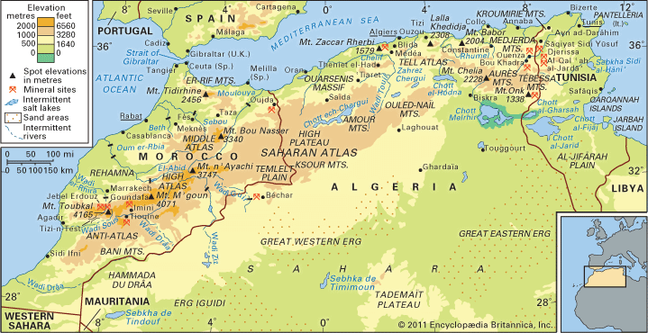
The Aurès Mountains are located in northeastern Algeria, forming part of the Saharan Atlas range in northern Africa.
Where are the Aurès Mountains located in Algeria?
The Aurès Mountains are located in northeastern Algeria, forming part of the Saharan Atlas range in northern Africa.1
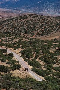
These mountains are characterized by rugged northern cliffs and two parallel fertile valleys—the wadies Abiod and ʿAbdi—that open toward the Sahara in the south. The range features the highest point in northern Algeria, Mount Chélia, which reaches an elevation of 7,638 feet (2,328 meters).1
What is the highest peak in the Aurès Mountains and how tall is it?
The highest peak in the Aurès Mountains is Mount Chélia. It reaches an elevation of 7,638 feet (2,328 meters), making it the highest point in northern Algeria.213
What ancient civilizations have left their mark on the Aurès Mountains?
The Aurès Mountains have been shaped by several distinct cultural influences throughout history, most notably the Berber people and the Roman Empire.
- Berber Tribes: The region has been long inhabited by seminomadic Berber tribes, specifically the Shawia (Chaouïa) population. These groups have historically maintained a unique way of life characterized by seasonal migration, terraced stone villages, and the use of fortified granaries known as guelaa to preserve their traditions and resources.14
- Roman Civilization: During the Roman period, the mountains were a focal point for military and administrative control. Under the emperor Trajan, the Romans established a frontier system that encircled the Aurès, constructing a line of forts to manage the boundary between settled and nomadic populations. Significant Roman ruins remain in the area, most notably at Tazoult-Lambese (Lambèse) and Timgad (Thamugadi), the latter of which was founded by Trajan as part of the effort to urbanize the frontier regions.516
While the Romans penetrated the mountains, the region was never fully Romanized, allowing the indigenous Berber culture to persist as a defining feature of the landscape.5
How do the Aurès Mountains affect the climate of the surrounding regions?
The Aurès Mountains play a significant role in moderating the climate of their immediate surroundings by acting as a barrier to the arid conditions of the Sahara. While precipitation generally diminishes as one moves south across the Atlas ranges, the Aurès massif serves as a notable exception, receiving approximately 16 inches (400 mm) of annual rainfall.9
This localized moisture allows the mountains to support vegetation that differs from the surrounding drier regions, including forests of pine, cedar, and oak at higher altitudes, which transition to xerophytic (dry-climate) plants on the lower slopes. By capturing more moisture than the neighboring plains, the Aurès create a more favorable environment for agriculture compared to the arid High Plateau or the desert regions further south. Additionally, the high peaks of the range, such as Mount Chélia, are snowcapped during the winter, further influencing the temperature and water runoff patterns in the adjacent fertile valleys of the wadies Abiod and Abdi.10
Sources
- Aurès — Encyclopædia Britannica
- Mount Chélia — Encyclopædia Britannica
- Saharan Atlas — Encyclopædia Britannica
- Atlas Mountains - The people — Encyclopædia Britannica
- Nemrut Dağ — Encyclopædia Britannica
- North Africa - Administration and defense — Encyclopædia Britannica
- North Africa - The growth of urban life — Encyclopædia Britannica
- Greece - The Aromani (Aromanians) — Encyclopædia Britannica
- Algeria - Climate — Encyclopædia Britannica
- Atlas Mountains - Climate of the Atlas Mountains — Encyclopædia Britannica
- Exploring 7 of Earth’s Great Mountain Ranges - Atlas Mountains — Encyclopædia Britannica
Published on · 2 min read