Back River
The Back River is a 605-mile (975-km) river located in the northern Mackenzie and Keewatin districts of Nunavut, Canada. It originates from several small…
What is Back River?
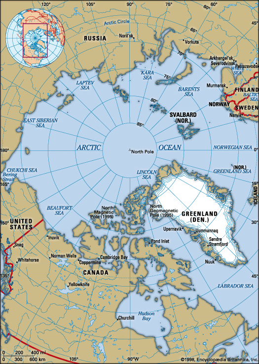
The Back River is a 605-mile (975-km) river located in the northern Mackenzie and Keewatin districts of Nunavut, Canada. It originates from several small lakes northeast of Great Slave Lake and flows northeastward through the Barren Grounds, a sub-Arctic prairie region.1
Along its course, the river widens to form Lakes Pelly, Garry, Macdougall, and Franklin before it eventually empties into Chantrey Inlet, an arm of the Arctic Ocean. The river was named in honor of Capt. George (later Adm. Sir George) Back, who explored the region between 1833 and 1835. Due to numerous rapids, the Back River is not considered a usable waterway, and its basin remains largely uninhabited, save for a small, dispersed population.1
Who was Sir George Back and what were his other explorations?
Sir George Back (1796–1878) was a distinguished British naval officer and explorer instrumental in mapping the Arctic coastline of North America.3
His career was defined by several significant expeditions:
- Franklin Expeditions: Back twice accompanied John Franklin on his explorations of Canada’s Northwest Territories between 1819–1822 and 1825–1827.3
- Search for John Ross: In 1833, Back led an expedition to locate the missing explorer John Ross. During this journey, he explored the Great Fish River, which was later renamed the Back River in his honor.3
- Coastal Exploration: In 1836, he commanded an expedition aboard the H.M.S. Terror to further explore the Arctic coastline east of the Back River’s mouth.3
Back documented his findings in Narrative of the Arctic Land Expedition to the Mouth of the Great Fish River (1836) and Narrative of Expedition in H.M.S. Terror (1838), and he was knighted in 1839 for his contributions to geography.3
What are the Barren Grounds of Canada like?
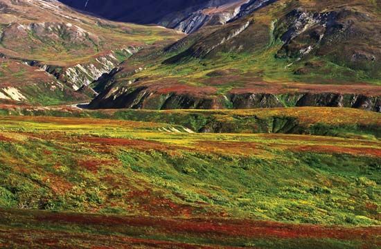
The Barren Grounds are a vast, treeless subarctic prairie region—or tundra—located in northern mainland Canada. Primarily situated in Nunavut, the region also extends into the eastern Northwest Territories, stretching from Hudson Bay westward to Great Slave Lake and Great Bear Lake, and northward to the Arctic Ocean.44
Key characteristics of the region include:
- Terrain: It is a low, glaciated, and treeless plain lying below 1,000 feet (300 meters) in elevation. The surface is covered with mosses, lichens, and grasses, and is dotted with numerous lakes and rivers, such as the Coppermine, Back, and Thelon rivers.56
- Permafrost: The ground is permanently frozen (permafrost) to within a few inches of the surface. During the brief summer thaw, this creates vast, poorly drained areas that become infested with mosquitoes and flies.56
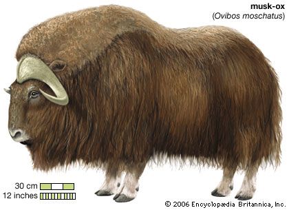
- Wildlife: The region supports diverse animal life, including caribou, musk oxen, foxes, and bears. Large portions are protected by wildlife sanctuaries.56
Why are some rivers considered unnavigable?
Rivers are often considered unnavigable due to physical obstructions and turbulent flow that prevent the safe passage of watercraft. The primary factors include:
- Rapids and Waterfalls: Rapids are sections of a river where the channel gradient increases, causing turbulent flow and white water. Waterfalls, where water drops abruptly and nearly vertically, represent major interruptions in a river’s profile. These features are often caused by variations in rock resistance, tectonic activity, or glaciation, and they render many rivers, such as the Back River, unusable for navigation.18
- Ice Accumulations: In colder climates, the formation of ice can block river channels. Large, deep rivers may develop “hanging dams”—massive deposits of frazil ice—that obstruct flow. In smaller streams, the formation of icings (also known as Aufeis or naleds) can become thick enough to completely block water passage.9
Sources
- Back River — Encyclopædia Britannica
- list of rivers - North America — Encyclopædia Britannica
- Sir George Back — Encyclopædia Britannica
- Barren Grounds — Encyclopædia Britannica
- Barren Grounds — Merriam-Webster
- Northwest Territories - Land — Encyclopædia Britannica
- Arctic - Terrain of the Arctic — Encyclopædia Britannica
- waterfall — Encyclopædia Britannica
- ice in lakes and rivers - Ice buildups — Encyclopædia Britannica
Published on · 3 min read