Boggeragh Mountains
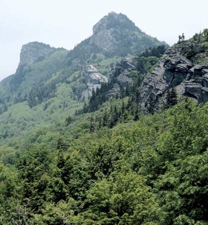
The Boggeragh Mountains are a mountain range located in west County Cork, Ireland. They form the western portion of the Boggeragh-Nagles anticline, a…
What is Boggeragh Mountains?
The Boggeragh Mountains are a mountain range located in west County Cork, Ireland. They form the western portion of the Boggeragh-Nagles anticline, a geological upwarp of rock strata that extends eastward from County Kerry toward the Drum Hills in County Waterford.1
The range is geographically bounded by the valley of the River Blackwater to the north and the Sullane River to the south. The highest peak in the range is Musheramore, which reaches an elevation of 2,118 feet (646 metres). While the higher elevations remain largely unsettled, the surrounding lowlands between the Boggeragh and Nagles ranges support extensive settlement and mixed farming practices.1
What is an anticline in geology?
In geology, an anticline is a type of fold in the Earth’s crust characterized by an arch-like shape that is convex upward. In this formation, layers of stratified rock bend downward in opposite directions from a central crest, meaning the strata dip outward from the axis of the fold.23
Anticlines are often contrasted with synclines, which are folds that are concave upward, forming a trough where beds dip toward each other. Depending on the orientation of the fold’s axial plane, anticlines can take various forms:34
- Symmetrical: The axial plane is vertical.3
- Asymmetrical: The axial plane is inclined.3
- Overturned: The axial plane is inclined to the point where the strata on one limb are overturned.3
- Recumbent: An overturned anticline where the axial plane is nearly horizontal.5
These structures are frequently found in mountainous regions and are typically formed by compressional forces acting on the Earth’s crust.3
What are some other mountain ranges in Ireland?
Ireland’s landscape is defined by a central lowland plain ringed by coastal highlands, which vary significantly in their geological composition and structure. Several prominent mountain ranges contribute to this diverse topography:6
- Macgillycuddy’s Reeks: Located on the Iveragh Peninsula in County Kerry, this range contains Carrantuohill, the highest peak in Ireland at 3,414 feet (1,041 metres).76
- Wicklow Mountains: Situated in the east, this extensive range forms part of the Leinster Chain. It is a vast anticline featuring granite summits, including Lugnaquillia, which reaches 3,039 feet (926 metres).86
- Twelve Pins (Twelve Bens): Found in the Connemara region of County Galway, these are sharp-peaked quartzite ranges with many summits exceeding 2,000 feet (610 metres).69
- Other Ranges: The country also features the Blue Stack Mountains in the north, as well as the Knockmealdown and Comeragh mountains in the south.6
How does the River Blackwater shape the local landscape?
The River Blackwater in southern Ireland significantly shapes the local landscape through its distinct course and erosional activity. For most of its 104-mile journey, the river flows west to east between uplands and a sandstone ridge, creating a broad valley characterized by pastures, woodlands, and large estates.10
The river’s influence on the terrain changes dramatically at Cappoquin, County Waterford, where it turns southward. In this final 15-mile stretch, the river cuts across the grain of the land, carving through the Drum Hills and the Youghal and Clashmore anticlines to form a series of dramatic gorges and depressions.10
As a powerful agent of landscape evolution, the river acts as more than a transport system; its movement of sediment-laden water facilitates pronounced erosion, which transforms the underlying geologic setting into distinct topographic features. By cutting through these geological structures, the Blackwater actively molds the physical character of the region.1110
Sources
- Boggeragh Mountains — Encyclopædia Britannica
- anticline — Merriam-Webster
- fold — Encyclopædia Britannica
- syncline — Merriam-Webster
- recumbent anticline — Merriam-Webster
- Macgillycuddy’s Reeks — Encyclopædia Britannica
- Wicklow Mountains — Encyclopædia Britannica
- Ireland - Relief — Encyclopædia Britannica
- Connemara — Encyclopædia Britannica
- River Blackwater — Encyclopædia Britannica
- river - Rivers as agents of landscape evolution — Encyclopædia Britannica
- River Blackwater — Encyclopædia Britannica
- Ireland - Drainage of Ireland — Encyclopædia Britannica
Published on · 3 min read