Bohemian Massif
The Bohemian Massif is a large, dissected quadrangular plateau covering approximately 60,000 square miles (158,000 square km), primarily occupying the Czech…
What is Bohemian Massif?
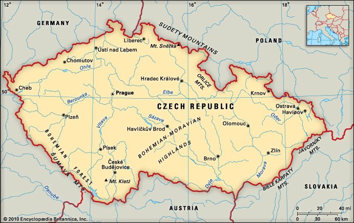
The Bohemian Massif is a large, dissected quadrangular plateau covering approximately 60,000 square miles (158,000 square km), primarily occupying the Czech Republic. Centered on Prague, this region consists of a roughly ovoid elevated basin composed of crystalline rock.12
The massif is encircled by several mountain ranges, including:
- Northwest: Ore Mountains
- Northeast: Giant Mountains
- Southeast: Bohemian-Moravian Highlands
- Southwest: Bohemian Forest (Šumava Mountains)12
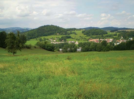
The landscape is characterized as a rounded, forested, and relatively monotonous highland. Its highest point, Mount Sněžka, reaches an elevation of 5,256 feet (1,602 meters) within the Giant Mountains. The region serves as a significant geographical feature, influencing the drainage patterns of major rivers like the Vltava and the Elbe.123
What is the Moravian Karst and how was it formed?
The Moravian Karst is a prominent karst region located in the Jihomoravský region of the eastern Czech Republic, north of Brno. It is characterized by a complex landscape of limestone formations, including a labyrinth of swallow holes, underground lakes, and extensive cave systems.4
Formation
The Moravian Karst was primarily shaped by the dissolution of soluble carbonate bedrock through underground water routes rather than surface weathering. This process, known as fluviokarst, occurs as follows:5
- Stream Erosion: Surface streams cut into limestone beds, gradually enlarging joints and fractures into small cave passages.6
- Subsurface Drainage: Over time, these passages expand to accommodate more water, eventually diverting entire surface streams underground.6
- Landscape Evolution: As surface channels dry up, they form “dry valleys,” while the underground conduits continue to enlarge.6
- Collapse: Features like the famous Macocha Gorge were likely formed by the structural collapse of underground cave roofs.7
This region remains a dynamic example of how chemical reactions between groundwater and bedrock create intricate subterranean networks.5
How do the Carpathian Mountains differ from the Bohemian Massif?
The Carpathian Mountains and the Bohemian Massif differ significantly in their geological age, structure, and formation.
Geological Origin and Age
- Bohemian Massif: This region is a much older geological feature, representing a segment of the Variscan orogenic belt. It formed between 370 million and 290 million years ago due to ancient continental collisions.8
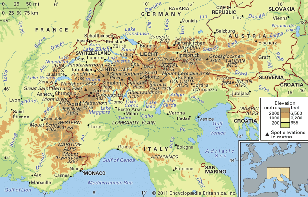
- Carpathian Mountains: These are geologically young mountains that formed as an eastward continuation of the Alps. Their development occurred primarily during the Cenozoic Era, with significant mountain-building movements continuing until less than 10 million years ago.92
Structure and Relief
- Bohemian Massif: It is characterized as a large, ovoid elevated basin (the Bohemian Plateau) encircled by various mountain ranges. Its core is composed of crystalline rock, and it is generally lower in elevation, with its highest point, Mount Sněžka, reaching 5,256 feet (1,602 meters).910
- Carpathian Mountains: This system forms a wide, crescent-shaped arc spanning 900 miles. It is a complex chain of parallel structural ranges, including flysch zones, isolated crystalline blocks, and volcanic chains. The Carpathians are significantly higher than the Bohemian Massif, with peaks like Gerlachovský Štít reaching 8,711 feet (2,655 meters).92
While the Bohemian Massif acts as a stable, ancient structural element of Europe, the Carpathians represent a dynamic, younger mountain system that separates the massif from other major geological platforms.9
What are the main rivers that originate in the Bohemian Massif?
The Bohemian Massif serves as a significant European watershed, acting as the source for several major river systems that flow toward the North, Baltic, and Black Seas. Key rivers originating within or near the highlands of the massif include:
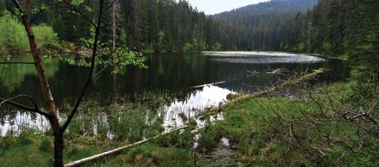
- Vltava River: The longest river in the Czech Republic, it rises in the Bohemian Forest (specifically the Šumava range) from the Teplá and Studená Vltava headstreams.113
- Regen River: This river also has its headwaters in the Bohemian Forest.3
- Ilz River: Like the Regen, the Ilz originates within the forested highlands of the Bohemian Forest.3
- Lužnice River: This river helps define the western boundary of the Bohemian-Moravian Highlands, a southeastern section of the massif.12
- Dyje River: Originating in the region of the Bohemian-Moravian Highlands, it serves as a major drainage feature for the southern part of the massif.12
- Morava River: This river marks the eastern boundary of the Bohemian-Moravian Highlands.12
These rivers are integral to the hydrology of the region, feeding into larger systems such as the Elbe and the Danube.12
Sources
- Bohemian Massif — Encyclopædia Britannica
- Czech Republic - Relief — Encyclopædia Britannica
- Bohemian Forest — Encyclopædia Britannica
- Moravian Karst — Encyclopædia Britannica
- cave - Fluviokarst — Encyclopædia Britannica
- Macocha Gorge — Encyclopædia Britannica
- cave — Encyclopædia Britannica
- Carpathian Mountains — Encyclopædia Britannica
- Carpathian Mountains - Geology — Encyclopædia Britannica
- Variscan orogenic belt — Encyclopædia Britannica
- Vltava River — Encyclopædia Britannica
- Bohemian-Moravian Highlands — Encyclopædia Britannica
Published on · 3 min read