Bohemian-Moravian Highlands
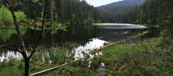
The Bohemian-Moravian Highlands are a rolling, hilly region that serves as the southeastern boundary of the Bohemian Massif. The average elevation of this…
What is the average elevation of the Bohemian-Moravian Highlands?
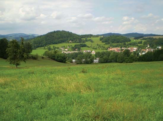
The Bohemian-Moravian Highlands are a rolling, hilly region that serves as the southeastern boundary of the Bohemian Massif. The average elevation of this area ranges from 2,000 to 2,500 feet (600 to 750 meters) above sea level.1
Within this region, there are two primary highland areas: the Jihlava Heights to the south, which reach a peak of 2,746 feet (837 meters) at Javořice, and the Žďár Heights to the north, which reach 2,743 feet (836 meters) at Devět skal.1
Are there any important historical events associated with the Bohemian-Moravian Highlands?
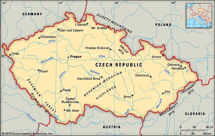
The Bohemian-Moravian Highlands have historically served as a significant geographic boundary separating the provinces of Bohemia and Moravia. While the region was traditionally considered a bleak and inhospitable area unfavorable to large-scale agriculture, it contains numerous historically significant towns and castles that reflect the long-standing development of the surrounding lands.1
Beyond its role as a natural watershed between the Elbe and Danube river systems, the area became a focal point for industrial development starting in the late 1930s, particularly in towns such as Jihlava and Žďár nad Sázavou. Historically, the broader region encompassing these highlands was deeply affected by the Thirty Years’ War and the subsequent Counter-Reformation, which led to significant population shifts and the imposition of Roman Catholicism under Habsburg rule. During the 18th and 19th centuries, the nearby Czech and Slovak lands were also the site of major military engagements, including the Battle of Austerlitz.13
What are some of the notable towns or cities located within the Bohemian-Moravian Highlands?
The Bohemian-Moravian Highlands are home to several historically and economically significant towns. Notable locations include:
- Jihlava: The largest town in the region, Jihlava rose to prominence in the 13th century due to its silver mines and a royal mint. It later transitioned into a center for the cloth trade and, in the modern era, manufacturing.
- Žďár nad Sázavou: This town became a key site for industrial development beginning in the late 1930s. It is also home to the Pilgrimage Church of St. John of Nepomuk at Zelená Hora, a recognized site of historical importance.
- Třebíč: Known for its well-preserved Jewish Quarter and St. Procopius Basilica, which are significant cultural landmarks within the region.
- Telč: Renowned for its historic town centre, which is celebrated for its architectural preservation.
These towns, along with numerous castles scattered throughout the hilly landscape, reflect the long-standing development of the area between the historic provinces of Bohemia and Moravia.617
What are the key geological features of the Bohemian-Moravian Highlands?
The Bohemian-Moravian Highlands are a plateau forming the southeastern boundary of the Bohemian Massif. Geologically, the region is characterized by a rolling, hilly landscape composed primarily of crystalline rock, with an average elevation ranging from 2,000 to 2,500 feet (600 to 750 meters).12
The highlands are divided into two primary areas:
- Jihlava Heights (Jihlavské vrchy): Located to the south, reaching a peak of 2,746 feet (837 meters) at Javořice.1
- Žďár Heights (Žďárské vrchy): Located to the north, reaching a peak of 2,743 feet (836 meters) at Devět skal.1
Additionally, the Moravian side features the Drahanská vrchovina, a group of limestone hills that includes the Moravian Karst, a notable karst landscape. The highlands serve as a major watershed, separating the drainage systems of the Elbe and Danube rivers, and are defined by the Lužnice, Dyje, Morava, and Elbe river tributaries.1
Sources
- Bohemian-Moravian Highlands — Encyclopædia Britannica
- Bohemian Massif — Encyclopædia Britannica
- Czechoslovak history - Re-Catholicization and absolutist rule — Encyclopædia Britannica
- Czechoslovak history - Bohemia — Encyclopædia Britannica
- Moravia — Encyclopædia Britannica
- Jihlava — Encyclopædia Britannica
- Bohemian Forest — Encyclopædia Britannica
- list of World Heritage sites - Czech Republic — Encyclopædia Britannica
Published on · 3 min read