Black Mountains
The name "Black Mountains" refers to two distinct geographical features:
What is Black Mountains?
The name “Black Mountains” refers to two distinct geographical features:
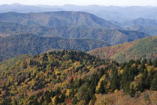
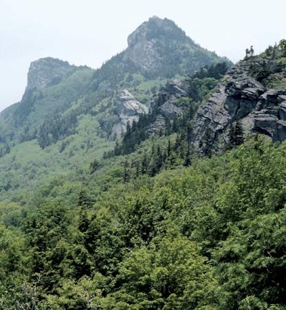
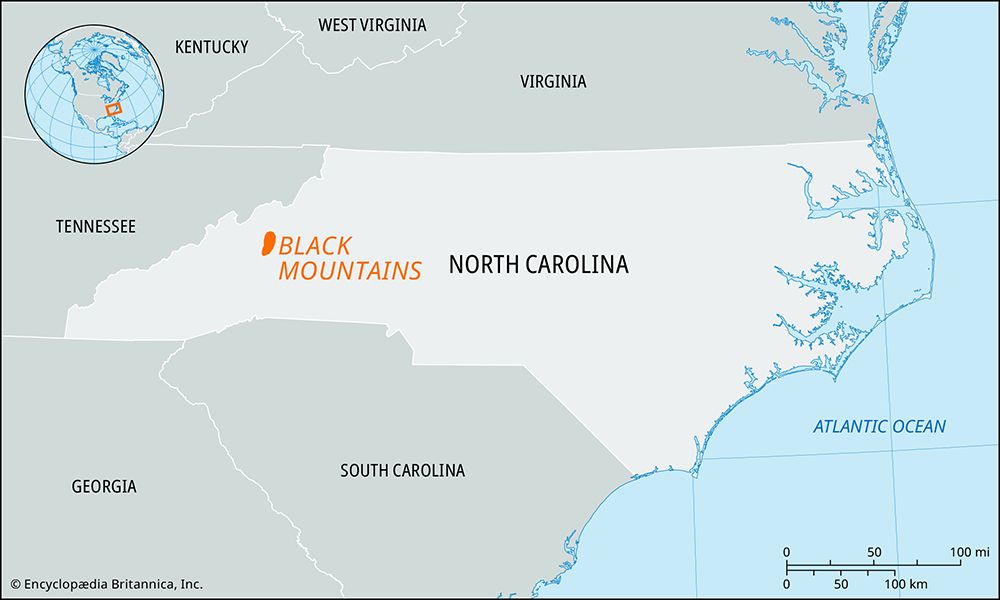
- North Carolina, U.S.: A mountain range in Yancey and Buncombe counties that forms part of the Appalachian Mountains and extends north from the Blue Ridge. This range contains Mount Mitchell, which is the highest point east of the Mississippi River. Because the area was not subject to glaciation, the slopes are heavily wooded and covered with soil to their summits.12
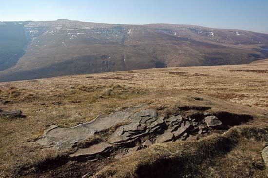
- Wales: A plateau located in Powys county, situated east of the River Usk between Abergavenny and Hay-on-Wye. Its highest peak is Waun Fach, which reaches an elevation of 2,660 feet (811 meters).3
What is the significance of Mount Mitchell in the Appalachian range?
Mount Mitchell is significant as the highest peak in the United States east of the Mississippi River, reaching an elevation of 6,684 feet (2,037 meters). Located in the Black Mountains of western North Carolina, it serves as a prominent landmark within the Appalachian Mountains.51
The mountain is historically significant for its association with Elisha Mitchell, a professor who surveyed the peak in 1835 and identified it as the highest point in the eastern United States. Originally known by the Cherokee as Attakulla and later called Black Dome, the mountain was renamed in his honor following his death there in 1857. Today, the peak is protected within Mount Mitchell State Park and the Pisgah National Forest, where its heavily wooded slopes remain a popular destination for recreation.51
How does glaciation affect the soil and vegetation of mountain ranges?
Glaciation significantly alters the physical and biological characteristics of mountain ranges through both erosional and depositional processes.
Impact on Soil
Mountain soils are often shallow and nutrient-poor, a condition exacerbated by the fact that ice caps during the last glacial interval scraped away much of the existing soil cover. In many high-altitude regions, soil is virtually absent on rocky peaks and ridges. However, glaciation also creates more fertile environments in lower areas; as glaciers retreat, they leave behind moraines—ridges of till and sediment—that can result in soils that are inherently more fertile than those found on surrounding heights. In some cases, glacial meltwater and subsequent river processes further redistribute these sediments, creating productive valley floors.78
Impact on Vegetation
Glaciation influences vegetation primarily by shaping the terrain and climate:
- Tree Line Dynamics: The tree line is a fundamental structural feature of mountain vegetation, determined largely by temperature. Glacial erosion has created steep, rugged landscapes that dictate local microclimates, affecting where trees can survive.78
- Subalpine Zones: In temperate regions, the transition from forest to alpine vegetation often includes a subalpine belt where trees become stunted, deformed shrubs known as krummholz due to harsh conditions like wind and frost.7
- Post-Glacial Recovery: The removal of ice allows for the colonization of new surfaces, though the speed and type of vegetation growth are limited by the nutrient content of the remaining glacial deposits and the harshness of the high-altitude climate.7
What are some other notable mountain ranges found in the United Kingdom?
The United Kingdom features a diverse array of mountain ranges and upland masses, primarily concentrated in the “highland zone” of the north and west. Notable ranges include:
Scotland
- Grampian Mountains: The core of the Scottish Highlands, featuring rounded, grassy slopes and wide plateaus. This range contains Ben Nevis, the highest summit in the United Kingdom.1112
- Cairngorm Mountains: A rugged, high-elevation group within the Grampians, known for peaks exceeding 4,000 feet.1112
- Southern Uplands: A region of rolling hills and plateaus, including the Cheviot Hills on the border with England.1112
England
- Pennines: Often called the “backbone” of northern England, this series of moorland hills and dales extends from Northumberland to Derbyshire.1113
- Cumbrian Mountains: An isolated, compact group in the Lake District, containing England’s highest peaks, such as Scafell Pike.11
- South West Peninsula: Features several distinct granite uplands, including Dartmoor and Exmoor.11
Wales
- Cambrian Mountains: The central backbone of Wales, characterized by plateaus and moorlands.1114
- Snowdonia: A rugged, volcanic mountain region in the northwest containing Snowdon, the highest point in Wales.1114
- Brecon Beacons: A prominent mountain area in the south with softer, rounded outlines.1114
Northern Ireland
Sources
- Black Mountains — Encyclopædia Britannica
- Black Mountains — Encyclopædia Britannica
- list of mountain ranges - North America — Encyclopædia Britannica
- Black Mountains — Merriam-Webster
- Mount Mitchell — Encyclopædia Britannica
- Mitchell, Mount — Merriam-Webster
- Quaternary - Landforms — Encyclopædia Britannica
- Alps - Geology — Encyclopædia Britannica
- Pleistocene Epoch - Glaciation — Encyclopædia Britannica
- Mountain ecosystem - Environment — Encyclopædia Britannica
- United Kingdom - The highland zone — Encyclopædia Britannica
- Pennines — Encyclopædia Britannica
- Northern Ireland - Relief — Encyclopædia Britannica
- Scotland - Relief of Scotland — Encyclopædia Britannica
- Wales - Relief — Encyclopædia Britannica
Published on · 3 min read