Cape Branco
Cape Branco (Cabo Branco) is a cape located on the Atlantic coast of the state of Paraíba in eastern Brazil. It is situated approximately 5 miles (8 km)…
What is Cape Branco?
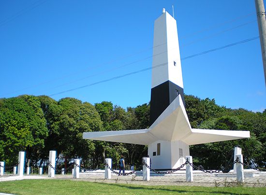
Cape Branco (Cabo Branco) is a cape located on the Atlantic coast of the state of Paraíba in eastern Brazil. It is situated approximately 5 miles (8 km) southeast of João Pessoa, the state capital.1
While Cape São Roque is frequently cited as the easternmost point of the South American continent, that distinction actually belongs to Cape Branco. The area is characterized by its abundant rainfall and scenic white sand beaches, which are bordered by taboleiros—distinctive, flat-topped sedimentary formations that rise sharply above the coastline to heights ranging from 150 to 500 feet (45 to 150 meters).21
What are the geographical features of the Brazilian coastline?
The Brazilian coastline is characterized by a diverse array of geographical features, ranging from narrow strips of land to expansive lowlands. While these coastal lowlands occupy only a small portion of Brazil’s total territory, they exhibit significant variety in their physical composition.34
Key Coastal Features
- Topography and Landforms: The coastal plains vary in width, reaching up to 125 miles (200 km) in the North, narrowing in the Northeast, and disappearing entirely in certain areas of the Southeast. The landscape includes level floodplains, swamps, lagoons, sand dunes, and extensive stretches of white sandy beaches.3
- Escarpments and Harbors: In many regions, particularly in the Southeast, the rocky slopes of coastal mountain ranges—such as the Serra do Mar—plunge directly into the ocean. This creates deep, natural harbors like Guanabara Bay and All Saints Bay.35
- Lagoons: In the South, the coastal plain widens significantly, hosting major water bodies such as Patos Lagoon and Mirim Lagoon.3
- Sedimentary Formations: Areas like the coast of Paraíba feature taboleiros, which are flat-topped, mesa-like sedimentary strata that rise sharply above the beaches.6
- Protection: Some coastal stretches are shielded by barrier islands and coral reefs.3
How do scientists determine the easternmost point of a continent?
Scientists determine the easternmost point of a continent by utilizing the principles of geodesy, the scientific discipline focused on measuring the Earth’s size, shape, and precise geographic positions.
To establish such a location, surveyors rely on a network of accurately surveyed control points. These points are defined by their latitude and longitude, which provide a precise coordinate system for mapping. Because the Earth is not a perfect sphere, geodesists use a reference surface known as an ellipsoid of revolution—a mathematical model that closely approximates the geoid, or the Earth’s mean sea-level surface.
Modern determinations are significantly enhanced by satellite triangulation and laser ranging techniques. By observing perturbations in the orbits of artificial satellites, scientists can calculate the relative positions of landmasses and ground stations with high accuracy. This allows for the identification of the furthest geographic extent of a landmass, such as distinguishing Cape Branco as the true eastern extremity of South America, rather than the more commonly cited Cape São Roque.
What is the significance of the state of Paraíba in Brazil?
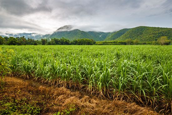
The state of Paraíba, located in northeastern Brazil, holds significant historical and economic importance. Founded in 1585, it was a central region during the 16th century when the Portuguese established the world’s first large-scale sugarcane plantations, which relied on slave labour. This era concentrated economic and political power among a few wealthy landowning families.16
The state’s name, of Tupí Indian origin, means “arm of the river.” Its capital, João Pessoa, was renamed in 1930 to honor a former governor whose assassination helped trigger the revolution that brought Getúlio Vargas to national power16.17
Geographically, Paraíba is notable for the Borborema Plateau and its coastal mesas. While historically agricultural—producing sugar, cotton, pineapples, and sisal—the state has developed industrially since the 1960s, with major hubs in João Pessoa and Campina Grande. Additionally, the state contains Cape Branco, which is the easternmost point of Brazil.1617
Sources
- Cape Branco — Encyclopædia Britannica
- Cape São Roque — Encyclopædia Britannica
- Brazil - Coastal lowlands — Encyclopædia Britannica
- Brazil - Climate of Brazil — Encyclopædia Britannica
- Brazil - Relief — Encyclopædia Britannica
- South America - The Brazilian cycle — Encyclopædia Britannica
- Rio de Janeiro - Climate — Encyclopædia Britannica
- South America - Events in the Mesozoic — Encyclopædia Britannica
- Brazil - Brazilian Highlands — Encyclopædia Britannica
- continental margin - Margin types — Encyclopædia Britannica
- paleogeography - Shorelines and continental margins — Encyclopædia Britannica
- Eastern Hemisphere — Encyclopædia Britannica
- geology - Geodesy — Encyclopædia Britannica
- surveying - Basic control surveys — Encyclopædia Britannica
- easternmost — Merriam-Webster
- Paraíba — Encyclopædia Britannica
- João Pessoa — Encyclopædia Britannica
- Paraíba do Sul River — Encyclopædia Britannica
Published on · 3 min read