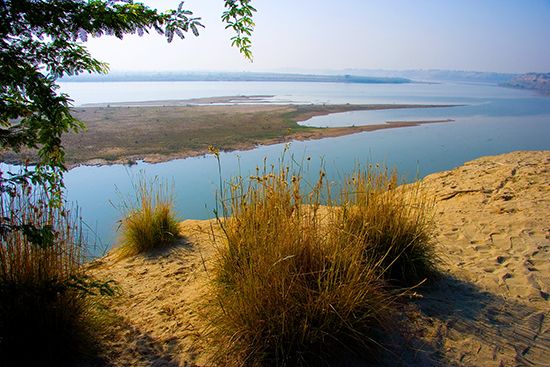
Cher River
The Cher River is a 217-mile (350 km) river located in central France. It originates in the northwest of the Massif Central and flows northward across the…
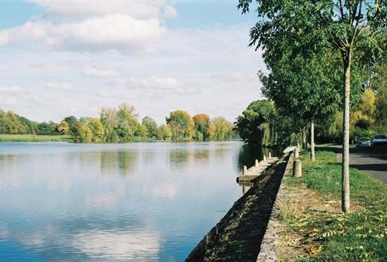
What is Cher River?
The Cher River is a 217-mile (350 km) river located in central France. It originates in the northwest of the Massif Central and flows northward across the Combrailles Plateau, passing through towns such as Montluçon and Saint-Amand-Montrond.12
After being joined by the Yèvre River at Vierzon and the Arnon River, the Cher turns westward. It flows through Chenonceaux—noted for the historic château that bridges the river—and continues south of Tours before emptying into the Loire River at Cinq-Mars-la-Pile. The river’s basin covers an area of approximately 5,400 square miles (14,000 square km).1
What is the significance of the Loire Valley châteaux?
The châteaux of the Loire Valley are historically significant as architectural markers of France’s transition from the medieval feudal era to the Renaissance. During the 15th and 16th centuries, as the feudal system declined and warfare methods evolved, the nobility shifted from building strictly defensive castles to constructing luxurious châteaux de plaisance (country houses).3
These structures represent a unique fusion of styles:
- Architectural Evolution: They combined medieval elements—such as moats, towers, and thick walls—with the symmetrical organization and classical ornamentation of the Italian Renaissance.34
- Cultural Prestige: Because the French capital was located at Tours during the reigns of Louis XII and Francis I, the Loire Valley became the epicenter of this new style, reflecting the monarchy’s desire to adopt Italian artistic models.45
- Historical Legacy: Beyond their aesthetic value, these sites served as grand hunting lodges, political statements of royal ambition, and even wartime refuges for national treasures, such as during World War II.5
How do rivers like the Cher shape the geography of France?
Rivers like the Cher play a fundamental role in shaping the geography of France by acting as agents of erosion, drainage, and regional development. Originating in the Massif Central, these waterways carve through diverse landscapes, creating distinct topographical features such as plateaus, basins, and deep, gorgelike valleys.16
The influence of these rivers on French geography includes:
- Drainage and Basin Formation: Rivers like the Cher and the Loire serve as primary drainage systems, directing water from highlands toward the sea. The tectonic uplift of the Massif Central determined the formation of major river trenches, which in turn dictate the flow and direction of the surrounding landscape.76
- Landform Modification: Through continuous flow, rivers trench through limestone and other rock formations, creating dramatic gorges and flat-floored basins. In areas like the Causses, rivers have dissected the terrain, leaving behind unique geological structures.86
- Human Geography and Settlement: Rivers have historically dictated the location of towns and economic activity. The fertile valley floors provided by these river systems have supported agriculture, while the rivers themselves served as vital highways for the movement of goods and the development of trade networks.76
What are the main characteristics of the Massif Central region?
The Massif Central is a vast upland region in south-central France covering approximately 33,000 square miles, or about one-sixth of the country’s total area. Its primary characteristics include:1011
Geological Composition and Relief
- Formation: The region is largely underlain by ancient crystalline rocks (granite, gneiss, and schist) from the Hercynian period, later uplifted and tilted by Alpine mountain-building movements.1011
- Volcanic Features: Intense volcanic activity has created complex structures, including the Chaîne des Puys and the massifs of Cantal and Monts Dore. The highest peaks are Puy de Sancy (6,184 feet) and Plomb du Cantal (6,096 feet).1011
- Diverse Landscapes: The region features high plateaus, deep gorgelike valleys carved by glacial waters, and the Grands-Causses—a permeable limestone area known for dramatic river gorges like that of the Tarn.1011
Economy and Land Use
- Agriculture: The region maintains a strong rural character. It is dominated by cattle rearing for meat and dairy, with specialized production of distinctive cheeses like Cantal and Roquefort.
- Industry and Services: While historically significant for coal mining and metallurgy, the modern economy is centered on food processing, small-to-medium manufacturing, and a growing tourism sector supported by national and regional parks.10
Sources
- Cher River — Encyclopædia Britannica
- Cher — Merriam-Webster
- Château — Encyclopædia Britannica
- Western architecture - Early Renaissance — Encyclopædia Britannica
- Château de Chambord — Encyclopædia Britannica
- Loire River — Encyclopædia Britannica
- France - The smaller rivers and the lakes — Encyclopædia Britannica
- European Plain - Drainage — Encyclopædia Britannica
- France - The Massif Central — Encyclopædia Britannica
- Massif Central — Encyclopædia Britannica
- Massif Central — Merriam-Webster
- France - Plant life — Encyclopædia Britannica
- France - Drainage of France — Encyclopædia Britannica
Published on · 3 min read