Choctawhatchee River
The Choctawhatchee River is a waterway located in the southeastern United States, spanning parts of Alabama and northwestern Florida.
What is Choctawhatchee River?
The Choctawhatchee River is a waterway located in the southeastern United States, spanning parts of Alabama and northwestern Florida.
Rising in Barbour County, Alabama, the river flows southwest until it meets the Pea River in Geneva. From there, it continues south into Florida and turns west, eventually emptying into the eastern end of Choctawhatchee Bay, an inlet of the Gulf of Mexico. Spanning approximately 180 miles (290 km), the river is navigable along its lower course. Its name is derived from the Choctaw people and the word hatchee, which translates to “stream.”1
What is the history of the Choctaw people?
The Choctaw are a Native American tribe of Muskogean linguistic stock that traditionally inhabited present-day southeastern Mississippi. Historically, they were skilled agriculturalists who lived in settled communities and maintained complex social and funerary traditions, such as the ritualized handling of ancestral remains.2
During the colonial era, the Choctaw often allied with the French against the English and other tribes, including the Chickasaw2. As the U.S. cotton market expanded in the 19th century, pressure to acquire Choctaw land intensified. In 1830, the Choctaw became the first of the Five Civilized Tribes to sign a removal treaty, ceding their eastern lands for territory in the West.3245
The subsequent forced relocation, part of the Trail of Tears, was marked by federal corruption and logistical failure, leading to widespread death from exposure and disease. In Oklahoma, the tribe established a quasi-autonomous government until its dissolution in 1906 in preparation for statehood. Today, the Choctaw maintain their tribal identity, with descendants numbering over 159,000 in the early 21st century.452
How do rivers contribute to the ecosystem of the Gulf of Mexico?
Rivers play a complex role in the ecosystem of the Gulf of Mexico, acting as both vital conduits for nutrients and significant sources of environmental stress.
Biological Productivity
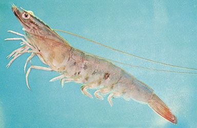
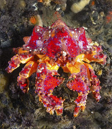
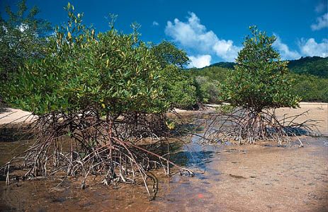
Rivers, particularly through the formation of estuaries, are essential for marine life. As rivers meet the sea, they create a “salt wedge” circulation that pumps nutrient-rich bottom waters toward the surface, stimulating the growth of phytoplankton. This high primary productivity supports diverse food webs, providing nursery grounds for fish and invertebrates like shrimp and crabs within mangrove forests and salt marshes.67
Environmental Challenges
Conversely, rivers are primary pathways for human-induced pollution. Runoff from agricultural lands carries high levels of nitrogen and phosphorus fertilizers into the Gulf. Because fresh water is less dense than salt water, this nutrient-rich runoff forms a surface layer that triggers excessive phytoplankton growth. When these organisms die and decompose, they deplete oxygen in the water, creating “dead zones” where bottom-dwelling marine life cannot survive.89
We could dive deeper into the specific impact of the Mississippi River on these coastal dynamics or explore how water pollution affects coral reef health.
What are the main differences between a river and a bay?
A river and a bay are distinct geographical features defined by their formation, shape, and water composition.
River
A river is a natural passageway for water that flows across the land toward a larger body of water, such as an ocean, sea, or lake. Rivers are primarily agents of landscape evolution, carving valleys through erosion and transporting sediment downstream. They are characterized by their linear, directional flow of fresh water.111213
Bay
A bay is a concavity or reentrant of a coastline where the sea or a lake extends into the land. Unlike the linear nature of a river, bays are typically semicircular or nearly circular in shape. They are often formed by the differential erosion of coastal rocks, where softer materials are worn away more rapidly than harder, resistant formations. While rivers are defined by their flow, bays are defined by their sheltered, enclosed position along a shoreline, which often makes them ideal for harbors.14
Key Differences
- Shape: Rivers are elongated, while bays are generally semicircular or circular.14
- Water Composition: Rivers consist of fresh water, whereas bays contain marine or brackish water.1415
- Function: Rivers act as conduits for water and sediment transport, while bays serve as coastal indentations that provide protection from open water.1412
When a river meets the sea, it may form an estuary, which is a distinct, funnel-shaped environment where fresh river water mixes with salt water.1415
Sources
- Choctawhatchee River — Encyclopædia Britannica
- Choctaw — Encyclopædia Britannica
- Trail of Tears — Encyclopædia Britannica
- Indigenous peoples of the American Southeast - The early 19th century: forced removal — Encyclopædia Britannica
- Chickasaw — Encyclopædia Britannica
- Gulf of Mexico / Gulf of America - Study and the impact of human activity — Encyclopædia Britannica
- conservation - Pollution — Encyclopædia Britannica
- estuary - Primary productivity — Encyclopædia Britannica
- estuary - Salt wedge estuaries — Encyclopædia Britannica
- salinity — Encyclopædia Britannica
- bay — Merriam-Webster
- river — Merriam-Webster
- bay — Encyclopædia Britannica
- river - Origin and classification — Encyclopædia Britannica
- estuary - Geology and geomorphology — Encyclopædia Britannica
- estuary - Partially mixed estuaries — Encyclopædia Britannica
- river - Estuaries — Encyclopædia Britannica
Published on · 3 min read