Escravos River
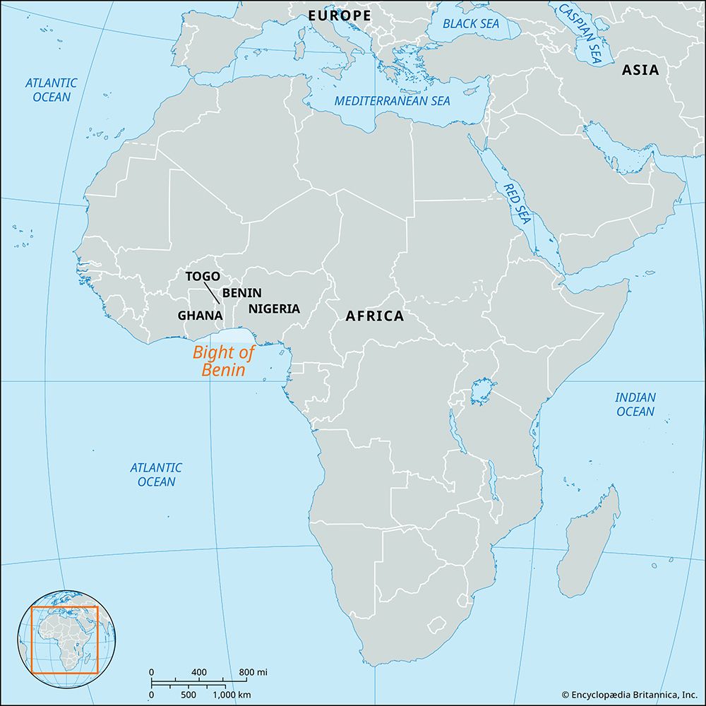
The Escravos River is a distributary of the Niger River situated in the western Niger Delta of southern Nigeria.
Where is the Escravos River located in Nigeria, and what are its major geographical features?
The Escravos River is a distributary of the Niger River situated in the western Niger Delta of southern Nigeria.1
Its primary geographical features include:
- Course: The river follows a 35-mile (56-kilometre) westerly path through a landscape characterized by mangrove swamps and coastal sand ridges.1
- Hydrology: It empties into the Bight of Benin within the Gulf of Guinea.1
- Connectivity: While it lacks its own ports, the river is part of a complex network of interconnected waterways that link it to the Forcados, Warri, Benin, and Ethiope rivers.1
- Maritime Significance: Following the 1964 completion of the Escravos Bar Project, the river became the essential route for oceangoing vessels accessing Delta ports such as Warri, Burutu, Sapele, and Koko. Additionally, it supports a petroleum-shipping station for a submarine oil field located 11 miles offshore.1
What is the significance of the Escravos River to the local communities and economy?
The Escravos River serves as a vital economic artery for southern Nigeria. Its primary significance lies in its role as the essential maritime gateway for the region’s trade and industry.1
Following the completion of the Escravos Bar Project in 1964, the river became the exclusive route for oceangoing vessels accessing key Delta ports, including Warri, Burutu, Sapele, and Koko. By accommodating vessels with a 22-foot draft, the river effectively replaced the silt-blocked Forcados River as the primary channel for commercial shipping in the western Niger Delta.12
Beyond general commerce, the river is critical to the energy sector. It supports a petroleum-shipping station that serves a submarine oil field located 11 miles offshore, facilitating the export of crude oil from the region. Through a complex network of interconnected waterways, the Escravos links local communities and industrial hubs to the Gulf of Guinea, sustaining the flow of goods and resources essential to the regional economy.12
Are there any notable landmarks or settlements along the Escravos River?
The Escravos River itself does not host any major ports or settlements directly along its banks, as its 35-mile course primarily traverses remote mangrove swamps and coastal sand ridges.1
However, the river is a critical maritime landmark due to the Escravos Bar Project, completed in 1964. This engineering project transformed the river into the primary gateway for the western Niger Delta, serving as the exclusive route for oceangoing vessels to reach significant regional ports, including:
- Warri
- Burutu
- Sapele
- Koko
Additionally, a notable industrial landmark exists near the river’s mouth: a petroleum-shipping station that supports a submarine oil field located 11 miles offshore. While the river is connected to a maze of waterways linking it to the Forcados, Benin, and Ethiope rivers, it functions primarily as a transit corridor rather than a site for residential or urban development.1
How has the Escravos River influenced the history and culture of the region?
The Escravos River has primarily influenced the region as a critical maritime corridor rather than a center for traditional cultural development. Its historical significance is defined by its transformation into the essential gateway for the western Niger Delta economy.1
For much of the early 20th century, the Forcados River served as the primary channel for trade. However, as silt accumulation rendered the Forcados exit impassable to oceangoing vessels by 1939, the Escravos emerged as the vital alternative. The completion of the Escravos Bar Project in 1964 was a turning point in regional history, as it allowed the river to accommodate larger vessels with a 22-foot draft. This engineering feat solidified the Escravos as the exclusive route for international shipping to major ports such as Warri, Burutu, Sapele, and Koko.21
Beyond trade, the river has facilitated the integration of the region into the global energy market, supporting infrastructure for offshore crude oil extraction.1
Sources
- Escravos River — Encyclopædia Britannica
- Forcados River — Encyclopædia Britannica
Published on · 3 min read