Euphrates River
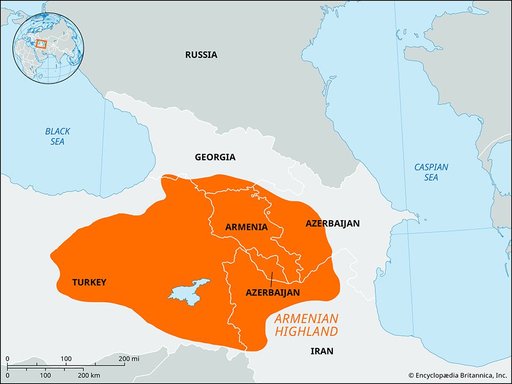
The Euphrates River is formed by two primary headstreams in the Armenian Highland of Turkey:
What are some of the major tributaries of the Euphrates River?
The Euphrates River is formed by two primary headstreams in the Armenian Highland of Turkey:
- Murat River: The major headstream of the Euphrates, which rises near Mount Ararat and flows westward to unite with the Karasu River.12
- Karasu River: Along with the Murat, this river serves as a foundational headwater that joins to form the upper Euphrates near Keban Euphrates near Keban.2
As the river flows southeast into Syria, its flow is further supplemented by two significant tributaries:
- Balīkh River: A tributary that joins the Euphrates, supporting intensive agriculture in the region.2
- Khābūr River: A major tributary whose northern reaches receive ample precipitation, historically supporting the development of major cities and modern agricultural efforts.2
How does the Euphrates River contribute to agriculture and water resources in modern-day countries?
The Euphrates River is a vital, albeit contested, resource for Turkey, Syria, and Iraq. Its waters are essential for irrigation in these arid regions, supporting the cultivation of crops such as wheat, barley, rice, and various fruits.234
Modern Water Management
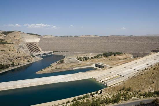
In the 20th and 21st centuries, the river has been transformed by large-scale water-control projects. Dams like the Atatürk Dam in Turkey and the Euphrates Dam in Syria create reservoirs that regulate flow, mitigate flood-and-drought cycles, and feed massive irrigation networks. However, these technologies have also led to environmental challenges, including the desiccation of marshlands and a decrease in natural soil nutrient replenishment.254
Agricultural Challenges
Intensive irrigation, while necessary, has caused significant salinization. Poor drainage allows mineral residues to rise to the surface through evaporation, which progressively destroys soil quality and reduces agricultural yields. Furthermore, the strategic control of these waters is a source of regional geopolitical tension, as downstream nations fear that upstream dam construction reduces their water supply and limits their ability to manage flow timing.346
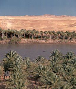
How has the Euphrates River been used for transportation throughout history?
Throughout history, the Euphrates River has served as a vital artery for transportation and trade in the Middle East. Traditionally, downstream travel relied on the kalak—a timber raft supported by inflated goatskins capable of carrying up to 35 tons of goods and passengers. Upon reaching their destination, these rafts were typically disassembled, and the materials were sold, while the skins were deflated for transport back north by donkey.7
Other traditional vessels have included muhaylahs and safīnahs, which are large sailing craft, as well as balams, which are slender, flat-bottomed boats. In the vicinity of Baghdad, circular basketwork coracles known as gufas were used to ferry passengers until the 1970s.7
Engineering efforts also facilitated movement between river systems; during the Sasanian period, five navigable canals were constructed to link the Euphrates to the Tigris. In 1836, Francis Rawdon Chesney successfully navigated the river with a steamship, though regular steam service did not follow. Today, while road and rail have largely replaced river transport, shallow-draft motorized vessels and pleasure boats remain in use.27
What is the geographical location and course of the Euphrates River?
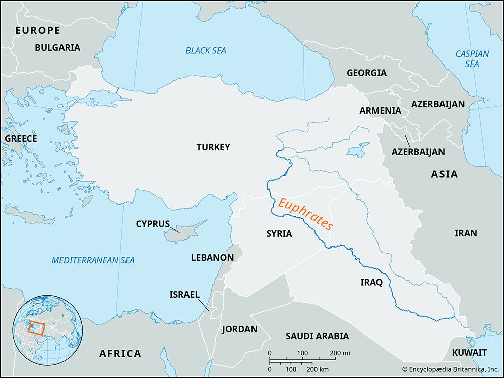
The Euphrates River is the longest river in southwest Asia, stretching approximately 1,740 miles (2,800 km) through the Middle East.82
Course and Geography
The river originates in the Armenian Highland of northeastern Turkey, formed by the confluence of the Karasu and Murat rivers. Its journey is generally divided into three sections:810
- Upper Course: The river descends from the highlands through deep gorges in the Taurus Mountains, flowing through southeastern Turkey.8102
- Middle Course: It enters Syria, flowing southeast across the Syrian plateau. In this region, the river is heavily managed by dams, such as the Euphrates Dam, which creates Lake Al-Asad.102
- Lower Course: Upon entering Iraq, the river traverses the alluvial plain of Mesopotamia. It eventually joins the Tigris River at Al-Qurnah to form the Shatt al-Arab, which empties into the Persian Gulf.8102
Sources
- Murat River — Encyclopædia Britannica
- Tigris-Euphrates river system - Physiography of the Euphrates — Encyclopædia Britannica
- Tigris-Euphrates river system - Agriculture and irrigation — Encyclopædia Britannica
- Tigris-Euphrates river system: Top Questions — Encyclopædia Britannica
- Tigris-Euphrates river system - Economy of the Tigris-Euphrates river system — Encyclopædia Britannica
- Asia - Water resources — Encyclopædia Britannica
- Tigris-Euphrates river system - Navigation — Encyclopædia Britannica
- Euphrates River — Encyclopædia Britannica
- Tigris-Euphrates river system - General considerations — Encyclopædia Britannica
- Tigris-Euphrates river system — Encyclopædia Britannica
Published on · 3 min read