Honshu
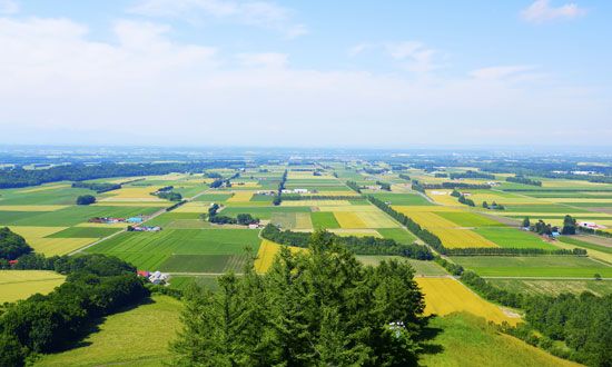
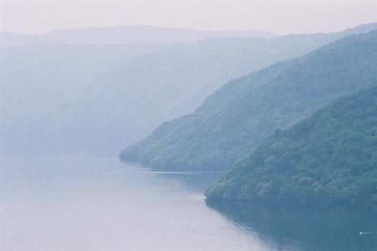
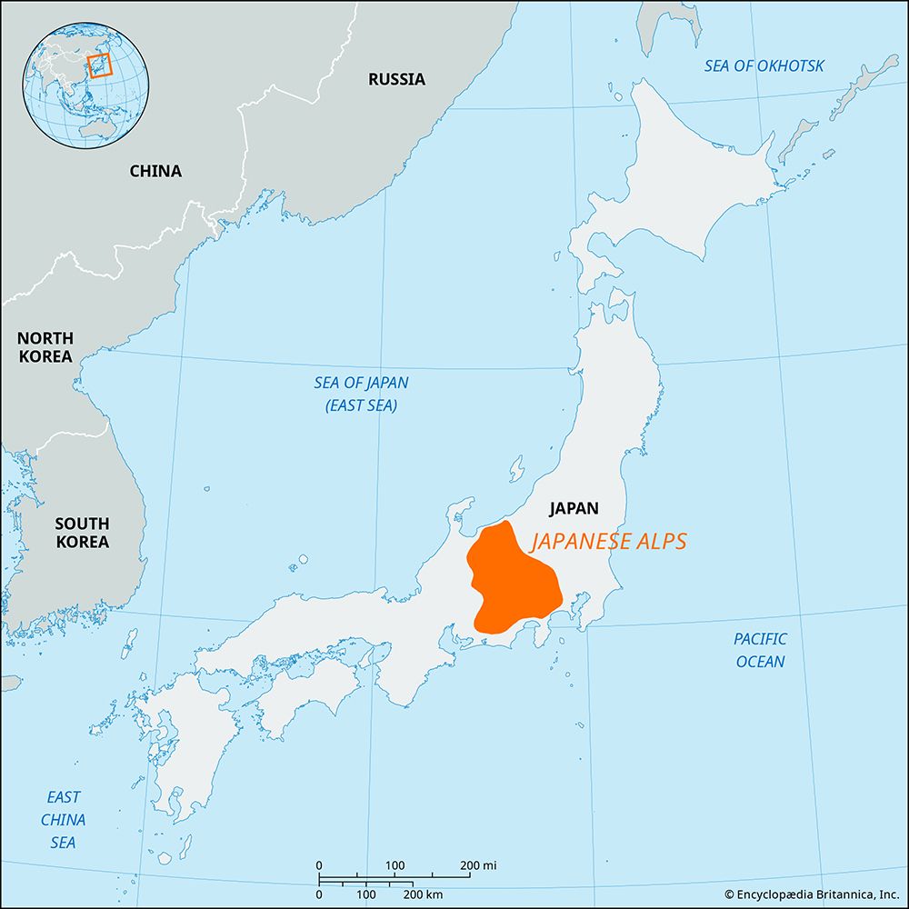
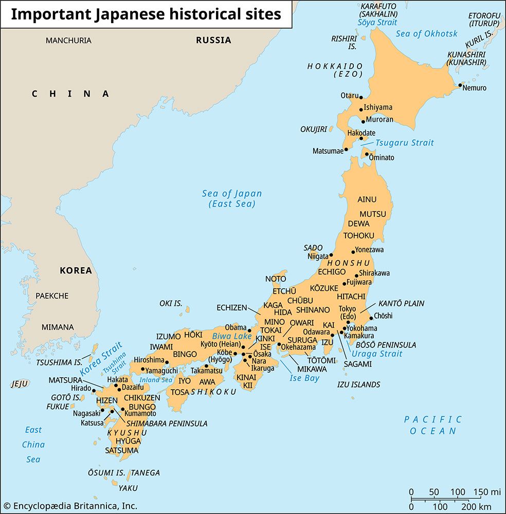
Honshu is the largest of the four main islands of Japan. It is situated between the Pacific Ocean to the east and the Sea of Japan to the west.
What is the geographical location and size of Honshu island in Japan?
Honshu is the largest of the four main islands of Japan. It is situated between the Pacific Ocean to the east and the Sea of Japan to the west.1
The island forms a northeast–southwest arc that extends approximately 800 miles (1,287 km) in length, with a coastline spanning 6,266 miles (10,084 km). In terms of size, Honshu covers an area of 87,992 square miles (227,898 square km). It is considered the Japanese mainland and serves as the country’s primary economic hub, housing major metropolitan areas such as Tokyo–Yokohama and Ōsaka–Kōbe.1
How has Honshu been affected by natural disasters, such as earthquakes and tsunamis, throughout history?
Honshu, Japan’s main island, is situated in one of the world’s most geologically unstable regions due to the subduction of the Pacific and Philippine plates beneath the Eurasian Plate. This tectonic activity has made the island highly susceptible to frequent earthquakes, volcanic eruptions, and tsunamis throughout its history.3
Major Historical Disasters
Several catastrophic events have significantly impacted Honshu:
- Tokyo-Yokohama Earthquake (1923): A magnitude 7.9 earthquake struck the metropolitan area, causing over 140,000 deaths. The disaster was compounded by widespread fires and a 39.5-foot tsunami that devastated coastal regions.4
- Kobe Earthquake (1995): This magnitude 6.9 event in the Hanshin region resulted in approximately 6,400 deaths and left over 300,000 people homeless. It exposed significant vulnerabilities in infrastructure, leading to major revisions in national disaster preparedness and building codes.5
- Japan Earthquake and Tsunami (2011): A magnitude 9.0 earthquake off the coast of northeastern Honshu triggered a massive tsunami that devastated the Tōhoku region massive tsunami that devastated the Tōhoku region. The disaster resulted in approximately 18,500 deaths or missing persons and caused a major nuclear accident at the Fukushima Daiichi power station.367
Impact and Response
These disasters have consistently highlighted the vulnerability of Honshu’s infrastructure, including transportation networks, power supplies, and coastal defenses. In response, the Japanese government has implemented extensive reconstruction efforts, such as the creation of the Reconstruction Agency, the construction of seawalls, and the reinforcement of buildings and highways to better withstand future seismic activity.875
How has Honshu’s history shaped Japan’s cultural and economic development?
Honshu, the Japanese mainland, has served as the primary stage for Japan’s historical, cultural, and economic evolution. Much of the country’s early history unfolded in its southern regions, where administrative and political structures were first established to govern the island’s diverse geography.1
Historical Foundations and Regional Development
The development of Japan’s administrative units, such as the kuni (provinces) and dō (regions), was deeply tied to Honshu’s physical landscape. During the Nara and Heian periods, the island was divided into regions like Kantō and Kansai, which remain central to Japan’s cultural identity today. The rise of castle towns in the 16th century, particularly along the Pacific coast, laid the groundwork for many of Japan’s modern urban centers, including Tokyo and Osaka.1011
Economic Transformation
Honshu’s Pacific seaboard has become the nation’s primary economic engine, known as the Pacific Belt Zone. This area houses the majority of Japan’s population and its largest cities. Following World War II, rapid industrialization and a massive population shift from rural villages to these urban corridors transformed Japan into a global economic power. While this growth brought a higher standard of living, it also necessitated significant social changes, including shifts in family structures, gender roles, and the adoption of global cultural influences.11012
How does the political and administrative structure of Honshu differ from other parts of Japan?
Honshu does not have a unique political or administrative structure that distinguishes it as a single entity from the rest of Japan. Instead, the entire country, including Honshu, operates under a unified system of local government established by the 1947 constitution.15
Japan is divided into 47 prefectures, and while Honshu contains the majority of these, the administrative categories used across the country apply to all islands. These categories include:1510
- Ken (Prefectures): The standard administrative unit, of which there are 43.15
- To (Metropolis): Tokyo is the only prefecture with this status, granted in 1943.1510
- Fu (Urban Prefectures): Osaka and Kyoto hold this designation.1510
- Dō (District): Hokkaido is the only prefecture with this status.1510
While Honshu is home to the national capital and the most populous urban centers, its prefectures function under the same principles of autonomy as those on other islands, with elected governors and assemblies managing local affairs such as education, social welfare, and disaster prevention. The administrative differences in Japan are based on specific prefectural designations—such as Tokyo’s unique metropolitan status—rather than the geographic boundaries of the islands themselves.1516
Sources
- Honshu — Encyclopædia Britannica
- Shikoku — Encyclopædia Britannica
- Japan earthquake and tsunami of 2011 — Encyclopædia Britannica
- Japan earthquake and tsunami of 2011 - Relief and rebuilding efforts — Encyclopædia Britannica
- Japan - Geologic framework — Encyclopædia Britannica
- Tokyo-Yokohama earthquake of 1923 — Encyclopædia Britannica
- tsunami - Notable tsunamis — Encyclopædia Britannica
- Japan earthquake and tsunami of 2011 - Casualties and property damage — Encyclopædia Britannica
- Kōbe earthquake of 1995 — Encyclopædia Britannica
- Japan - Traditional regions — Encyclopædia Britannica
- Japan - Urban settlement — Encyclopædia Britannica
- Hokuriku — Encyclopædia Britannica
- Japan - Social change — Encyclopædia Britannica
- Honshu — Merriam-Webster
- Japan - Local government — Encyclopædia Britannica
- Tokyo-Yokohama Metropolitan Area - Government — Encyclopædia Britannica
- Hokkaido — Encyclopædia Britannica
Published on · 4 min read