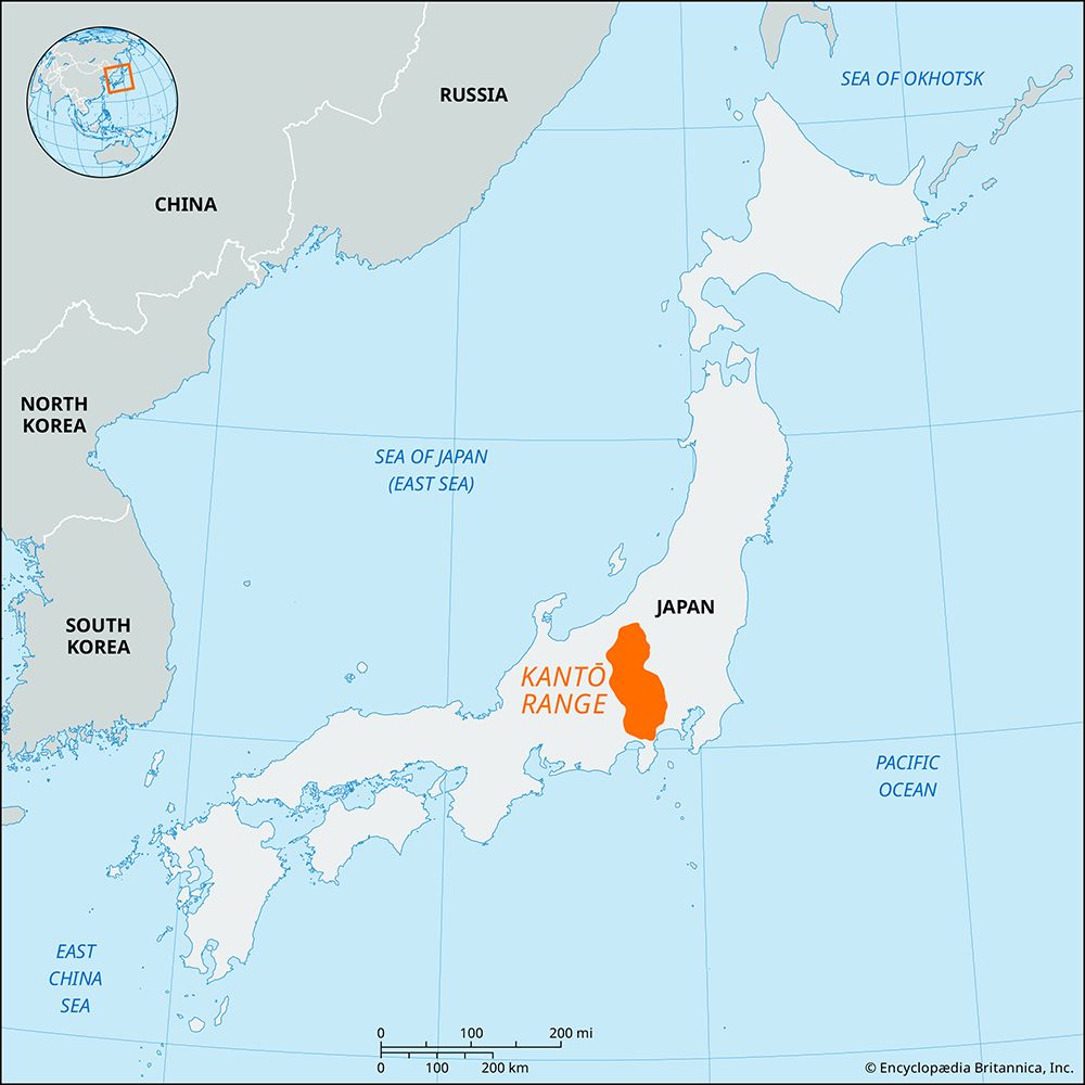
Kantō Plain
The Kantō Plain, which encompasses the Tokyo metropolitan area, is home to several significant cultural and religious sites.
Are there any significant cultural or religious sites located within the Kantō Plain region?
The Kantō Plain, which encompasses the Tokyo metropolitan area, is home to several significant cultural and religious sites.
One prominent location is Kamakura, a city south of Yokohama that served as the capital of Japan during the Kamakura period. It features notable historic landmarks, including:
- The Great Buddha (Daibutsu): A famous bronze statue and national treasure.1
- Kenchō and Engaku Temples: Significant Buddhist sites that reflect the city’s historical importance.1
Additionally, the Shrines and Temples of Nikkō are located within the broader region and are recognized as a World Heritage site. Furthermore, Mount Fuji—a sacred place and a profound source of artistic inspiration—is situated in the vicinity and is also designated as a World Heritage site.2
These locations highlight the deep intersection of Shintō and Buddhist traditions that have shaped the cultural landscape of the region for centuries.3
How does the Kantō Plain contribute to Japan’s economy and agriculture?
The Kantō Plain is the most productive and populous region in Japan, serving as the nation’s primary economic and industrial hub.6
Economic Contribution
The region is anchored by the Tokyo-Yokohama metropolitan area, which functions as Japan’s leading center for finance, commerce, and industry. Key economic drivers include:7
- Industrial Power: The Keihin Industrial Zone is the country’s foremost manufacturing region, specializing in electronics, printing, and publishing.7
- Northern Expansion: The Northern Kantō region supports this output through the manufacture of electrical machinery, transport equipment, and metal products, often acting as a vital link in the supply chain for the Keihin zone.8
- Infrastructure: As the nation’s chief transportation hub, the plain facilitates the distribution of goods globally and domestically through extensive rail networks, including the Shinkansen, and major airports.7
Agriculture
Agriculture in the Kantō Plain is diverse, shaped by the region’s varied terrain:
- Crops: Farmers produce rice, livestock, mulberries, pears, and chestnuts.8
- Land Use: Cultivation is adapted to the landscape, ranging from dry, gravelly upstream areas to fertile, deltaic, and swampy downstream sections.6
How has the Kantō Plain’s geology and topography influenced its development?
The geology and topography of the Kantō Plain have been fundamental in shaping its development as Japan’s most populous and productive region.
Geological Structure
Often referred to as a structural basin, the plain is walled by mountains to the north and west and hills to the south. Its terrain is characterized by three distinct physical features:6
- Tablelands: These flat-topped uplands consist of unconsolidated alluvial fan deposits or shallow marine sediments, frequently covered by a layer of volcanic ash soil known as loam.69
- Hills: Older Quaternary deposits, such as the Tama hills, provide varied elevation within the region.6
- Lowlands: River valley lowlands separate the hills and tablelands, transitioning from gravelly, dry upstream reaches to fertile, swampy deltaic zones downstream.6
Topographical Influence on Development
The plain’s river systems, particularly the Tone River, have been critical to human activity. The river’s course has been extensively modified by dikes and diversions to manage water flow and support agriculture. Historically, this river network served as a vital transportation artery, fostering the growth of port towns. In the modern era, the construction of dams on the river’s headwaters has provided essential hydroelectric energy and water supplies for the Keihin Industrial Zone.10
What are the main rivers and water systems that flow through the Kantō Plain?
The Kantō Plain is primarily drained by three major river systems that flow from the northeast to the southwest:9
- Tone River: This is the most significant river system in the region, covering the greater part of the plain. Rising in the volcanic area of northwestern Kantō, it flows for 200 miles before reaching the Pacific Ocean at Chōshi. It is an indispensable source of water for irrigation and, through its headwater dams, provides essential hydroelectric energy and water supplies for the Keihin Industrial Zone.69
- Naka River: This river system contributes to the drainage of the northeastern portion of the plain.9
- Sagami River: This system serves the southwestern section of the plain.9
These rivers have been vital to the region’s development, historically serving as transportation networks that fostered the growth of numerous port towns. Today, the Tone River, in particular, remains the most heavily modified river in Japan, with its course extensively managed through dikes and diversions to support the needs of the surrounding population.6
Sources
- Kamakura — Encyclopædia Britannica
- Kyōto - The city layout — Encyclopædia Britannica
- list of cities and towns in Japan - Tokyo — Encyclopædia Britannica
- Jinja — Encyclopædia Britannica
- list of World Heritage sites - Japan — Encyclopædia Britannica
- Kantō Plain — Encyclopædia Britannica
- Tokyo — Encyclopædia Britannica
- Northern Kantō — Encyclopædia Britannica
- Tone River — Encyclopædia Britannica
- Japan - Relief — Encyclopædia Britannica
- Keihin Industrial Zone — Encyclopædia Britannica
- Japan - Drainage — Encyclopædia Britannica
Published on · 3 min read