Kantō Range
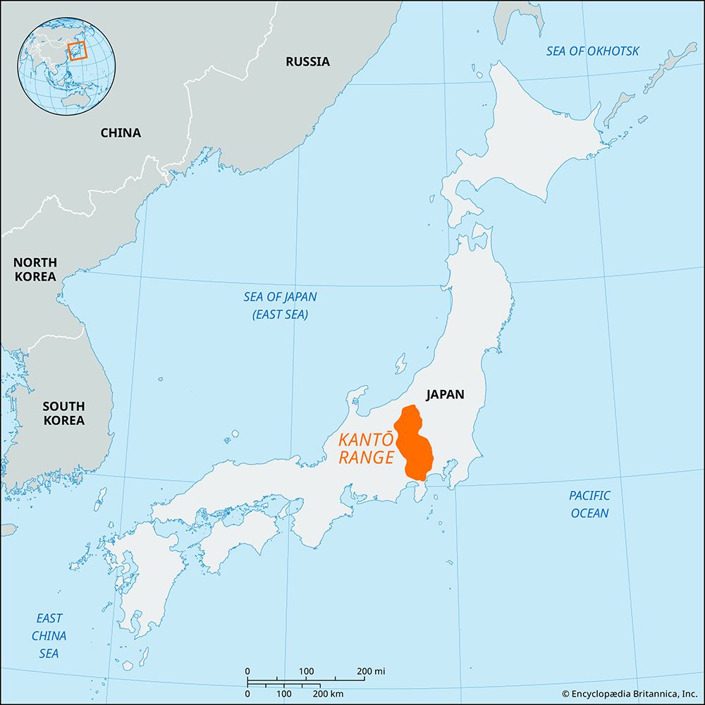
The Kantō Range is a significant mountain system on Honshu, extending 80 miles (130 km) north to south and 50 miles (80 km) east to west. It serves as a…
How do the Kantō Range mountains compare in size and elevation to other mountain ranges in Japan?
The Kantō Range is a significant mountain system on Honshu, extending 80 miles (130 km) north to south and 50 miles (80 km) east to west. It serves as a physical boundary between the Kantō and Chūbu regions.1
In terms of elevation, the range is divided into two sections. The northern Chichibu Mountains contain the highest peaks of northeastern Japan, with Mount Kimpō reaching 8,514 feet (2,595 meters). The southern section, associated with the Tanzawa Mountains, is lower, with Mount Kenashi peaking at 6,381 feet (1,945 meters).1
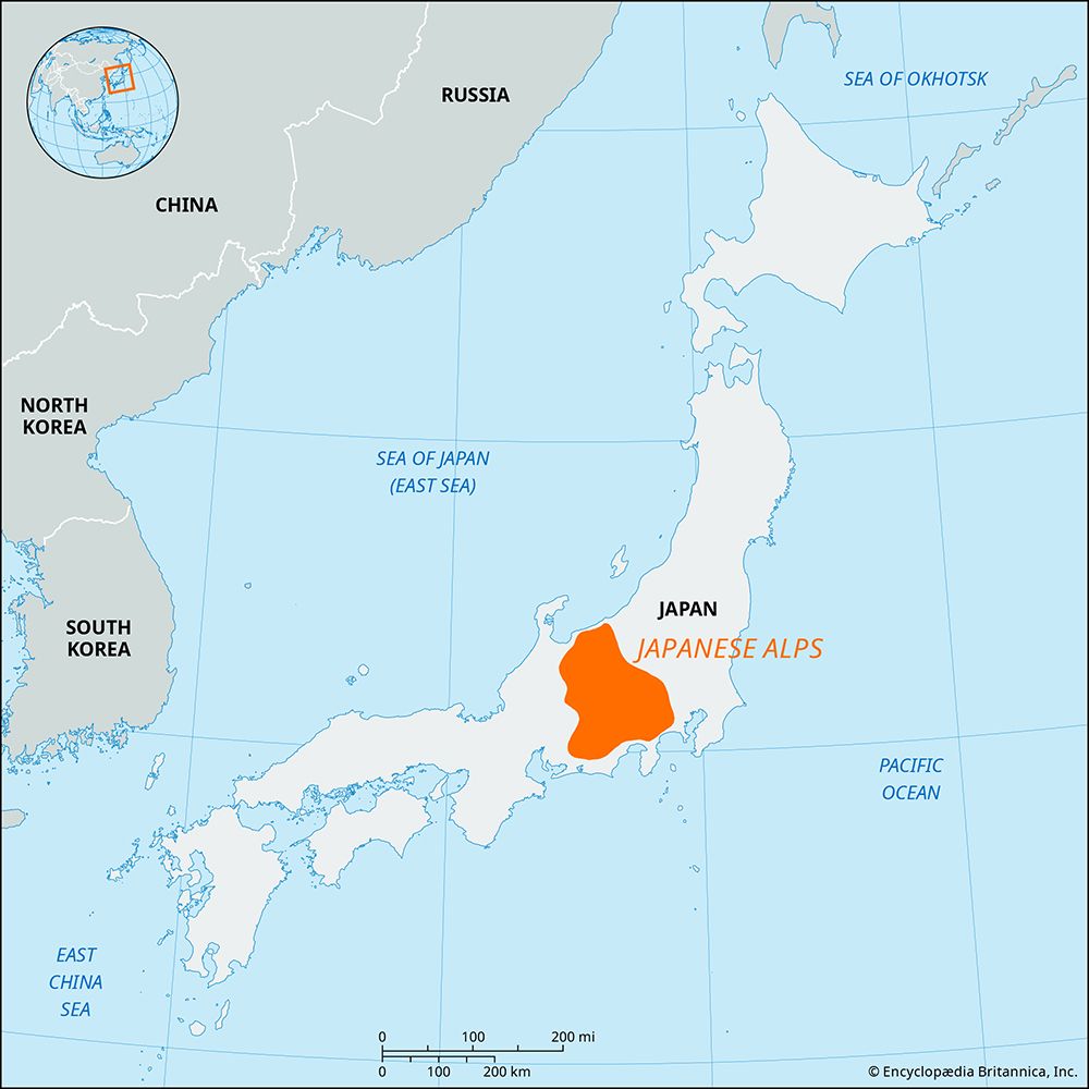
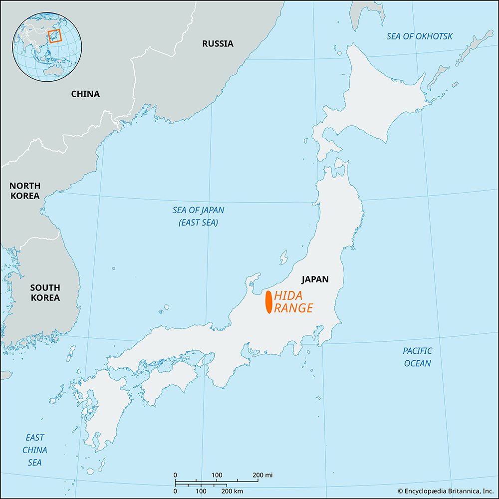
Compared to other major ranges, the Kantō Range is situated to the east of the “lofty, partially glaciated” Japanese Alps—comprising the Akaishi, Kiso, and Hida ranges—which represent some of the most prominent high-altitude terrain in central Japan. While the Kantō Range features steep, dissected slopes, it is distinct from the volcanic-heavy Ōu Mountains of the northeast or the complex fault-block structures of the Chūgoku Range.21
Are there any significant cultural or historical sites associated with the Kantō Range?
The Kantō Range is home to several areas of historical and cultural significance, primarily centered around the Chichibu region.
- Chichibu Basin: Located near the eastern edge of the range, this intermontane basin has served as an important settlement area throughout Japanese history. The city of Chichibu is a notable cultural hub, long recognized as a center for sericulture. While the silk industry has largely declined, the city remains a gateway to the Chichibu-Tama National Park and is famous for the annual festival held at the Chichibu Shintō shrine.1
- Mount Fuji: The southern section of the Kantō Range is geologically linked to the Misaka-Tenshu range, which embraces a depression now buried by Mount Fuji. As a UNESCO World Heritage site, Mount Fuji is recognized globally as a sacred place and a profound source of artistic inspiration.
What is the significance of the Kantō Range in terms of Japan’s water resources?
The Kantō Range plays a vital role in Japan’s water resources by serving as the headwaters for major river systems that sustain the Kantō Plain. The range’s steep, dissected slopes and canyonlike valleys facilitate the collection and flow of water into the lowlands, where it is essential for both agriculture and industry.63
The Tone River system, which rises in the volcanic northwestern region of the Kantō, is the most significant of these water sources. Since 1950, dams constructed on the headwaters of the Tone River have been critical for two primary functions:
- Hydroelectric Power: The dams generate energy to support the region’s infrastructure.1
- Water Supply: They create reservoirs that provide an indispensable water supply to the Keihin Industrial Zone and irrigation for the populous drainage basin.1
Additionally, the Sagami River system, which is fed by tributaries originating within the range, further contributes to the water management network of the region.6
How was the Kantō Range formed geologically, and what types of rocks are found there?
The Kantō Range was formed through complex tectonic processes, including intense faulting and warping of the Earth’s crust, which have elevated the terrain faster than erosion could wear it down. These mountain-building (orogenic) forces have been particularly active during the Quaternary period, roughly the past 2.6 million years.123
Geologically, the range is characterized by a zonal arrangement of rock formations that vary significantly in age, ranging from approximately 2.6 to 540 million years old. The composition includes:7
- Crystalline Schists: These metamorphic rocks are a primary feature of the range’s zonal structure.7
- Diverse Formations: The range contains a variety of geologic formations spanning from the Paleozoic to the Cenozoic eras, reflecting a long history of tectonic activity.78
- Volcanic Influence: In the southern section, the mountains are associated with volcanic activity, notably forming a crescent-shaped range that embraces a depression buried by Mount Fuji.7
The resulting landscape is dominated by steep slopes and narrow, canyonlike valleys, with the range divided into two distinct sections by the Katsura River.7
Sources
- Kantō Range — Encyclopædia Britannica
- Japan - The major physiographic regions — Encyclopædia Britannica
- Kantō Plain — Encyclopædia Britannica
- Chichibu — Encyclopædia Britannica
- list of World Heritage sites - Japan — Encyclopædia Britannica
- Tone River — Encyclopædia Britannica
- Japan - Relief — Encyclopædia Britannica
- mountain - Tectonic processes that produce high elevations — Encyclopædia Britannica
- Chūgoku Range — Encyclopædia Britannica
- mountain - Tectonic processes that create and destroy mountain belts and their components — Encyclopædia Britannica
Published on · 3 min read