Laguna De Bay
Laguna de Bay is the largest lake in the Philippines, located on the island of Luzon just southeast of Manila. Covering approximately 356 square miles (922…
What is Laguna de Bay?
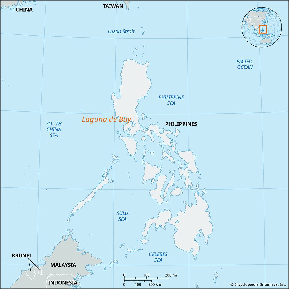
Laguna de Bay is the largest lake in the Philippines, located on the island of Luzon just southeast of Manila. Covering approximately 356 square miles (922 square km), the lake is believed to be a former extension of Manila Bay that was separated by volcanism.12
The lake features a shallow, crescent-shaped basin that is drained by numerous small streams, and its surrounding low-lying plains are prone to flooding during heavy rainfall. The Pasig River serves as the lake’s primary outlet, connecting it to Manila Bay.12
Laguna de Bay is a significant region for fishing and agriculture, particularly rice cultivation along its wet margins. The lake is characterized by two northern peninsulas and several islands, the largest of which is the densely populated Talim Island. Major towns situated along its southern shore include Santa Cruz, Biñan, and Calamba.1
How does the Pasig River connect Laguna de Bay to Manila Bay?
The Pasig River serves as the primary outlet for Laguna de Bay, facilitating the flow of water from the lake into Manila Bay.31
Spanning approximately 14 miles (23 km) in length, the river originates at the lake and flows in a north-northwest direction. As it travels, the river passes through the town of Pasig and bisects the city of Manila before finally emptying into Manila Bay between the North and South harbors. Although the river is a shallow and sluggish stream, it remains navigable by small craft and is spanned by nine bridges. Historically, the river was a vital hub for interisland trade, though its port functions have diminished over time.3
What role does volcanism play in the formation of lakes in the Philippines?
Volcanism has played a significant role in shaping the landscape and hydrology of the Philippines, including the formation of some of its most prominent lakes.
- Crater Lakes: Some lakes are formed directly within the remnants of volcanic activity. For example, Taal Lake occupies a large volcanic crater and features a volcanic cone, Volcano Island, rising from its center.45
- Geological Separation: Volcanic processes can also alter coastal geography. Laguna de Bay, the largest lake in the country, is believed to have been a former extension of Manila Bay that was cut off and isolated by volcanism.2
- Volcanic Landscape: The islands of the Philippines are composed primarily of volcanic rock, and many regions are characterized by isolated volcanoes and irregular mountainous terrain, which influence the drainage patterns and the creation of inland basins.1
How does Taal Lake differ from Laguna de Bay?
Taal Lake and Laguna de Bay are both prominent bodies of water on the island of Luzon, but they differ significantly in their formation, size, and drainage:
- Formation: Taal Lake occupies a volcanic crater and features a central volcanic cone known as Volcano Island, which remains active. In contrast, Laguna de Bay is a much larger basin that was historically isolated from the sea.42
- Size: Laguna de Bay is the largest lake in the Philippines, covering 356 square miles (922 square km). Taal Lake is the country’s third-largest lake, spanning 94 square miles (244 square km).42
- Drainage: Taal Lake is drained by the Pansipit River into Balayan Bay of the South China Sea. Laguna de Bay is connected to Manila Bay via the Pasig River, which flows through the city of Manila.42
Sources
- Laguna de Bay — Encyclopædia Britannica
- Philippines - Drainage — Encyclopædia Britannica
- Pasig River — Encyclopædia Britannica
- Taal Lake — Encyclopædia Britannica
- Philippines - Relief — Encyclopædia Britannica
- Taal — Merriam-Webster
Published on · 3 min read