Lhotse
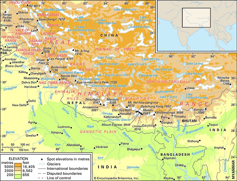
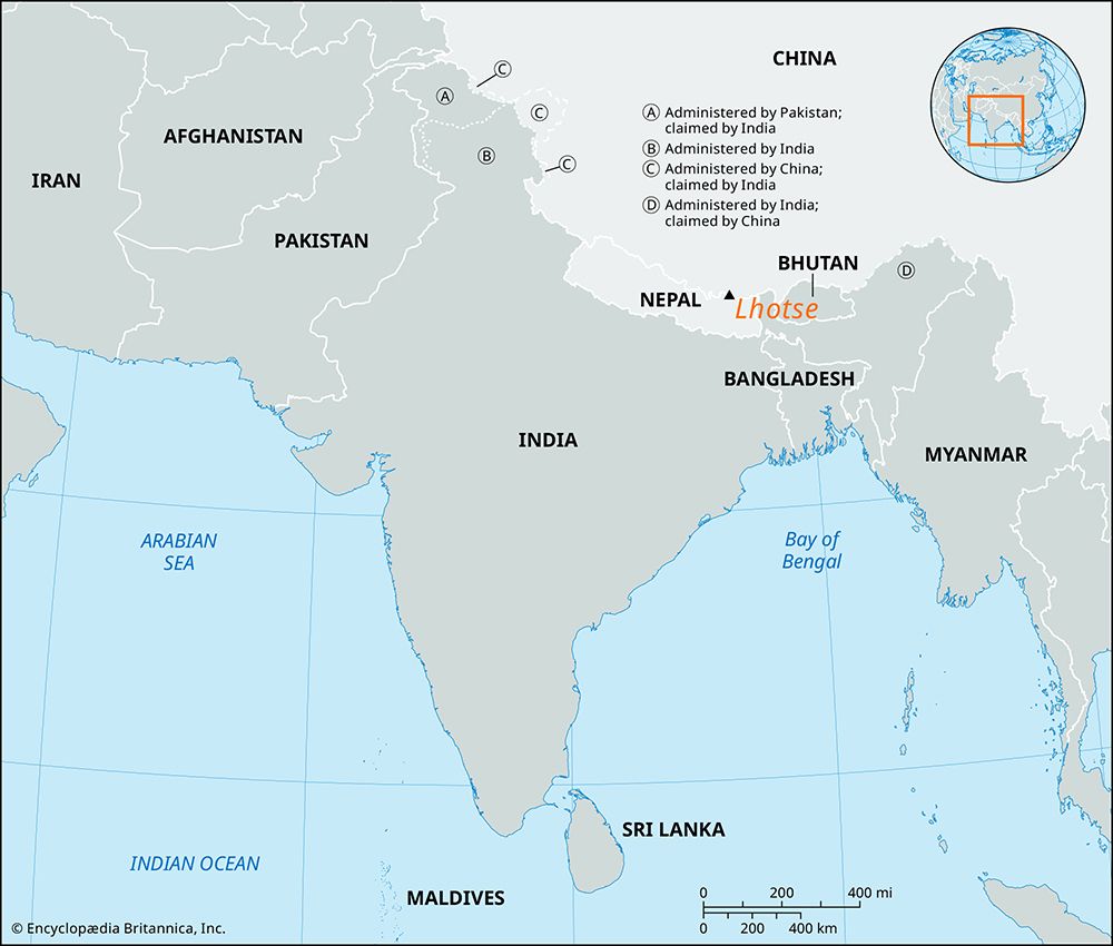
Lhotse is a mountain massif located in the Himalayas along the border between Nepal and the Tibet Autonomous Region of China.
What is Lhotse?
Lhotse is a mountain massif located in the Himalayas along the border between Nepal and the Tibet Autonomous Region of China.1
It is composed of three summits, with its highest point, Lhotse I, reaching 27,940 feet (8,516 meters), making it the fourth tallest peak in the world. Situated just south of Mount Everest, Lhotse is connected to it by a ridge at an elevation of approximately 25,000 feet (7,600 meters) and is sometimes categorized as part of the Everest massif. The first successful ascent of Lhotse I was achieved on May 18, 1956, by Swiss climbers Fritz Luchsinger and Ernest Reiss. The mountain’s steep face is also a notable feature for climbers attempting to reach the South Col on the route to Everest.12
How does the Lhotse Face challenge climbers on the way to Mount Everest?
The Lhotse Face presents a significant physical challenge for climbers attempting to reach the South Col on the route to Mount Everest. This imposing wall of ice and rock rises approximately 4,000 feet (1,220 meters) and requires immense endurance and technical effort to navigate.1
Historically, climbers have faced considerable difficulty establishing a viable route up this steep incline. During early expeditions, such as the 1952 Swiss attempt, teams had to navigate beside a prominent rock spur known as the Éperon des Genevois to make progress toward the col. The sheer scale of the face often necessitates long, grueling days of climbing, sometimes forcing teams to bivouac on the slope before they can successfully reach the South Col to establish camp.1
What are the other mountains that make up the world’s tallest peaks?
The “Seven Summits” are recognized by mountaineers as the highest peaks on each of the world’s seven continents. While there is some debate regarding geographical classification—specifically concerning the boundaries of Europe and the inclusion of Oceania—the following peaks are widely considered the highest points of their respective regions:4
- Asia: Mount Everest (29,032 feet / 8,849 meters), the highest mountain in the world, located on the border of Nepal and the Tibet Autonomous Region of China.54
- South America: Mount Aconcagua (22,831 feet / 6,959 meters), the highest point in the Western Hemisphere, situated in Argentina.4
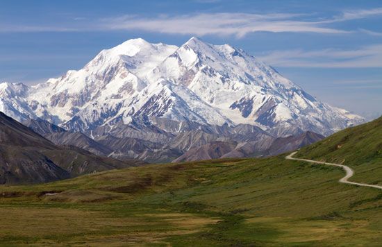
- North America: Denali (formerly Mount McKinley; 20,310 feet / 6,190 meters), located in the Alaska Range.4
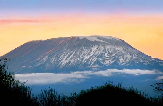
- Africa: Kilimanjaro (19,340 feet / 5,895 meters), a volcanic massif in Tanzania.4
- Europe: Mount Elbrus (18,510 feet / 5,642 meters), an extinct volcano in the Caucasus Mountains of Russia.4
- Antarctica: Vinson Massif (16,050 feet / 4,892 meters), located in the Sentinel Range.4
- Australia/Oceania: Depending on the classification, this is either Mount Kosciuszko (7,310 feet / 2,228 meters) in Australia proper or Jaya Peak (16,024 feet / 4,884 meters) in Oceania.4
What is the significance of the South Col in Himalayan mountaineering?
The South Col is a high-altitude saddle located at the junction between Mount Everest and Lhotse. It serves as a critical geographical and logistical pivot point in Himalayan mountaineering, particularly for the southern approach to Everest.13
Its significance includes:
- Strategic Gateway: The South Col acts as the high-altitude base for the final push to the summit of Everest via the Southeast Ridge.63
- Logistical Hub: In the traditional “siege” style of climbing, the South Col is typically the site of the final high-altitude camp. Establishing this camp is a major milestone that allows an “assault” team to be positioned within striking distance of the peak.3
- Route Connectivity: It is reached by climbing the daunting 4,000-foot (1,220-meter) face of Lhotse, a technical challenge that requires significant endurance and often involves navigating complex terrain like the Éperon des Genevois.6
- Historical Precedent: The route through the South Col became the standard for southern expeditions after the 1951 reconnaissance mission identified it as a viable path through the Western Cwm, eventually leading to the first successful summit by Edmund Hillary and Tenzing Norgay in 1953.13
Sources
- Lhotse — Encyclopædia Britannica
- Mount Everest - Spring attempt of 1952 — Encyclopædia Britannica
- Mount Everest - Geology and relief — Encyclopædia Britannica
- Mount Everest — Encyclopædia Britannica
- The World’s Highest Mountains by Continent — Encyclopædia Britannica
- Mount Everest - Reconnaissance of 1921 — Encyclopædia Britannica
- Mount Everest - Reconnaissance of 1951 — Encyclopædia Britannica
- Mount Everest - Routes and techniques — Encyclopædia Britannica
Published on · 3 min read