Himalayas
The Himalayas were formed through the process of continental collision, a result of powerful plate-tectonic forces. Following the breakup of the…
How were the Himalayan mountains formed, and when did this process begin?
The Himalayas were formed through the process of continental collision, a result of powerful plate-tectonic forces. Following the breakup of the supercontinent Gondwana approximately 180 million years ago, the Indian subcontinent began a northward journey toward the Eurasian Plate.1
The initial collision between the Indian and Eurasian plates occurred between 40 and 50 million years ago, which began the process of crustal thickening and deformation. However, the intense, large-scale mountain building of the Himalayas began in earnest about 20 million years ago during the early Miocene Epoch. During this time, massive thrust sheets and nappes of rock were pushed southward, significantly contracting the former Tethys Sea trench. The range reached its status as the highest mountains on Earth likely within the last 600,000 years, during the Pleistocene Epoch, characterized by intense uplift.213
What unique flora and fauna can be found in the Himalayan region?
The Himalayan region boasts extraordinary biodiversity, with flora and fauna varying significantly based on elevation, precipitation, and geography.
Flora
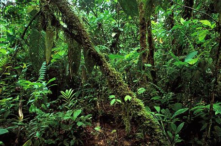
Himalayan vegetation is categorized into four primary zones:
- Tropical and Subtropical: The humid foothills feature evergreen rainforests with dipterocarps, bamboos, and oaks. In drier western areas, sal forests and subtropical thorn steppe are common.5
- Temperate: Extending up to 11,000 feet, these forests contain conifers like deodar cedar, blue pine, and spruce, alongside broad-leaved trees.5
- Alpine: Above the tree line, vegetation includes juniper, rhododendrons, mosses, and lichens, with flowering plants appearing at high elevations.65
Fauna
The region’s animal life is diverse, with eastern species showing affinities to Southeast Asia and western species resembling those of Mediterranean or Ethiopian regions.67
- Forests and Foothills: Denizens include Asiatic black bears, clouded leopards, langurs, and tahr. The Tarai region is home to Indian rhinoceroses and elephants.67
- High Elevations: Remote areas support snow leopards, brown bears, lesser pandas, and the yak, which is genetically adapted to low-oxygen environments.78
- Avian and Aquatic: The region hosts nearly 800 bird species in Nepal alone, including magpies and lammergeiers. Streams are inhabited by fish of the genus Glyptothorax.7
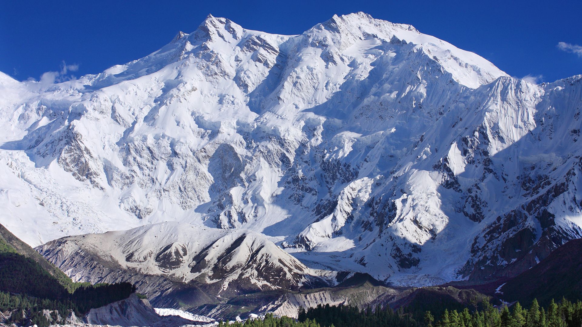
How do the Himalayas affect the climate and weather patterns of South Asia?
The Himalayas serve as a critical climatic divide, profoundly shaping the meteorological conditions of the Indian subcontinent and Central Asia. Due to their immense height and strategic location, they act as a physical barrier that dictates regional weather patterns in two primary ways:
- Blocking Cold Air: During winter, the Great Himalaya Range obstructs the passage of frigid continental air from the north, preventing it from sweeping into India and keeping the region warmer than it would otherwise be.9
- Monsoon Regulation: The mountains force the moisture-laden southwesterly monsoon winds to rise and release their precipitation on the southern slopes. This process results in heavy rainfall and snowfall on the Indian side, while creating arid, rain-shadow conditions in Tibet and the northern valleys.910
Additionally, the mountains influence local climates through the foehn effect, where winds crossing the range descend as warm, dry air on the leeward side. These topographical interactions ensure that precipitation varies drastically across the region, ranging from lush, rain-drenched southern slopes to the extreme aridity of the high-altitude interior.109
We could dive deeper into how these specific precipitation patterns influence the drainage basins of major South Asian rivers.
What are some of the highest peaks in the Himalayas, and how tall are they?
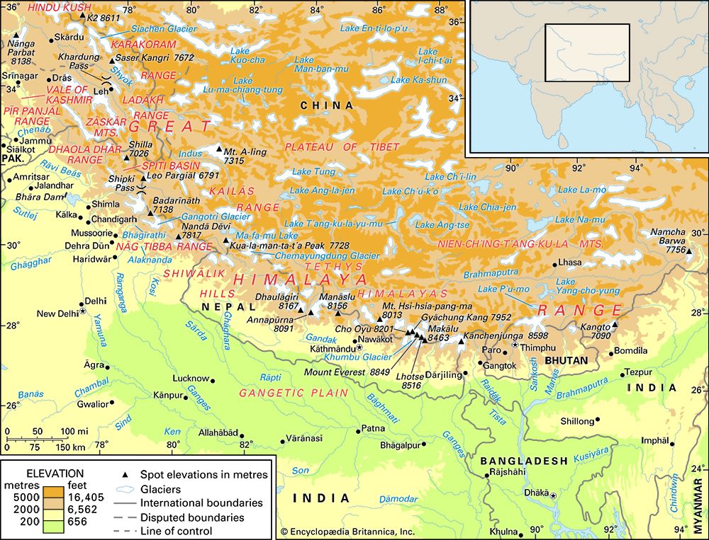
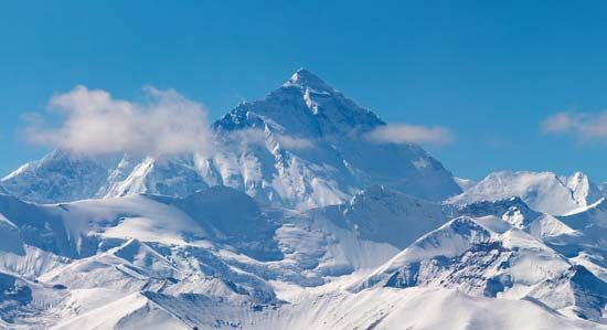
The Himalayas are home to many of the world’s tallest mountains. Below are some of the highest peaks in the region and their respective elevations:
Mountain
Elevation (feet)
Elevation (meters)
Mount Everest
29,032–29,035
8,849–8,850
Kanchenjunga
28,169
8,586
Lhotse
27,940
8,516
Makalu
27,766
8,463
Dhaulagiri
I
26,795
8,167
Manaslu
I
26,781
8,163
Annapurna
I
26,545
8,091
These peaks are primarily located within the Great Himalayas, a range that stretches across several countries, including Nepal, China (Tibet), India, Pakistan, and Bhutan. Many of these mountains are permanently snow-covered and serve as the source for numerous glaciers in the region.111213
Sources
- plate tectonics - Mountains by continental collision — Encyclopædia Britannica
- Tethys Sea — Encyclopædia Britannica
- Himalayas - Geologic history — Encyclopædia Britannica
- Asia - Cenozoic events in the Alpide plate boundary zone and in the Arabian and Indian cratons — Encyclopædia Britannica
- Exploring 7 of Earth’s Great Mountain Ranges - Himalayas — Encyclopædia Britannica
- Himalayas - Plant life — Encyclopædia Britannica
- Himalayas - Animal life — Encyclopædia Britannica
- human respiratory system - High altitudes — Encyclopædia Britannica
- Himalayas - Climate of the Himalayas — Encyclopædia Britannica
- Asia - The influence of topography — Encyclopædia Britannica
- Mount Everest — Encyclopædia Britannica
- Great Himalayas — Encyclopædia Britannica
- Mount Everest - Geology and relief — Encyclopædia Britannica
- Nepal Himalayas — Encyclopædia Britannica
- India - The Great Himalayas — Encyclopædia Britannica
Published on · 3 min read