Rainy Lake
Rainy Lake, located on the border between Minnesota and Ontario, is a popular destination for a variety of outdoor recreational activities. The region is…
What are some of the recreational activities popular on and around Rainy Lake?
Rainy Lake, located on the border between Minnesota and Ontario, is a popular destination for a variety of outdoor recreational activities. The region is well-regarded for hunting, fishing, and canoeing.
Because a portion of the lake is situated within Voyageurs National Park, visitors can take advantage of seasonal access methods to explore the wilderness:
- Summer: The park is primarily accessed by boat, allowing for extensive water-based exploration of the lake’s many islands and indented shores.1
- Winter: The area transforms into a hub for cold-weather recreation, including snowmobiling and skiing. Additionally, a seasonal road is established on the ice of Rainy Lake, enabling motor vehicles to travel along the northern edge of the Kabetogama Peninsula.1
How does the international border between the United States and Canada impact the management of Rainy Lake?
The management of Rainy Lake, which sits astride the international border between the United States and Canada, is overseen by the International Joint Commission. Established by the International Boundary Waters Treaty of 1909, this commission is responsible for regulating the use of shared boundary waters to prevent disputes and protect the interests of both nations.3
The commission holds jurisdiction over a wide range of issues concerning Rainy Lake, including:
- Water Quality: Safeguarding the lake against water pollution.3
- Resource Use: Managing fishing rights and the diversion or use of shared water resources.3
- Infrastructure: Overseeing the construction of dams and bridges that may impact the boundary waters.3
- Transportation: Regulating shipping and other transportation rights across the border.3
By facilitating annual meetings, the commission ensures that both the United States and Canada coordinate their management efforts to maintain the health and utility of the lake for the inhabitants of both countries.3
How does Rainy Lake contribute to the economy of the surrounding region?
Rainy Lake serves as a vital economic engine for the surrounding region, primarily through industrial production and tourism. The lake and its outlet, the Rainy River, provide essential resources that support the local economy in the following ways:
Industrial Power and Manufacturing
The region’s economy is heavily anchored by the lumber, pulp, and paper milling industries.1 A power station located on the Rainy River, just downstream from the lake, generates the electricity necessary to sustain these manufacturing operations in the neighboring cities of Fort Frances, Ontario, and International Falls, Minnesota.15
Tourism and Recreation
Beyond manufacturing, the region relies on a robust tourism sector. The area is a popular destination for outdoor enthusiasts, drawing visitors for activities such as:
- Water Sports: Boating, canoeing, and fishing.51
- Seasonal Recreation: Hunting and winter activities, including snowmobiling, which are supported by the proximity of Voyageurs National Park.51
As a port of entry, International Falls also functions as a key supply point for travelers exploring this wilderness region.1
Where is Rainy Lake located, and what are its key geographical features?
Rainy Lake is a narrow lake situated directly on the international border between the United States and Canada, specifically between the state of Minnesota and the Rainy River district of northwestern Ontario.16
Geographical Features
- Dimensions: The lake covers an area of 360 square miles (932 square km) and spans approximately 50 miles (80 km) in length. Of this length, 35 miles (56 km) serve as the international boundary.16
- Width: It has an average width of 5 miles (8 km), with a maximum width reaching 27 miles (43 km).1
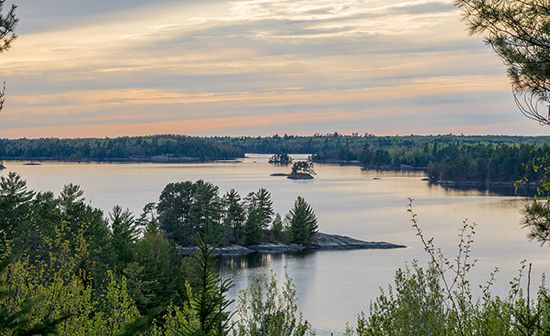
- Shoreline and Islands: The lake is characterized by an irregular, deeply indented shoreline and contains more than 500 islands.1
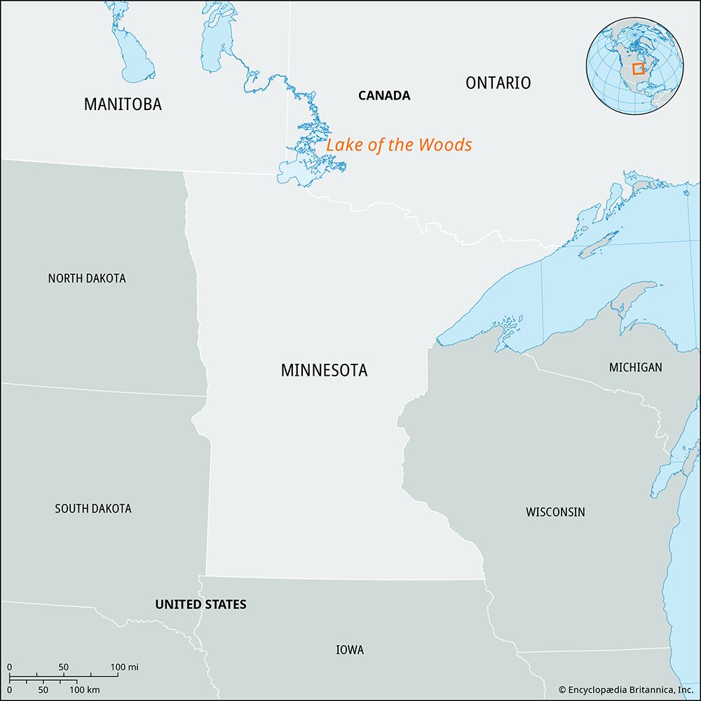
- Drainage: Water flows westward from the lake through the 85-mile (137-km) Rainy River into Lake of the Woods.17
The region’s landscape, like many in Minnesota, was shaped by glacial activity, which left behind the deep, clear waters and complex basins found in this area.8
Sources
- Rainy Lake — Encyclopædia Britannica
- Voyageurs National Park — Encyclopædia Britannica
- International Boundary Waters Treaty — Encyclopædia Britannica
- Lake of the Woods — Encyclopædia Britannica
- International Falls — Encyclopædia Britannica
- Rainy Lake — Merriam-Webster
- Rainy — Merriam-Webster
- Minnesota - Drainage — Encyclopædia Britannica
Published on · 3 min read