Salween River
The Salween River has historically held limited significance as a major transportation artery compared to other regional waterways like the Irrawaddy.…
What is the historical significance of the Salween River in terms of trade and transportation?
The Salween River has historically held limited significance as a major transportation artery compared to other regional waterways like the Irrawaddy. Because the river flows through narrow, deep gorges and contains dangerous rapids, it is not navigable for large vessels, with its lower course navigable for less than 100 miles.1
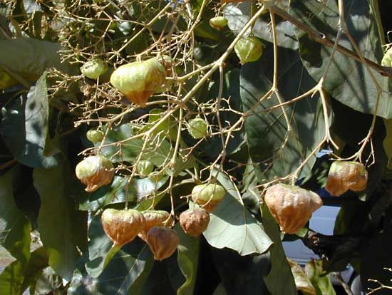
In terms of trade, the river’s primary economic utility has been the transport of timber, specifically floating teak logs from the forests of southeastern Myanmar down to the sea. While the river is crossed by the Burma Road and various road ferries in the Shan region, its physical geography has largely prevented it from becoming a major commercial shipping route. Instead, its potential is increasingly viewed through the lens of hydroelectric power development and irrigation, rather than traditional riverine trade.1
How is the Salween River used for hydroelectric power, and what are the environmental concerns?
The Salween River is currently recognized for its significant potential for hydroelectric development, particularly due to its steep terrain and powerful flow. While development has already occurred on the Pilu River—a right-bank tributary via the Pawn River—the main stem of the Salween, characterized by its extensive rapids, remains a target for future large-scale power and irrigation projects.1
However, the pursuit of hydroelectric power on major river systems often carries substantial environmental and social risks. Large-scale dam construction frequently necessitates the displacement of local populations and can trigger significant geological instability. For instance, similar projects in the region have been linked to reservoir-induced seismicity, which can increase the frequency of earthquakes in the surrounding areas. These factors highlight the complex balance between meeting regional energy demands and addressing the potential for ecological disruption and human displacement.3
What are the major cities or settlements located along the Salween River?
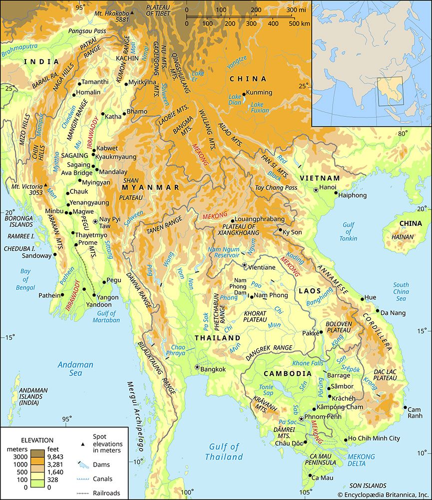
The Salween River flows through rugged, mountainous terrain, which has limited the development of large urban centers along its banks. The most prominent settlement located at its mouth is Mawlamyine (formerly Moulmein) in southeastern Myanmar.
- Mawlamyine: Situated on the Gulf of Martaban near the river’s mouth, this important port serves as a hub for the export of teak and rice transported downriver. It is located opposite the town of Martaban, which acts as a railhead connecting to Yangon.1
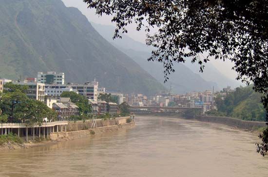
While the river passes through Yunnan province in China and the Shan region of Myanmar, it is characterized primarily by deep gorges and dangerous rapids rather than major cities. In the Shan region, the river is crossed by the Burma Road at the Huiting Bridge and is served by various small road ferries, but these locations function more as transit points than as significant urban settlements.4
What countries does the Salween River flow through, and how does it impact these regions?
The Salween River originates in the T’ang-ku-la Mountains of eastern Tibet and flows approximately 1,500 miles (2,400 km) through three primary regions:
- China: The river flows through Yunnan province, where it is characterized by narrow, deep gorges and high hills.1
- Myanmar: It traverses the eastern part of the country, cutting through the Shan Plateau. It serves as the longest river in Myanmar and is vital for draining the Shan Plateau.15
- Thailand: In its lower course, the river forms the international frontier between Myanmar and Thailand for about 80 miles (130 km).1
The river significantly impacts these regions by serving as a major economic artery for the timber industry, specifically in floating teak logs from southeastern Myanmar to the sea. While its dangerous rapids and narrow, restricted drainage basin limit its use as a major waterway for large-scale navigation, it holds substantial potential for future hydroelectric power and irrigation projects. At its mouth in Moulmein, it contributes to a small alluvial delta that supports local geography and trade.12
Sources
- Salween River — Encyclopædia Britannica
- Myanmar: Top Questions — Encyclopædia Britannica
- Jinping-I Dam: Top Questions — Encyclopædia Britannica
- Mawlamyine — Encyclopædia Britannica
- Southeast Asia - Drainage of Southeast Asia — Encyclopædia Britannica
Published on · 3 min read