Sao Tome and Principe
Sāo Tomé and Príncipe gained independence from Portugal on July 12, 1975. This transition followed a 1974 coup in Portugal, after which the new Portuguese…
How did São Tomé and Príncipe gain independence, and what type of government does it have today?
Sāo Tomé and Príncipe gained independence from Portugal on July 12, 1975. This transition followed a 1974 coup in Portugal, after which the new Portuguese government agreed to hand over power to the Movement for the Liberation of Sao Tome and Principe (MLSTP).12
Today, the country is a multiparty republic officially known as the Democratic Republic of Sāo Tomé and Príncipe. Under its 1990 constitution, the government functions as follows:32
- Executive Branch: The president serves as the head of state and is directly elected to a five-year term, limited to two successive terms. The prime minister serves as the head of government.4
- Legislative Branch: The country has a unicameral legislature consisting of a 55-seat National Assembly, with members elected by popular vote to four-year terms.34
- Regional Autonomy: Since April 1995, the island of Príncipe has operated as an autonomous region.4
Following independence, the nation initially operated as a single-party state before transitioning to a multiparty democracy in 1990, which facilitated the country’s first free elections in 1991.24
What role does cocoa production play in São Tomé and Príncipe’s economy?
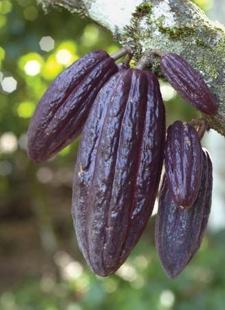
Cocoa production remains a cornerstone of the economy in São Tomé and Príncipe, despite significant historical and structural challenges. The nation’s fertile volcanic soils and favorable tropical climate make it well-suited for cacao cultivation, which occupies nearly two-thirds of the country’s total cultivated land.5
The role of cocoa in the economy is characterized by the following:
- Primary Export: Despite a long-term decline in production levels, cocoa continues to account for almost all foreign exchange earnings derived from merchandise exports.6
- Historical Legacy: The plantation economy was established in the 19th century, and by the early 20th century, the islands were among the world’s largest producers of the commodity. This history has left a lasting impact on land use and local labor dynamics.157
- Current Challenges: Since independence in 1975, many plantations have suffered from poor maintenance and under-tending. Furthermore, the legacy of the plantation system has contributed to a lack of self-sufficiency in staple food crops, as the focus remained heavily on cash crops for export. Recent agricultural reforms have involved distributing former state-owned plantation land to smallholders and medium-sized enterprises to improve productivity.57
What is the history of São Tomé and Príncipe, including its colonial past?
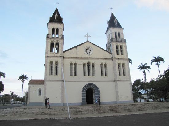
São Tomé and Príncipe were uninhabited when discovered by Portuguese navigators around 1470. In the late 15th century, Portugal began settling the islands, using them as a base for enslaved Africans to cultivate sugar. By the 16th century, São Tomé was briefly the world’s largest sugar producer, but competition from Brazil and social instability—including uprisings by enslaved people—led to an economic decline.
Following the collapse of the sugar industry, the islands became an entrepôt for the slave trade to Brazil. In the 19th century, the economy shifted toward coffee and cacao production. By the early 20th century, the colony was a leading global producer of cocoa, though this relied on indentured laborers whose conditions were often indistinguishable from slavery until 1910.
The brutal conditions on these plantations, exemplified by the 1953 Batepá Massacre, fueled the independence movement. The Movement for the Liberation of Sao Tome and Principe (MLSTP) was formed in 1960. Following a 1974 coup in Portugal, the new government agreed to transfer power, and the islands gained independence on July 12, 1975.1
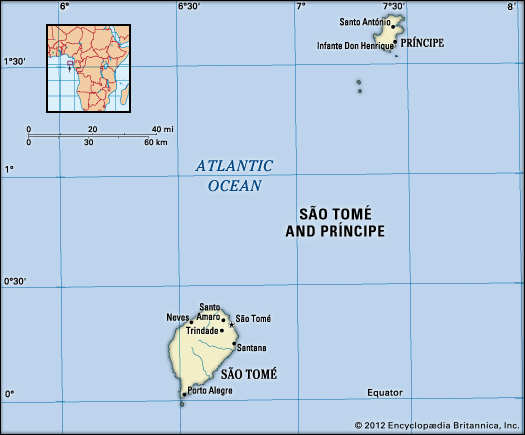
What is the significance of São Tomé and Príncipe’s location in the Gulf of Guinea?
São Tomé and Príncipe’s location in the Gulf of Guinea is significant primarily due to its geological origins and potential economic resources.
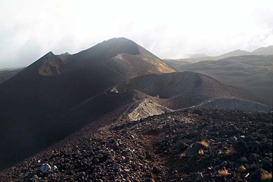
- Geological Context: The islands are part of an active volcanic island arc that extends 450 miles offshore, aligned with Mount Cameroon on the African mainland.10
- Economic Potential: While the islands themselves lack known mineral resources, their location within the Gulf of Guinea has granted the country access to maritime areas believed to contain significant deepwater hydrocarbon reserves. This potential has led to international interest and the establishment of a Joint Development Zone (JDZ) with Nigeria to explore and develop offshore oil fields.11
- Geographic Positioning: Situated on the Equator, the country serves as an isolated microstate in the eastern tropical Atlantic Ocean, positioned near the coasts of Gabon and Equatorial Guinea.1213
Sources
- Sao Tome and Principe - Portuguese colonial rule — Encyclopædia Britannica
- Sao Tome and Principe: Country Facts — Encyclopædia Britannica
- history of Sao Tome and Principe — Encyclopædia Britannica
- Sao Tome and Principe - Constitutional framework — Encyclopædia Britannica
- Sao Tome and Principe - Agriculture, forestry, and fishing — Encyclopædia Britannica
- Sao Tome and Principe - Finance and trade — Encyclopædia Britannica
- Sao Tome and Principe - Economy of Sao Tome and Principe — Encyclopædia Britannica
- Sao Tome and Principe - History of Sao Tome and Principe — Encyclopædia Britannica
- flag of Sao Tome and Principe — Encyclopædia Britannica
- Sao Tome and Principe — Encyclopædia Britannica
- Sao Tome and Principe - Land — Encyclopædia Britannica
- São Tomé and Príncipe — Merriam-Webster
- Gulf of Guinea — Encyclopædia Britannica
- Sao Tome and Principe - Resources and power — Encyclopædia Britannica
- Sao Tome and Principe - Transportation and telecommunications — Encyclopædia Britannica
- Bab el-Mandeb Strait: Top Questions — Encyclopædia Britannica
Published on · 3 min read