Gulf of Guinea
The Gulf of Guinea is a region of significant economic importance, primarily due to its vast energy reserves and marine resources.
What are some of the significant natural resources found in and around the Gulf of Guinea?
The Gulf of Guinea is a region of significant economic importance, primarily due to its vast energy reserves and marine resources.
Hydrocarbon Resources
The most prominent natural resources in the Gulf of Guinea are its extensive offshore petroleum and natural gas deposits. The region holds multiple giant and supergiant fields that drive the economies of several coastal nations:12
- Nigeria: The Niger Delta is a major hub, containing massive oil and gas reserves, including fields like Agbami and Bonga.3
- Angola: Its offshore development zone, particularly in the Congo Basin, features significant deepwater fields such as Kizomba, Dalia, and Pazflor.3
- Equatorial Guinea: The Zafiro field and the Alba field (a major source of natural gas) have transformed the nation’s economic profile.34
- Gabon and Ghana: Both countries possess substantial recoverable oil reserves, with Ghana’s Jubilee field representing a major recent discovery.3
- Joint Development: São Tomé and Príncipe and Nigeria have established a Joint Development Zone (JDZ) to explore potential hydrocarbon reserves in their overlapping maritime waters.2
Marine and Other Resources
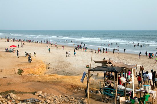
Beyond hydrocarbons, the gulf supports productive coastal fisheries, particularly off the coasts of Ghana and Côte d’Ivoire, where seasonal upwelling enhances marine life. While the region’s overall marine biodiversity is more limited than that of the Indo-Pacific, these fisheries remain a vital local resource.1
What is the geographical location and extent of the Gulf of Guinea?
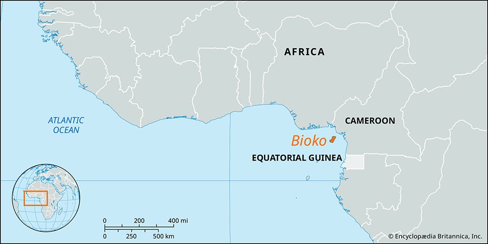
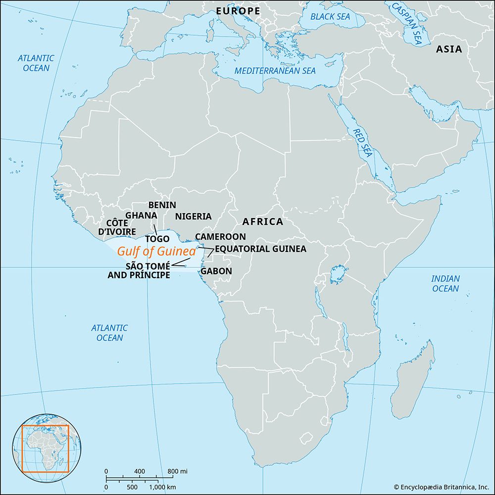
The Gulf of Guinea is a part of the eastern tropical Atlantic Ocean located off the coast of western Africa. Its geographical extent stretches westward from Cap López, situated near the Equator, to Cape Palmas at longitude 7° west.1
The gulf’s coastline is characterized by a narrow continental shelf, which widens significantly only in specific areas, such as the Bight of Biafra and the region between Sierra Leone and the Bijagós Archipelago. The region is also notable for an island arc that extends 450 miles (724 km) offshore to the southwest, featuring islands such as São Tomé, Príncipe, Bioko, and Annobón.1
How does the Intertropical Convergence Zone (ITCZ) influence the Gulf of Guinea’s weather patterns?
The Intertropical Convergence Zone (ITCZ) is a critical climatic control for the Gulf of Guinea, acting as the meeting point for two distinct air masses: the hot, dry continental air mass (the harmattan) from the Sahara and the warm, humid maritime tropical air mass from the South Atlantic.9
The ITCZ influences the region’s weather through the following mechanisms:
- Seasonal Oscillation: The convergence zone shifts north and south following the seasonal movement of the sun. In January, it reaches its southernmost position near 7° N, just north of the coastline, while in August, it moves as far north as the central Sahara.9
- Precipitation Patterns: The convergence zone is characterized by line squall precipitation. When the maritime tropical air mass dominates, the region experiences its rainy seasons. Conversely, when the continental air mass and the harmattan prevail, drought conditions occur.9
- Coastal Complexity: Along the southern coast (4°–6° N), the influence of the ITCZ is atypical. While the southwest monsoon (the maritime air) brings the main rainy season from April to June, the region experiences a “short drought” in July and August. During this time, despite the southwesterly flow, the air originates from Southern Hemisphere anticyclones and is relatively dry.1
How does the Gulf of Guinea affect the climate of surrounding regions?
The Gulf of Guinea significantly influences the climate of surrounding regions through its warm tropical waters and its role in the atmospheric dynamics of the Guinea Coast.
The climate of the coastal regions is primarily determined by the interplay between two major air masses:
- Maritime Tropical Air: A warm, humid air mass originating over the South Atlantic that brings the rainy seasons to the region.1
- Continental Air (Harmattan): A hot, dry air mass from the Sahara that moves southward with the northeast trade winds, resulting in dry, dusty conditions.1
The convergence of these air masses, governed by the seasonal oscillation of the sun, dictates the timing of wet and dry periods. Additionally, the Guinea Current—an eastward-flowing surface current—transports warm water along the northern coast, which helps moderate temperatures and contributes to the high humidity characteristic of the region. Coastal areas also benefit from land and sea breezes, which help mitigate the enervating effects of high temperatures and humidity. Furthermore, the gulf’s warm waters and high coastal rainfall contribute to the relatively low salinity of the surface layer, which is a defining feature of the local marine environment.10121
Sources
- Gulf of Guinea — Encyclopædia Britannica
- petroleum - Sub-Saharan Africa — Encyclopædia Britannica
- Guinea: Top Questions — Encyclopædia Britannica
- Equatorial Guinea - Economy of Equatorial Guinea — Encyclopædia Britannica
- The Gambia - Agriculture, forestry, and fishing — Encyclopædia Britannica
- Burkina Faso - Resources — Encyclopædia Britannica
- Sao Tome and Principe - Resources and power — Encyclopædia Britannica
- Ghana - Land — Encyclopædia Britannica
- Intertropical convergence zone — Encyclopædia Britannica
- Ghana - Climate — Encyclopædia Britannica
- West African monsoon — Encyclopædia Britannica
- Guinea Current — Encyclopædia Britannica
Published on · 3 min read