Tegernsee
The name Tegernsee is derived from the Old High German word tegar, which means "large" or "great," combined with see, the German word for "lake." Thus, the…
What is the origin of Lake Tegernsee’s name?
The name Tegernsee is derived from the Old High German word tegar, which means “large” or “great,” combined with see, the German word for “lake.” Thus, the name translates to “great lake” or “large lake.” This name reflects the lake’s historical significance as a prominent body of water in the region, which has long been a focal point for the surrounding Bavarian Alps and the local community, including the historic Benedictine abbey founded in 746.1
How does Lake Tegernsee contribute to the local economy and tourism industry?
Lake Tegernsee serves as a vital hub for the regional economy, primarily through its role as a premier destination for year-round tourism and recreation. The lake’s natural setting on the fringe of the Bavarian Alps supports a diverse range of activities that drive local commerce.1
Key economic contributors include:
- Recreational Sports: The lake is a popular destination for both summer and winter activities, offering extensive facilities for yachting and various water sports.1
- Resort Towns: Several communities around the lake act as economic centers, each offering unique attractions:
- Tegernsee village: Known for its historical significance, including the castle of King Maximilian I, which was formerly a Benedictine abbey.1
- Bad Wiessee: Functions as a health and wellness destination, drawing visitors to its specialized iodine and sulfur springs.1
- Rottach-Egern: Serves as a gateway to the Wallberg, a mountain peak that provides panoramic views and attracts hikers and sightseers.1
Where is Lake Tegernsee located in Germany, and what are its key geographical features?
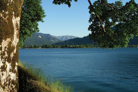
Tegernsee is a lake located in southern Bavaria, Germany, situated south of Munich on the fringe of the Bavarian Alps.1
The lake is characterized by the following geographical features:
- Elevation and Dimensions: It lies at an altitude of 2,380 feet (725 m) above sea level. The lake spans approximately 4 miles (6.5 km) in length and nearly 1 mile (1.6 km) in width, covering an area of 3.5 square miles (9 square km) with a maximum depth of 236 feet (72 m).1
- Surroundings: It is nestled among wooded mountains. To the south, the lake is overlooked by the Wallberg, a mountain peak reaching 5,650 feet (1,722 m).1
- Hydrology: The lake’s waters discharge through the Mangfall River into the Inn River system.1
- Regional Context: The area offers views of the Mangfall Mountains, the Hohe Tauern, and the Zugspitze, which is Germany’s highest mountain.1
How deep is Lake Tegernsee, and how does its size compare to other lakes in Bavaria?
Lake Tegernsee has a maximum depth of 236 feet (72 m) and covers an area of 3.5 square miles (9 square km).1
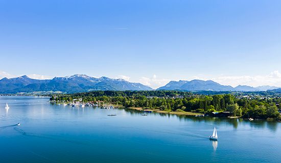
When compared to other lakes in Bavaria, such as Chiemsee, Tegernsee is significantly smaller. Chiemsee is the largest lake in Bavaria, spanning 32 square miles (82 square km), which is roughly nine times the surface area of Tegernsee. While Tegernsee is a notable recreational destination nestled in the Bavarian Alps, it remains much more compact than the expansive Chiemsee, which features multiple islands and a different topographical setting.13
Sources
- Tegernsee — Encyclopædia Britannica
- Alps - Physiography — Encyclopædia Britannica
- Chiemsee — Encyclopædia Britannica
Published on · 2 min read