Bavarian Alps
The climate of the Bavarian Alps is characterized by significant variations due to elevation and exposure. Generally, the mountains experience a cooler and…
What is the climate like in the Bavarian Alps throughout the year?
The climate of the Bavarian Alps is characterized by significant variations due to elevation and exposure. Generally, the mountains experience a cooler and wetter climate than the surrounding lowlands, with annual precipitation in these Alpine regions often exceeding 80 inches (2,000 mm).1
Seasonal weather is highly variable. Winters in the higher elevations are typically cold, with snow cover often lasting from mid-November through May. Conversely, summers are generally mild, though temperatures can fluctuate based on altitude and local topography.12
A notable feature of the region is the foehn, a warm, dry wind that descends from the mountains to the Bavarian Plateau. This wind can cause abrupt temperature increases and rapid snowmelt, sometimes creating clear conditions that make the Alps visible from great distances. Additionally, the region is subject to temperature inversions during autumn and winter, where valleys may remain filled with fog and cold air while higher elevations experience sunnier, warmer conditions. Due to the steep terrain and heavy snowfall, avalanches remain a persistent seasonal hazard from late November to early June.12
What major rivers originate in or flow through the Bavarian Alps?
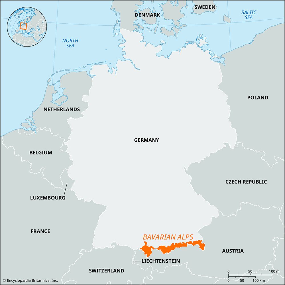
Several major rivers originate in or flow through the Bavarian Alps, serving as vital components of the region’s hydrology and the broader Danube River basin.
- Isar River: Rising at an elevation of 5,741 feet in the Karwendelgebirge near Innsbruck, Austria, the Isar flows through a deep gorge before emerging onto the Bavarian plain. It travels 183 miles through Germany, passing through Munich before eventually joining the Danube downstream from Regensburg.45
- Inn River: This major tributary of the Danube rises in Switzerland and flows through Austria and Germany. In the Unterinntal, it cuts between the Bavarian Alps and the Kaisergebirge. Upon entering Bavaria, it flows north and east, eventually forming part of the Austro-German border before its confluence with the Danube at Passau. before its confluence with the Danube at Passau.4
These rivers, along with other Alpine tributaries like the Lech and Iller, are essential to the drainage of the Alps, contributing significantly to the total runoff of the upper Danube.6
Are there any significant lakes in the Bavarian Alps, and what are their names?
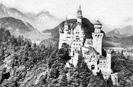
The Bavarian Alps are home to several significant and picturesque lakes, which serve as important recreational and cultural landmarks in the region:
- Tegernsee: Located south of Munich, this lake sits at an elevation of 2,380 feet (725 m). It covers an area of 3.5 square miles (9 square km) and reaches a maximum depth of 236 feet (72 m). It is a popular destination for water sports and is surrounded by resorts such as Tegernsee, Bad Wiessee, and Rottach-Egern.
- Königssee: Situated within the Berchtesgaden National Park, this lake is known for its deep, clear waters surrounded by sheer limestone mountains. It is 5 miles (8 km) long and reaches a notable depth of 617 feet (188 m). The lake is famous for the historic St. Bartholomew pilgrimage church located on its western shore.
How do the Bavarian Alps compare to other parts of the Alps in terms of height and terrain?
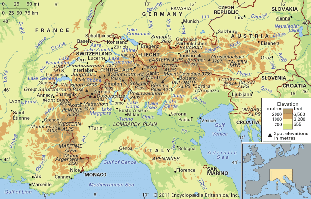
The Bavarian Alps represent a distinct segment of the Eastern Alps, characterized by unique topographical features compared to the higher, more crystalline ranges found elsewhere in the mountain system.813
Elevation
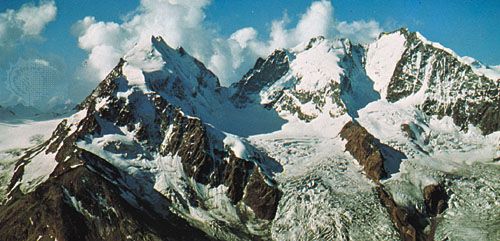
In terms of height, the Bavarian Alps are significantly lower than the central and western portions of the range. The highest point in the Bavarian Alps—and in all of Germany—is the Zugspitze, which reaches 9,718 feet (2,962 meters). This is notably lower than the “giants” of the Western Alps, such as Mont Blanc (15,771 feet), or the Central Alps, where peaks like the Matterhorn exceed 14,000 feet.813
Terrain
The terrain of the Bavarian Alps is defined by a striking asymmetry:
- Southern Face: The range features a steep, imposing wall that overlooks the Inn River valley.8
- Northern Face: In contrast, the northern side consists of gentler slopes that are well-suited for cattle grazing.8
While the inner Alps are dominated by crystalline massifs, the Bavarian Alps are part of the limestone-heavy landscape of the Eastern Alps, resulting in a different geological character than the high-altitude, glacier-covered domes found further west.813
Sources
- Germany - Climate of Germany — Encyclopædia Britannica
- Alps - Climate of the Alps — Encyclopædia Britannica
- Austria - Climate of Austria — Encyclopædia Britannica
- Inn River — Encyclopædia Britannica
- Isar River — Encyclopædia Britannica
- Alps — Encyclopædia Britannica
- Isar — Merriam-Webster
- Bavarian Alps — Encyclopædia Britannica
- Danube River - Physiography — Encyclopædia Britannica
- Rhine River - Hydrology of the Rhine River — Encyclopædia Britannica
- Tegernsee — Encyclopædia Britannica
- Königssee — Encyclopædia Britannica
- Alps - Physiography — Encyclopædia Britannica
Published on · 3 min read