Adamawa Plateau
The Adamawa Plateau is a volcanic plateau located in west-central Africa. While primarily situated in north-central Cameroon, it extends into southeastern…
What is Adamawa Plateau?
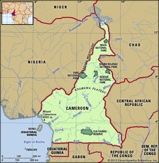
The Adamawa Plateau is a volcanic plateau located in west-central Africa. While primarily situated in north-central Cameroon, it extends into southeastern Nigeria as the Gotel Mountains.1
Key features of the region include:
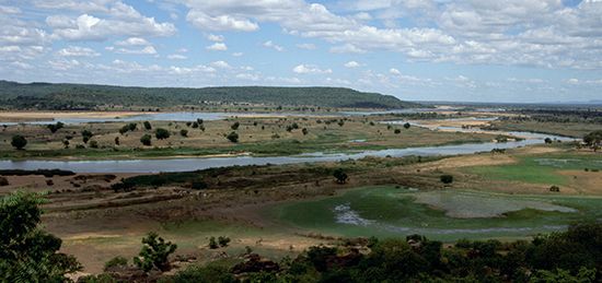
- Geography: The plateau reaches elevations exceeding 8,700 feet (2,650 metres) above sea level and is characterized by volcanic craters and small lakes. It serves as the source of the Benue River.1
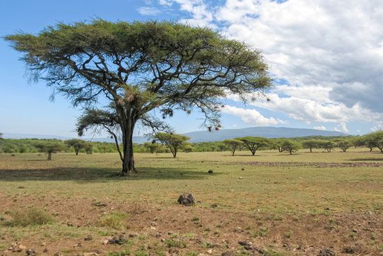
- Environment: The landscape is dominated by savanna vegetation interspersed with tropical woodlands.1
- Economy: The regional economy relies on pastoralism, cattle ranching, and subsistence agriculture. Mineral exploitation includes tin and bauxite.1
- History: The region is named after Modibbo Adama, the founder of a Fulani emirate that originated as an offshoot of the Sokoto caliphate.1
What is the significance of the Benue River to the region?
The Benue River is a vital waterway in western Africa, serving as the longest tributary of the Niger River and a key component of the region’s drainage system. Originating in the Adamawa Plateau, it plays several critical roles:31
- Transportation and Trade: The river is a significant artery for commerce. It is navigable for much of the year, facilitating the transport of imports like petroleum and the export of agricultural products such as cotton and peanuts from the Chad region. Makurdi serves as its chief port.34
- Economic Support: The river basin supports diverse economic activities, including agriculture and mining. The surrounding areas rely on the river for irrigation and transport, while the river valley itself contains valuable mineral deposits, including lead, limestone, and saline springs.4
- Hydrological Connectivity: During flood periods, the Benue links to the Logone River, creating a seasonal connection to the Lake Chad basin.3
Who were the Fulani people and what is their historical influence?
The Fulani are a primarily Muslim people widely dispersed across West Africa, ranging from the Atlantic coast to Lake Chad. Traditionally a pastoral society, their history and social organization were historically defined by the needs of their cattle herds.7
Historical Influence and the Sokoto Jihad
The Fulani’s most significant historical influence in the region stems from the 19th-century Sokoto jihad, a movement led by the scholar Usman dan Fodio. Unhappy with the mixing of Islam with traditional religious practices in the Hausa states, Usman launched a holy war in 1804 to purify the faith and establish governance based on Islamic law.789
This movement resulted in the creation of the Fulani empire, a vast theocratic system that unified much of northern Nigeria and extended into regions like Adamawa, Nupe, and Ilorin. By establishing a centralized administration based in Sokoto, the Fulani aristocracy transformed the political landscape, influencing trade, agriculture, and law across approximately 200,000 square miles.1089
Cultural Diversity
Today, the Fulani exhibit diverse socioeconomic patterns:
- Pastoralists: Many remain nomadic, maintaining an egalitarian social structure and holding high cultural prestige.7
- Sedentary/Urban: Many have settled in urban communities, particularly in northern Nigeria, where they have often adopted Hausa language and culture.7
How do volcanic landforms shape the geography of Africa?
Volcanic landforms have played a transformative role in shaping the geography of Africa, particularly through the tectonic processes associated with the East African Rift System.1112
Topographic Impact
Volcanism has been a primary driver in creating the continent’s highest elevations. Many of Africa’s most prominent peaks, such as Kilimanjaro, Mount Kenya, Mount Elgon, and Mount Cameroon, are volcanic in origin. These mountains often stand as isolated, resistant massifs above the general plateau surfaces. In the Virunga Mountains, ongoing volcanic activity has directly altered local drainage patterns; for instance, lava flows from these volcanoes dammed the rift valley, creating Lake Kivu.1312
Influence on Soil and Agriculture
Beyond shaping relief, volcanic activity has significantly enriched the continent’s pedology. In regions like the Lake Victoria basin and the highlands surrounding the Rift Valley, the weathering of volcanic deposits has produced highly fertile soils, such as dark brown loams. These nutrient-rich volcanic soils are essential for regional agriculture, supporting the cultivation of major cash crops like coffee and tea.14
Sources
- Adamawa Plateau — Encyclopædia Britannica
- Adamawa — Encyclopædia Britannica
- Benue River — Encyclopædia Britannica
- Cameroon - Drainage — Encyclopædia Britannica
- Nigeria: Top Questions — Encyclopædia Britannica
- Benue — Encyclopædia Britannica
- Fulani — Encyclopædia Britannica
- Fulani empire — Encyclopædia Britannica
- Nigeria - The Sokoto jihad — Encyclopædia Britannica
- Western Africa - The jihad of Usman dan Fodio — Encyclopædia Britannica
- East African mountains - Geology — Encyclopædia Britannica
- East African Rift System — Encyclopædia Britannica
- Africa - Relief — Encyclopædia Britannica
- Kenya - Soils — Encyclopædia Britannica
Published on · 3 min read