Aegean Islands
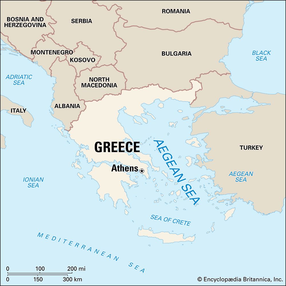
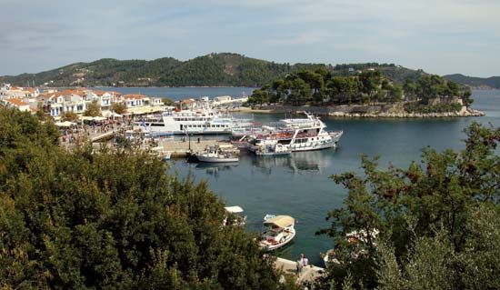
The Aegean Islands are a vast collection of Greek islands located within the Aegean Sea, situated between the Greek peninsula and Asia Minor. Geographically…
What is Aegean Islands?
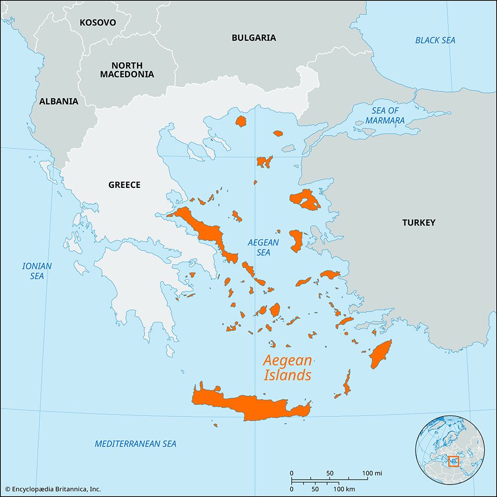
The Aegean Islands are a vast collection of Greek islands located within the Aegean Sea, situated between the Greek peninsula and Asia Minor. Geographically, these islands are often considered the mountain peaks of a now-submerged landmass known as Aegeis.12
The islands are typically organized into seven principal groups:
- Thracian Sea group: Includes Thásos, Samothrace, and Lemnos.2
- East Aegean group: Includes Lesbos, Chios, Ikaría, and Sámos.2
- Northern Sporades: Includes Skyros.2
- Cyclades: A group of about 30 islands, including Melos, Paros, Naxos, and Thera.12
- Saronic Islands: Includes Salamís, Aegina, and Hydra.2
- Dodecanese: Also known as the Southern Sporades, including Rhodes, Cos, and Pátmos.12
- Crete: The largest island, marking the southern boundary of the Aegean.2
Historically, these islands served as the cradle for significant Aegean civilizations, including the Minoan and Mycenaean cultures. Today, they are known for their rugged landscapes, agricultural products like olives and wine, and a thriving tourism industry.23
What are the major Aegean civilizations from the Bronze Age?
The Bronze Age in the Aegean region (c. 3000–1000 BCE) was defined by several distinct but interconnected civilizations that laid the foundation for later Greek culture.3
Major Aegean Civilizations
- Minoan Civilization: Flourishing on the island of Crete (c. 3000–1100 BCE), this was the first high civilization in the Aegean. Centered at Knossos, the Minoans were a maritime power known for their sophisticated palaces, vibrant frescoes, and early writing systems, such as Linear A writing systems, such as Linear A.34
- Cycladic Civilization: This culture developed throughout the Cyclades islands. While they maintained their own distinctive traditions, they were heavily influenced by trade and cultural exchange with Crete. They are particularly noted for their lively pottery styles and remarkable frescoes, such as those found at Akrotiri on the island of Thera.35
- Helladic (Mycenaean) Civilization: The Helladic period refers to the Bronze Age on the Greek mainland. By the 16th century BCE, this evolved into the Mycenaean civilization, named after its primary center, Mycenae. These warlike, Indo-European peoples initially adopted many aspects of Minoan culture before becoming the dominant power in the Aegean from about 1400 BCE until their decline around 1150 BCE.36
How did volcanic activity shape the landscape of islands like Thera?
Volcanic activity has fundamentally defined the landscape of Thera, transforming it from a single volcanic mountain into the distinct, bow-shaped island seen today.
Geological Transformation
Thera is the remaining eastern rim of a massive, exploded volcano. The island’s current configuration is the result of a catastrophic collapse that created a large caldera—a bowl-shaped depression formed when the volcano’s magma reservoir was rapidly emptied, causing the mountain’s summit to drop into the void.829
This collapse left behind an open lagoon, rimmed by steep, multi-colored volcanic cliffs of red, white, and black that rise to nearly 1,000 feet (300 meters). The island itself is composed largely of lava and pumice, the latter of which remains a primary export.8
Ongoing Volcanism
The volcanic processes that shaped Thera remain active. Within the central lagoon, two volcanic islets—Néa Kaméni and Palaéa Kaméni—continue to emerge as evidence of ongoing activity. The region is structurally prone to frequent earthquakes, which have historically damaged settlements on the island, including the 1956 earthquake that impacted the town of Thira.810
What is the significance of the euripus phenomenon in the Aegean Sea?
The Euripus is a narrow, 5-mile-long strait in the Aegean Sea that separates the Greek island of Euboea from the mainland. Its primary significance lies in its unique and complex tidal currents, which can reach velocities of 12 knots and reverse direction seven or more times daily. The exact cause of these erratic currents remains a subject of scientific intrigue, as it is not fully understood even today.16
Historically, the strait has been a site of both fascination and strategic importance. Popular tradition claims that the philosopher Aristotle drowned here in despair after failing to solve the mystery of the currents. Geologically, the strait is a submerged river valley that divides the Gulf of Euboea into northern and southern sections. The town of Chalkída has served as a vital trading center on the strait since ancient times, with the channel being spanned by various structures since 411 BCE.1617
Sources
- Aegean Islands — Encyclopædia Britannica
- Aegean Sea — Encyclopædia Britannica
- Aegean civilizations — Encyclopædia Britannica
- Minoan — Encyclopædia Britannica
- Aegean civilizations - The Middle Bronze Age on the mainland ( c. 2000–1550) — Encyclopædia Britannica
- Mycenaean — Encyclopædia Britannica
- Aegean civilizations - The Cyclades — Encyclopædia Britannica
- Thera — Encyclopædia Britannica
- caldera — Encyclopædia Britannica
- volcanism — Encyclopædia Britannica
- Europe - Chronological summary — Encyclopædia Britannica
- volcano - Submarine volcanoes — Encyclopædia Britannica
- volcano - Calderas — Encyclopædia Britannica
- igneous rock - Divergent plate boundaries — Encyclopædia Britannica
- eruption of Thera — Encyclopædia Britannica
- Euripus — Encyclopædia Britannica
- Gulf of Euboea — Encyclopædia Britannica
Published on · 3 min read