Afram River
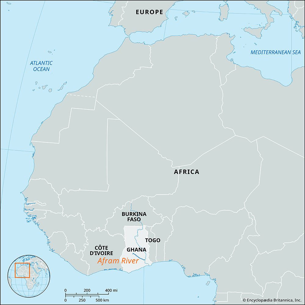
The Afram River is a river located in southern Ghana, western Africa. Rising northwest of Mampong, it flows southeast for approximately 55 miles (90 km) to…
What is Afram River?
The Afram River is a river located in southern Ghana, western Africa. Rising northwest of Mampong, it flows southeast for approximately 55 miles (90 km) to join Lake Volta.1
Historically a tributary of the Volta River, the lower portion of the Afram became an arm of the lake following the construction of the Akosombo Dam in the 1960s, transforming it into an important waterway. The river collects nearly all the drainage from the Kwahu Plateau, a major watershed in the region. Although the river runs dry between October and March, it remains significant for local fishing, and its valley is characterized by flat, swampy terrain.12
How did the creation of Lake Volta change the region?
The creation of Lake Volta via the Akosombo Dam transformed Ghana’s landscape and economy, though it brought significant social and environmental challenges.
Economic and Infrastructure Benefits
- Energy Production: The dam provides a massive source of hydroelectric power, currently generating about 85 percent of Ghana’s electricity and enabling exports to neighboring countries like Togo and Benin3.3
- Transportation and Industry: The lake is a navigable waterway that links the northern savanna to the coast. It was originally intended to power an integrated aluminum industry at Tema.43
- Resource Utilization: The reservoir supports commercial fishing, tourism, and irrigation for farmland in the Accra Plains farmland in the Accra Plains.3
Social and Environmental Costs
- Displacement: The project necessitated the inundation of 740 villages and the displacement of approximately 80,000 people. Resettlement efforts were widely criticized for insufficient planning and inadequate compensation.43
- Agricultural Disruption: The dam halted the natural cycle of seasonal flooding that once deposited nutrient-rich silt on surrounding lowlands. Farmers now rely on fertilizers, which cause chemical runoff and promote harmful algal growth.3
- Health and Safety: The altered ecosystem has attracted disease-carrying insects, such as mosquitoes. Additionally, controlled water releases to prevent dam failure have caused severe downstream flooding, displacing thousands.3
What is the significance of the Kwahu Plateau in Ghana?
The Kwahu Plateau is a significant geographical feature in southern Ghana that serves as the country’s primary watershed. Extending 160 miles (260 km) from Wenchi to Koforidua, it acts as a critical divide, separating the river systems that flow south to the Atlantic Ocean—such as the Birim, Pra, and Ankobra—from those belonging to the Volta River system, including the Afram, Pru, and Sene.25
Beyond its role in drainage, the plateau is vital for the following reasons:
- Climate Regulation: With an average elevation of 1,500 feet (460 m), the plateau shields the dense forest country to its south from the hot, dry harmattan winds that blow from the Sahara during the winter months.26
- Agriculture: The region supports diverse agricultural practices, including cacao cultivation in the west and vegetable farming in the eastern sector.2
- Topography: Marked by bold erosional scarps and prominent peaks like Mount Akwawa, the plateau represents the uplifted southern edge of the Voltaian Basin.25
How does the Akosombo Dam generate electricity?
The Akosombo Dam generates electricity by harnessing the potential energy of the Volta River, which is stored at a higher elevation in Lake Volta.3
The process follows these steps:
- Water Intake: Water is directed from the reservoir downward through large pipes or tunnels known as penstocks.3
- Turbine Rotation: As the water falls, its movement causes turbines to rotate, converting the water’s energy into mechanical energy.3
- Electricity Generation: These turbines are connected to generators, which convert the mechanical energy into electricity.3
- Transmission: Transformers then increase the voltage of the generated power to make it suitable for long-distance transmission to industrial sites, such as the smelter at Tema, and to the national grid.43
Currently, the dam has a generating capacity of 1,020 megawatts and provides approximately 85 percent of Ghana’s electricity needs.7
Sources
- Afram River — Encyclopædia Britannica
- Kwahu Plateau — Encyclopædia Britannica
- Lake Volta — Encyclopædia Britannica
- Akosombo Dam — Encyclopædia Britannica
- Ghana - Climate — Encyclopædia Britannica
- Ghana - Relief and drainage — Encyclopædia Britannica
- hydroelectric power — Encyclopædia Britannica
Published on · 3 min read