Agueda River
The Agueda River is a waterway located in western Spain. It originates on the northern slopes of the Sierra de Gata and travels approximately 80 miles (130…
What is Agueda River?
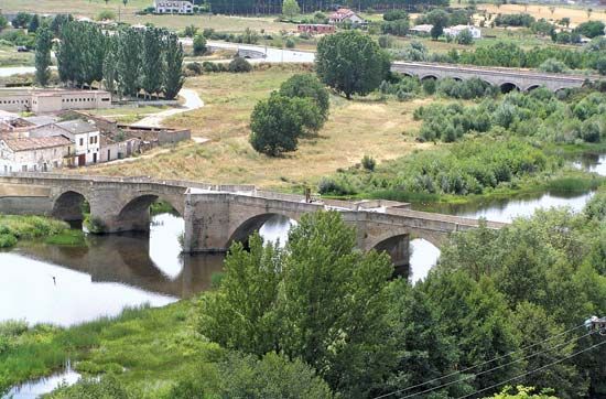
The Agueda River is a waterway located in western Spain. It originates on the northern slopes of the Sierra de Gata and travels approximately 80 miles (130 km) in a generally northwest direction before joining the Douro River. Notably, the final 15 miles (24 km) of its path serve as a portion of the international border between Portugal and Spain.1
What is the significance of the Douro River?
The Douro River is a vital waterway of the Iberian Peninsula, flowing 556 miles (895 km) from its source in Spain to the Atlantic Ocean at Porto, Portugal. Its significance spans economic, industrial, and historical domains:2
- Economic and Trade Hub: The river is essential for the transport of port wine, which is produced in the Douro district and stored in the warehouses of Vila Nova de Gaia. This trade has been a cornerstone of the region’s economy since the 17th century.23
- Energy and Infrastructure: Since the 1930s, the river has been extensively harnessed for hydroelectric power and irrigation, supporting the agricultural and industrial needs of the surrounding regions.23
- Historical and Cultural Importance: The river has shaped the development of cities like Porto, which grew from a Roman settlement on its banks. It has served as a strategic site for military events, including the Peninsular War, and is spanned by iconic engineering feats like the Dom Luís I Bridge.3
How do rivers act as international borders?
Rivers often serve as international borders because they provide a clear, visible, and relatively stable physical feature in the landscape that can be easily identified by neighboring states. When a river acts as a boundary, it typically defines the territorial limits of the countries on either side, often following the deepest part of the channel, known as the thalweg.
However, because rivers are dynamic agents of landscape evolution—constantly shaping the earth through erosion and the deposition of sediment—their courses can shift over time. This natural movement can lead to complex legal and political disputes regarding the exact location of the border. To manage these challenges, nations often establish formal agreements or treaties to govern the use of the water, allocate rights, and resolve conflicts. For example, the Indus Waters Treaty was created to manage the complex water-sharing rights between India and Pakistan, demonstrating how international cooperation is essential when a shared river system crosses or defines political boundaries.45
What are the main mountain ranges in Spain?
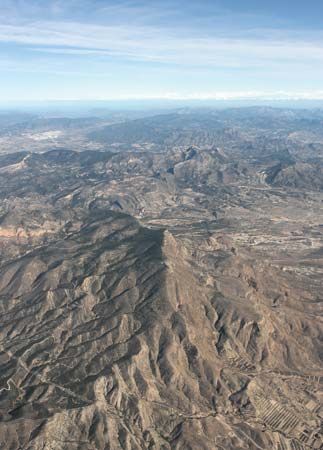
Spain’s topography is defined by several major mountain ranges that surround and divide its central plateau, the Meseta Central. These ranges significantly influence the country’s climate and regional development.67
- Pyrenees: Stretching across the neck of the peninsula, this massive range forms the natural border between Spain and France.6
- Cantabrian Mountains: Located in the north, this chain extends along the coast and acts as a significant barrier between the northern coastlands and the interior plateau.68
- Central Sierra (Sistema Central): This range trends west-southwest to east-northeast, effectively dividing the northern and southern portions of the Meseta Central.6
- Iberian Cordillera (Sistema Ibérico): Situated in the northeast and east, it separates the Ebro River depression from the central plateau.6
- Baetic Cordillera (Sistema Penibético): Running parallel to the southeastern coast, this range includes the Sierra Nevada, which contains Mulhacén Peak—the highest point on the Iberian Peninsula.69
- Sierra Morena: Located in the south, this range marks the southern edge of the Meseta Central, dropping steeply toward the Guadalquivir River basin.6
Sources
- Agueda River — Encyclopædia Britannica
- Douro River — Encyclopædia Britannica
- Porto — Encyclopædia Britannica
- river - Rivers as agents of landscape evolution — Encyclopædia Britannica
- Indus Waters Treaty — Encyclopædia Britannica
- Spain - Relief — Encyclopædia Britannica
- Sierra Nevada — Encyclopædia Britannica
- Cantabrian Mountains — Encyclopædia Britannica
- Spain - Climate of Spain — Encyclopædia Britannica
Published on · 3 min read