Boeuf River
The Boeuf River is a 230-mile (370-kilometre) river that originates in southeastern Arkansas, United States. It flows in a southwesterly direction, passing…
What is Boeuf River?
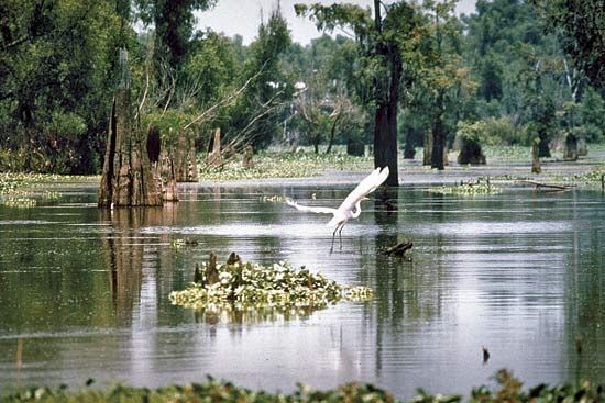
The Boeuf River is a 230-mile (370-kilometre) river that originates in southeastern Arkansas, United States. It flows in a southwesterly direction, passing between the Bartholomew and Mason bayous before entering Louisiana and eventually joining the Ouachita River in Catahoula Parish.1
A portion of the river’s course is navigable. The name “Boeuf” is derived from the French word for ox or steer. As a tributary, it contributes to the drainage basin of the Ouachita River, which spans the alluvial valley of the Mississippi and the Coastal Plain of Arkansas and Louisiana.12
What is the significance of the Ouachita River system?
The Ouachita River system is a vital waterway in the southern United States, serving as a significant corridor for navigation, energy production, and regional development. Spanning 605 miles, it drains a 25,000-square-mile basin across the Coastal Plain of Arkansas and Louisiana.2
Its significance is defined by several key roles:
- Navigation: The river has functioned as a critical transport route since the late 18th century, supported by a series of locks and dams constructed to maintain passage.2
- Energy and Flood Control: The upper river features three multipurpose dams—Carpenter, Blakely Mountain, and Remmel—which provide hydropower, flood control, and recreational opportunities through the creation of Lakes Ouachita, Hamilton, and Catherine.2
- Economic Hubs: The river supports major urban centers, including Arkadelphia and Camden in Arkansas, and Monroe in Louisiana, facilitating regional commerce.2
Ultimately, the system acts as a major tributary to the Red River, integrating the drainage of the Mississippi alluvial valley.2
How do rivers like the Boeuf shape the surrounding landscape?
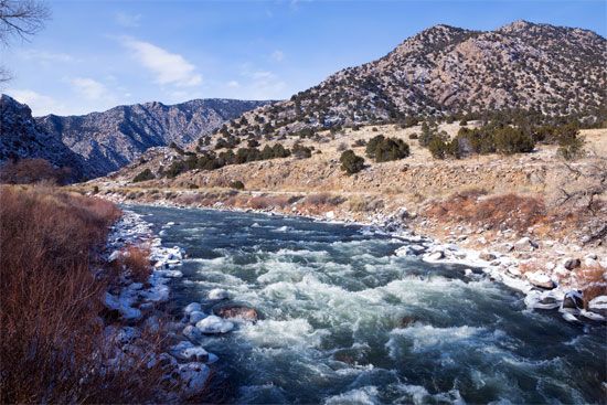
Rivers like the Boeuf River act as primary agents of landscape evolution by continuously reshaping the Earth’s surface through the processes of erosion and sedimentation. Rather than acting as simple conduits for water, these rivers transform geologic settings into distinct topographic forms by moving sediment-laden water across the landscape.4
The shaping of the surrounding terrain occurs through two primary mechanisms:
- Lateral Migration: As a river meanders, it erodes the outside banks of its bends while simultaneously depositing sediment on the inside to form point bars. This lateral movement creates features such as meander scrolls and eventually leads to the formation of oxbow lakes when abandoned channels are cut off.5
- Vertical Accretion: During periodic flooding, rivers overflow their banks, depositing sediment across the floodplain. This process builds up natural levees and gradually elevates the surrounding valley floor.5
Over time, these combined fluvial processes create complex landforms, including terraces and expansive alluvial plains, which reflect the river’s long-term interaction with the underlying geology and climate.46
What are some other major rivers in Louisiana and Arkansas?
Beyond the Ouachita River, several other major river systems play a vital role in the geography and economy of Arkansas and Louisiana:
- Mississippi River: This massive waterway serves as a primary drainage artery for both states. It is central to regional commerce, with major ports in cities like Baton Rouge, Louisiana, facilitating the shipment of petroleum, chemicals, and grain.23
- Arkansas River: Flowing through Arkansas, this river is a major tributary of the Mississippi. The Arkansas River Navigation System is a significant civil works project that provides a navigable, year-round waterway for transporting agricultural products, lumber, and coal, while also generating hydroelectric power.111213
- Red River: Rising in New Mexico, this river flows through Arkansas and Louisiana before entering the Atchafalaya River. It has historically been a key site for flood-control and river-development programs.14
- Sabine River: Located in Louisiana, this river is a key component of the state’s extensive water transportation network, connecting to the Intracoastal Waterway.3
Sources
- Boeuf River — Encyclopædia Britannica
- Ouachita River — Encyclopædia Britannica
- Red River — Encyclopædia Britannica
- river - Rivers as agents of landscape evolution — Encyclopædia Britannica
- river - Time and the floodplain system — Encyclopædia Britannica
- Mississippi River - Physiography — Encyclopædia Britannica
- river - Terraces and geomorphic history — Encyclopædia Britannica
- river - Floodplain deposits, origins, and features — Encyclopædia Britannica
- lake - Basins formed by fluvial and marine processes — Encyclopædia Britannica
- basin — Encyclopædia Britannica
- United States - The Atlantic Plain — Encyclopædia Britannica
- Arkansas River Navigation System — Encyclopædia Britannica
- Arkansas - Transportation — Encyclopædia Britannica
- Arkansas River — Encyclopædia Britannica
- Mississippi: Top Questions — Encyclopædia Britannica
- Mississippi - Drainage — Encyclopædia Britannica
- Louisiana - Transportation — Encyclopædia Britannica
Published on · 3 min read