Andaman Islands
The Andaman Islands hold significant strategic importance for India primarily due to their location along vital maritime corridors. Situated in the Indian…
What is the strategic importance of the Andaman Islands to India?
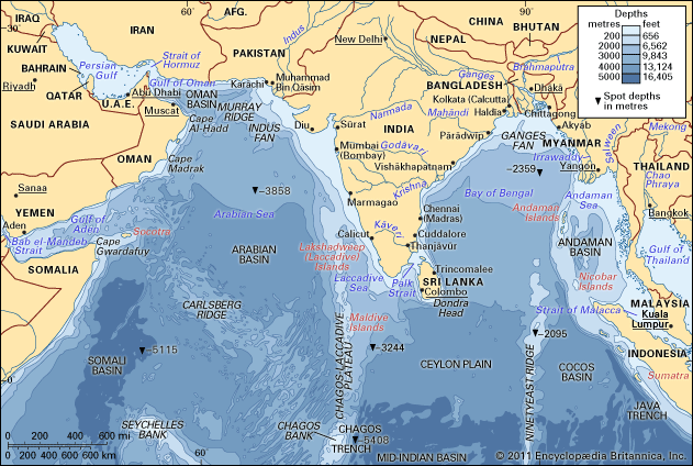
The Andaman Islands hold significant strategic importance for India primarily due to their location along vital maritime corridors. Situated in the Indian Ocean, the archipelago forms a natural boundary between the Bay of Bengal to the west and the Andaman Sea to the east.12
Their key strategic roles include:
- Maritime Trade Routes: The islands are positioned along a major shipping route connecting India and China via the Strait of Malacca. This strait is one of the most heavily traveled shipping channels in the world, serving as a critical passage for global trade, including oil tankers moving between the Middle East and East Asia.34
- Historical Connectivity: The islands have served as a link on ancient trade routes between India, Myanmar, and East Asia for centuries.15
- Geopolitical Presence: As a union territory of India, the islands extend the nation’s reach and maritime influence into the southeastern edge of the Bay of Bengal.1
What is the history of human settlement on the Andaman Islands?
The history of human settlement on the Andaman Islands is defined by the long-standing presence of indigenous groups and the subsequent arrival of colonial and modern populations.
Indigenous Inhabitants
The Andamanese are the aboriginal inhabitants of the islands. Historically, these small, isolated groups lived as hunter-gatherers, utilizing bows, nets, and harpoons from outrigger canoes. Their remoteness and territorial defenses shielded them from outside influence until the mid-19th century. Unfortunately, many groups were decimated by diseases introduced through contact with outsiders. Today, only a few groups, such as the Jarawa, the Onge, and the Sentinelese, maintain their traditional way of life.356
Colonial and Modern Settlement
While the islands were known to ancient travelers, the British began formal surveys in 1789. They established a penal colony at Port Blair in 1790, though it was soon abandoned. A permanent penal settlement was founded in 1858 following the Indian Mutiny, which significantly altered the demographic landscape as convicts from the mainland were settled there.7
During World War II, the islands were occupied by Japanese forces (1942–1945). Following Indian independence in 1947, the penal colony was abolished, and the territory became part of India. Since the 1950s, the population has grown through the arrival of numerous refugees and immigrants from South Asia.73
How did the Andaman Islands fare during World War II and the Japanese occupation?
During World War II, the Andaman and Nicobar Islands were occupied by Japanese forces from 1942 to 1945.5
The Japanese seized the Andaman Islands on March 23, 1942, as part of a broader strategy to gain control of the Indian Ocean and further isolate Australia. By establishing a presence there, the Japanese military aimed to secure their perimeter and disrupt Allied communications.8
Following the occupation, Japanese carrier-based aircraft and submarines utilized the region to launch operations against Allied interests. During the first week of April 1942, these forces preyed upon British warships and merchant vessels in the Indian Ocean and the Bay of Bengal, resulting in the sinking of nearly 30 cargo ships and significant damage to shore installations in Ceylon (now Sri Lanka).8
The British eventually recaptured the islands, after which the colonial penal colony in the Andamans was abolished. Administration of the territory was subsequently transferred to India upon its independence in 1947.5
Where are the Andaman Islands located, and what is their geographical significance?
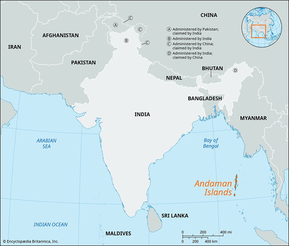
The Andaman Islands are located in the Indian Ocean, approximately 850 miles (1,370 km) east of the Indian subcontinent. Together with the Nicobar Islands to the south, they form a union territory of India.23
Their geographical significance is defined by several key factors:
- Tectonic Structure: The islands are the peaks of a submerged mountain range that forms an arc stretching about 620 miles (1,000 km) between Myanmar and Sumatra, Indonesia.3
- Maritime Boundary: This island arc serves as a natural boundary, separating the Bay of Bengal to the west from the Andaman Sea to the east.32
- Strategic Trade Route: The islands have been situated on ancient maritime trade routes connecting India with Myanmar and East Asia for centuries.351
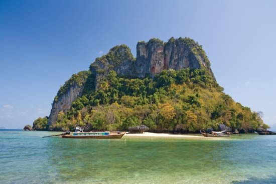
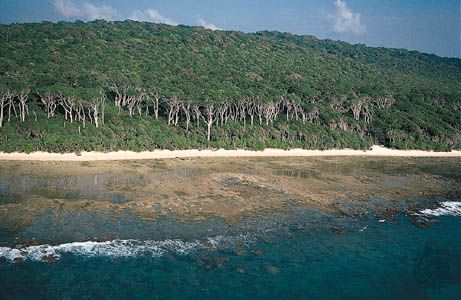
- Ecological and Geological Context: The islands are characterized by dense forests and rugged, dome-shaped hill ranges. Their location near major tectonic plate boundaries makes them vulnerable to seismic activity, as demonstrated by the devastating tsunami in 2004.231
Sources
- Andaman Sea — Encyclopædia Britannica
- Andaman and Nicobar Islands — Encyclopædia Britannica
- Andaman Islands — Encyclopædia Britannica
- Strait of Malacca — Encyclopædia Britannica
- Andaman and Nicobar Islands - History — Encyclopædia Britannica
- Andaman and Nicobar Islands - Population composition — Encyclopædia Britannica
- Andamanese — Encyclopædia Britannica
- Pacific War - The expansion of the Japanese perimeter — Encyclopædia Britannica
Published on · 3 min read