Arusha National Park
Arusha National Park is a protected preserve located in northern Tanzania. Established in 1960, the park is known for its rich variety of flora and fauna and…
What is Arusha National Park?
Arusha National Park is a protected preserve located in northern Tanzania. Established in 1960, the park is known for its rich variety of flora and fauna and serves as a significant site for both geological and natural interest.1
Key features of the park include:
- Mount Meru: A prominent mountain reaching 14,978 feet (4,565 meters).1
- Ngurdoto Crater: An extinct volcano located within the park boundaries.1
The park is situated in a region renowned for its wildlife and proximity to other major landmarks, including Mount Kilimanjaro, Olduvai Gorge, and the Ngorongoro Crater.1
What makes Mount Meru a significant landmark in Tanzania?
Mount Meru is a significant landmark in northern Tanzania due to its impressive physical stature and ecological importance. Standing at 14,978 feet (4,565 meters), it is a prominent volcanic cone located approximately 42 miles southwest of Mount Kilimanjaro.41
The mountain is notable for several key characteristics:
- Ecological Diversity: The slopes of Mount Meru support distinct vegetation zones, including rain forests up to 9,500 feet and an abundance of montane bamboo, which is notably absent on the neighboring Kilimanjaro.45
- Agricultural Value: The southern and eastern slopes are densely populated and well-watered by prevailing winds. The fertile volcanic soil in these areas is highly productive, supporting significant coffee plantations.4
- Geological Significance: As a major volcanic feature, the mountain contains an extinct crater that is easily accessible from the nearby town of Arusha. It is a central feature of Arusha National Park, which is recognized for its rich variety of flora and fauna.46
How does the East African Rift System shape the landscape of northern Tanzania?
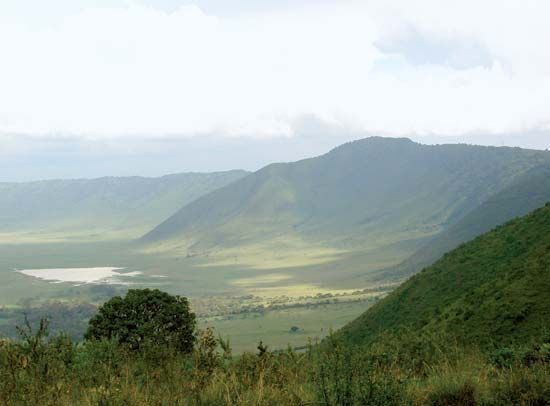
The East African Rift System has fundamentally shaped the landscape of northern Tanzania through millions of years of tectonic activity, faulting, and volcanism. This geological process has created a dramatic topography characterized by high-altitude massifs, deep depressions, and expansive plains.8910
Geological Features
- Volcanic Massifs: The rift’s formation has been accompanied by extensive volcanic activity, resulting in the creation of iconic peaks such as Mount Kilimanjaro and Mount Meru. Other notable volcanic features include the active volcano Ol Doinyo Lengai and the Ngorongoro Crater, which is the world’s largest caldera.8910
- Rift Depressions and Lakes: The system runs through northern Tanzania in a series of north-south-trending branches, creating narrow, deep depressions. These basins are often occupied by lakes, such as Lake Natron and Lake Manyara, which serve as distinct markers of the rift’s path.1011
- Lava Plains: Faulting and volcanic eruptions have produced broad lava plains that contrast with the surrounding highlands, contributing to the region’s diverse terrain, which ranges from wooded savannas to alpine areas.9
What are the primary differences between a national park and a conservation area?
While both national parks and conservation areas are designated to protect the natural environment, they differ primarily in their management objectives and the extent of human activity permitted within their borders.
National Parks
A national park is an area set aside by a national government to preserve the natural environment, often for public recreation, enjoyment, or scientific and historical interest. The primary goal is to keep landscapes, plants, and animals in their natural state. Because of the paradox between encouraging tourism and protecting wildlife, human activity is typically restricted to limited areas to minimize contact with the natural environment.122
Conservation Areas
A conservation area is a protected tract of land where development or certain uses are prohibited. Unlike many national parks, which focus strictly on preservation, some conservation areas allow for a degree of human integration. For example, in the Ngorongoro Conservation Area, while cultivation is prohibited, indigenous populations like the Maasai are permitted to graze their livestock, illustrating a model that balances conservation with traditional land use.1314
Sources
- Arusha National Park — Encyclopædia Britannica
- Ngorongoro Conservation Area — Encyclopædia Britannica
- Arusha — Encyclopædia Britannica
- Mount Meru — Encyclopædia Britannica
- East African mountains - Plant life — Encyclopædia Britannica
- Meru, Mount — Merriam-Webster
- East African mountains - Physiography — Encyclopædia Britannica
- East African Rift System — Encyclopædia Britannica
- Tanzania - Relief — Encyclopædia Britannica
- Africa - Relief — Encyclopædia Britannica
- volcano - Rift volcanoes — Encyclopædia Britannica
- conservation area — Merriam-Webster
- national park — Encyclopædia Britannica
- Tanzania - Plant and animal life — Encyclopædia Britannica
- Africa - Conservation of Africa — Encyclopædia Britannica
- national park: Top Questions — Encyclopædia Britannica
Published on · 3 min read