Atakora Mountains
The Atakora Mountains are a mountain range located in western Africa that trends in a north-northeasterly direction. This range is part of a larger chain…
What is Atakora Mountains?
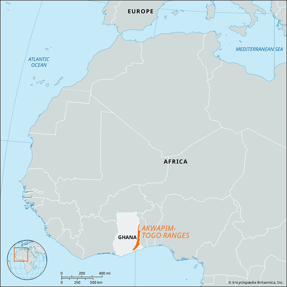
The Atakora Mountains are a mountain range located in western Africa that trends in a north-northeasterly direction. This range is part of a larger chain that begins in the Akwapim Hills of southeastern Ghana.12
As the chain extends through central Togo, it is often referred to as the Togo Mountains; it continues into Benin, where it is specifically known as the Atakora Mountains, eventually reaching the Niger River1. The mountains maintain an average elevation of approximately 2,000 feet (600 metres). The range reaches its highest point at Mount Agou—also known as Baumann Peak—which stands at 3,235 feet (986 metres) and serves as the highest peak in Togo.21
What is the significance of Mount Agou in Togo?
Mount Agou, also historically referred to as Baumann Peak, holds primary significance as the highest point in Togo, reaching an elevation of 3,235 feet (986 metres).32
Geographically, the mountain serves as an extreme western outlier of the Atakora Mountains, a range that extends across central Togo and into Benin across central Togo and into Benin. Its historical name, Baumann Peak, honors the Austrian-African explorer Oskar Baumann, reflecting the period when the region was a German colony known as Togoland between the 1880s and World War I. Situated in the southwestern part of the country near the border with Ghana, it stands as a prominent landmark within the broader Akwapim-Togo ranges system.32
How do the Atakora Mountains influence the climate of the region?
The Atakora Mountains play a significant role in the climate of northern Benin by influencing local rainfall patterns. While the northern climatic zone of Benin generally experiences two distinct seasons—a rainy season from May to September and a dry season—the presence of the mountains contributes to higher precipitation levels in their immediate vicinity.1
Specifically, the Atakora Mountains and the surrounding central region of Benin receive approximately 53 inches (1,346 mm) of rainfall annually. This amount is notably higher than the rainfall recorded in areas further to the north, where annual precipitation diminishes to about 38 inches (965 mm).1
Beyond this influence on moisture, the region is subject to the harmattan during the dry season. This hot, dry wind blows from the northeast between December and March, creating significant temperature fluctuations between day and night across the landscape.1
What are the major rivers that flow through or near these mountains?
The Akwapim-Togo Ranges, which include the Togo and Atakora Mountains, serve as a critical drainage divide for several major river systems in West Africa.
- Volta River Basin: The Volta River is the most prominent river associated with these ranges. It cuts through the mountain folds at the Ajena (Volta) Gorge in Ghana. The Oti River, a major tributary of the Volta, drains the sandstone plateau located north of the Togo Mountains.46
- Ouémé River: This river originates directly in the Atakora Mountains of Benin and flows southward for 280 miles before reaching the coastal lagoons.2
- Mono River: Rising in Togo, the Mono River and its tributaries, such as the Ogou, drain the tableland regions adjacent to the mountain chain. The Mono also forms part of the international frontier between Togo and Benin.62
- Niger River: The mountain chain extends northeasterly toward the Niger River, which, along with its own tributaries like the Mékrou, Alibori, and Sota, drains the northeastern portion of Benin.427
Sources
- Atakora Mountains — Encyclopædia Britannica
- Togo - Relief, drainage, and soils — Encyclopædia Britannica
- Mount Agou — Encyclopædia Britannica
- Akwapim-Togo Ranges — Encyclopædia Britannica
- Benin - Climate — Encyclopædia Britannica
- Ghana - Relief and drainage — Encyclopædia Britannica
- Benin - Drainage — Encyclopædia Britannica
Published on · 3 min read