Belaya River
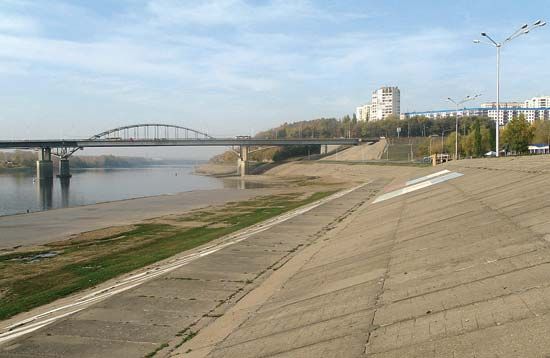
The Belaya River is a significant waterway located in the Bashkortostan republic of west-central Russia. It serves as the largest tributary of the Kama…
What is Belaya River?
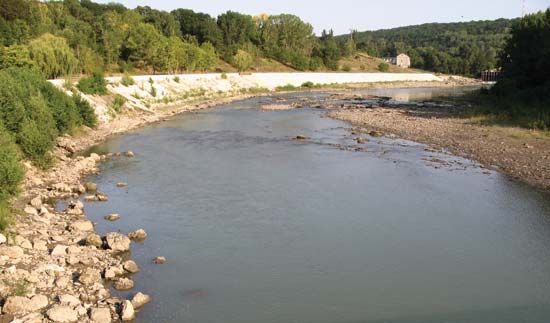
The Belaya River is a significant waterway located in the Bashkortostan republic of west-central Russia. It serves as the largest tributary of the Kama River, which is a major tributary of the Volga.1
The river originates in the southern Urals at the base of Mount Iremel. Its 882-mile (1,420-km) course begins in a narrow mountain valley before shifting northward, where the landscape transitions into a broad, terraced valley. The Belaya eventually joins the Kama River above Derbeshinsky, with the Ufa River serving as its own primary tributary.1
What is the significance of the Ural Mountains in Russian geography?
The Ural Mountains are of profound significance to Russian geography, serving as the traditional physiographic boundary between Europe and Asia. Stretching 1,550 miles, this rugged range acts as a central spine that influences the climate and economic development of the region.23
Geographic and Climatic Influence
Despite their relatively low elevation, the mountains significantly affect moisture distribution. Westerly winds bring precipitation from the Atlantic Ocean, causing the western slopes to be significantly wetter than the eastern slopes. The range also spans diverse latitudinal zones, from Arctic environments in the north to semidesert regions in the south.32
Economic and Industrial Importance
The Urals are exceptionally rich in mineral resources, including magnetite, copper, nickel, gold, and platinum, which have fueled a highly developed industrial complex. Major cities like Yekaterinburg, Chelyabinsk, and Perm became critical industrial hubs, particularly after World War II when many plants were relocated there.245
How does the Volga River system impact the economy of Russia?
The Volga River is the principal waterway of western Russia and a cornerstone of the nation’s economy. Its vast basin supports nearly half of the Russian population and serves as a vital hub for transportation, energy, and industry.6
Navigation and Trade
The Volga and its tributaries are navigable for approximately 2,000 miles, carrying nearly half of all inland freight and passengers in the region. The river system is integrated with the broader waterway network of eastern Europe through key infrastructure, including the Volga-Baltic Waterway, the Moscow Canal, and the Volga-Don Ship Canal. Major cargoes include construction materials, raw materials, petroleum, coal, and agricultural machinery.7
Energy and Industrialization
The river has been transformed by a series of massive dams and reservoirs that function as both navigation aids and hydroelectric power stations. These facilities, along with three on the Kama River, provide a combined generating capacity of approximately 11 million kilowatts. This energy supports significant industrial centers, such as Volzhsky, which hosts major chemical, steel, and manufacturing plants.89
What are the main characteristics of the Kama River?
The Kama River is a vital waterway in west-central Russia and a primary tributary of the Volga River. Its key characteristics include:
- Course and Basin: Rising in the Upper Kama Upland of Udmurtia, the river flows for 1,122 miles (1,805 km) through a basin covering 202,000 square miles (522,000 square km) before joining the Volga below Kazan.12
- Hydrology: The river experiences a significant spring surge, with snowmelt accounting for nearly 60 percent of its annual flow. It typically remains frozen from late autumn until April.12
- Navigation: It is a major transport artery, navigable for approximately 954 miles (1,535 km). Historically, it served as a crucial route to the Ural Mountains and Siberia.12
- Energy Infrastructure: The river has been transformed into a series of man-made lakes by three major barrages and hydroelectric stations located at Perm, Chaykovsky (near Votkinsk), and Nizhnekamsk.1210
Sources
- Belaya River — Encyclopædia Britannica
- Ural Mountains — Encyclopædia Britannica
- Ural Mountains - Economy — Encyclopædia Britannica
- Ural Mountains - Climate of the Ural Mountains — Encyclopædia Britannica
- Ural Mountains - People of the Ural Mountains — Encyclopædia Britannica
- Volga River — Encyclopædia Britannica
- Volga-Baltic Waterway — Encyclopædia Britannica
- Volga River - Navigation — Encyclopædia Britannica
- Volzhsky — Encyclopædia Britannica
- Volga River - Dams and reservoirs — Encyclopædia Britannica
- Volga River - Hydrology — Encyclopædia Britannica
- Kama River — Encyclopædia Britannica
Published on · 3 min read