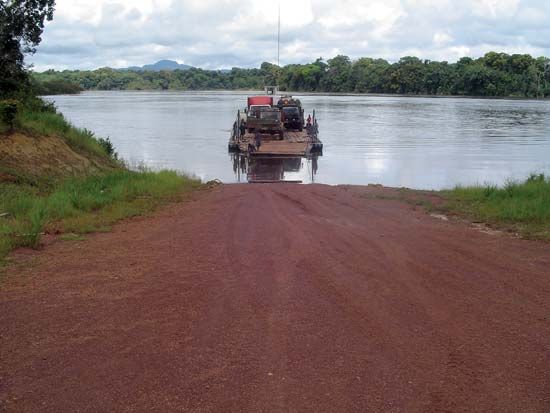
Berbice River
The Berbice River is a river located in eastern Guyana. It originates in the highlands of the Rupununi region and flows northward for 370 miles (595 km)…
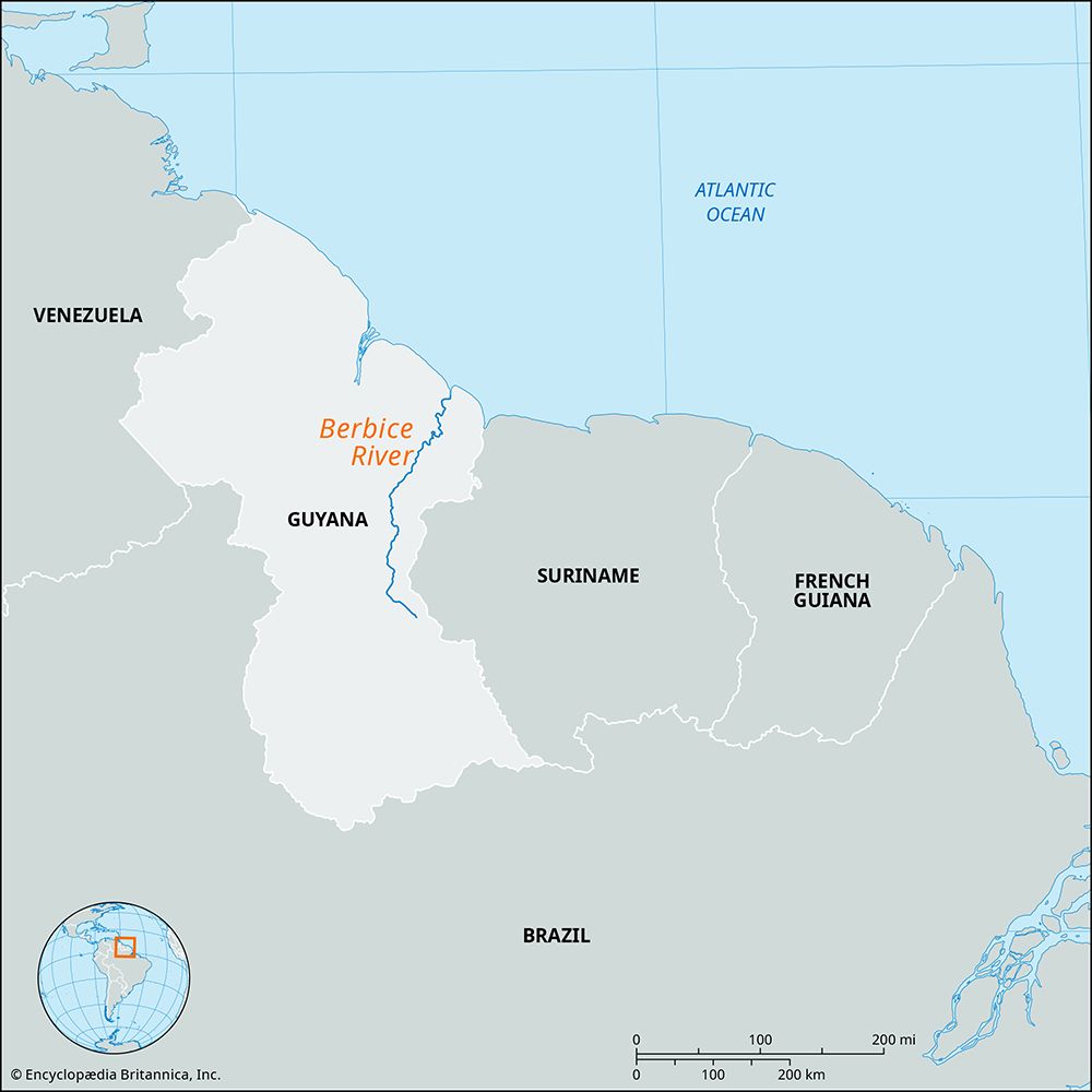
What is Berbice River?
The Berbice River is a river located in eastern Guyana. It originates in the highlands of the Rupununi region and flows northward for 370 miles (595 km) through dense forests before reaching the coastal plain and emptying into the Atlantic Ocean at New Amsterdam.1
The river’s basin is relatively narrow, constrained by the nearby Essequibo and Courantyne rivers, with the Canje serving as its primary tributary. While the river features many rapids upstream, it remains navigable for small vessels for approximately 100 miles (160 km) from its mouth.1
The river shares its name with a former Dutch colony, which was purchased by the British and united with other territories in 1831 to form the colony of British Guiana.12
What was the significance of the Dutch colony of Berbice?
The Dutch colony of Berbice was significant primarily as a foundational component in the development of what is now Guyana. Established by the Dutch during their period of colonial expansion in South America, Berbice served as a key site for the cultivation of sugarcane, a labor-intensive industry that relied on the forced labor of enslaved people brought from West Africa.32
The colony’s strategic value and agricultural potential made it a target during the shifting power dynamics of the late 18th and early 19th centuries. Following frequent changes in control between the British, French, and Dutch, Britain formally purchased Berbice, along with the regions of Demerara and Essequibo, in 1814.32
The unification of these three territories in 1831 to form the colony of British Guiana marked the end of Berbice as an independent colonial entity and established the administrative framework for the modern nation. Today, the region remains a vital part of Guyana’s coastal geography, with New Amsterdam serving as an important market centre at the mouth of the Berbice River.324
How do the Essequibo and Courantyne rivers compare to the Berbice?
The Essequibo, Courantyne, and Berbice rivers are primary waterways in Guyana that flow northward into the Atlantic Ocean. They differ significantly in scale, drainage capacity, and function:
River
Length
Key Characteristics
Essequibo
~630 miles (1,010 km)
The largest river between the
Amazon
and
Orinoco
; its system drains over half of Guyana.
Courantyne
~450 miles (700 km)
Forms the border between Guyana and
Suriname
; its basin remains largely undeveloped.
Berbice
~370 miles (595 km)
The shortest of the three; its basin is restricted by the proximity of the larger Essequibo and Courantyne rivers.
While the Essequibo is the most expansive, featuring a massive 20-mile-wide estuary, the Berbice is characterized by a more constrained basin and relies on the Canje as its primary tributary. Navigation on all three is limited by interior rapids and coastal obstructions like sandbars and mud.619
What indigenous groups originally lived in the Guyana region?
The indigenous peoples of the Guyana region have inhabited the area since at least the 1st millennium BCE, with early communities practicing shifting agriculture supplemented by hunting. These groups are generally categorized into coastal and interior populations.1011
Coastal and Interior Groups
- Coastal Groups: Historically, the coastal regions were inhabited by the Arawak, the Carib, and the Warao (also known as Warrau).11102
- Interior Groups: The forest and savanna areas are home to numerous groups, including the Wapisiana (Wapishana), the Arekuna, and the Macusí (Macushí), who are particularly prominent in the Rupununi Savanna region.11
Cultural Context
The South American Arawak and Carib groups typically lived in small, autonomous settlements, practicing a lifestyle centered on hunting, fishing, and farming crops such as cassava. While the Antillean branches of these groups often developed more complex social hierarchies or maritime traditions, the mainland groups in the Guianas maintained cultures typical of tropical forest inhabitants.312
Today, indigenous peoples constitute approximately one-tenth of Guyana’s population. While they continue to hold village lands informally, many have faced significant challenges in the late 20th and 21st centuries due to environmental damage from logging and gold-mining concessions.11
Sources
- Berbice River — Encyclopædia Britannica
- Guyana - Early history — Encyclopædia Britannica
- Essequibo - European colonization — Encyclopædia Britannica
- Guyana - Transportation — Encyclopædia Britannica
- Guyana - Settlement patterns — Encyclopædia Britannica
- Essequibo River — Encyclopædia Britannica
- Essequibo - Geography — Encyclopædia Britannica
- Courantyne River — Encyclopædia Britannica
- Guyana - Drainage — Encyclopædia Britannica
- Guyana - Ethnic groups — Encyclopædia Britannica
- Arawak — Encyclopædia Britannica
- Carib — Encyclopædia Britannica
- The Guianas — Encyclopædia Britannica
- Warrau — Merriam-Webster
Published on · 3 min read