Bering Land Bridge National Preserve
The Bering Land Bridge National Preserve is a remote wilderness area in northwestern Alaska, and it does not have developed recreational infrastructure or…
What recreational activities are available for visitors to the Bering Land Bridge National Preserve?
The Bering Land Bridge National Preserve is a remote wilderness area in northwestern Alaska, and it does not have developed recreational infrastructure or roads. Visitors primarily engage in activities centered on the preserve’s unique natural features, such as:
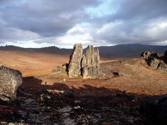
- Visiting Serpentine Hot Springs: This area features thermal pools and distinctive granite formations known as tors. A bunkhouse shelter is available for those who make the journey to this site.1
- Wildlife Viewing: The preserve is home to approximately 170 species of migrating birds, as well as land mammals including moose, musk oxen, reindeer, wolves, and bears. Marine mammals like seals, walruses, and whales can be observed in coastal areas.1
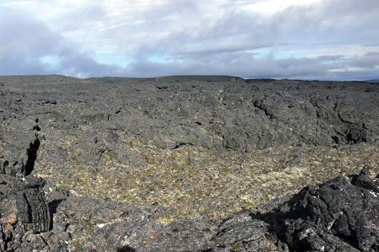
- Exploring Geological Features: Visitors may explore the preserve’s volcanic landscape, which includes ash explosion craters, lava fields, and maar lakes, such as the Devil Mountain Lakes.1
Access to the preserve is challenging and requires specialized travel: in summer, visitors typically arrive by seaplane or small boat, while winter access is limited to airplanes with ski runners, snowmobiles, or other tracked vehicles.1
What indigenous cultures have historical ties to the Bering Land Bridge area?
The Bering Land Bridge area, historically known as Beringia, served as a crucial corridor for human migration from Asia into the Americas. While the land bridge itself was submerged as sea levels rose at the end of the Pleistocene Epoch, the region remains deeply connected to the heritage of several Indigenous groups.
Historical and Contemporary Ties
The Indigenous peoples currently residing in the Arctic and subarctic regions of Alaska and Siberia are widely considered to be the descendants of the ancient populations that inhabited or traversed Beringia. These groups maintain rich cultural, linguistic, and historical ties to the land:2
- Inupiat: Residing on or near the Arctic Ocean and as far south as the Bering Strait, the Inupiat are speakers of the Inupiaq dialect of the Inuit language.3
- Yupiit: This group includes the Bering Sea Inuit, the St. Lawrence Island Inuit, and the Pacific Inuit (Sugpiat or Alutiit). They speak distinct forms of the Yupik language and have historically relied on marine resources in the Bering Sea and North Pacific.34
- Unangan (Aleuts): Inhabiting the Aleutian Islands and parts of the Alaska Peninsula, the Unangan possess a distinct cultural and linguistic heritage, speaking Unangam Tunuu.34
These groups are distinguished from other Native Americans by specific linguistic, physiological, and cultural characteristics. Today, many of these peoples have formed organizations to represent their interests in legal and political affairs, ensuring their continued stewardship of the region’s history and resources.43
How was the Bering Land Bridge formed during the last ice age?
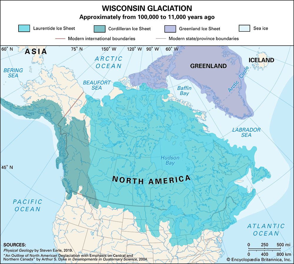
The Bering Land Bridge, known as Beringia, was formed during the Pleistocene Epoch due to global climate fluctuations. As massive glaciers expanded across the Northern Hemisphere, they locked up vast quantities of Earth’s water, causing global sea levels to drop by as much as 400 feet (120 meters).27
This significant decline in sea level exposed the shallow seafloor of the Bering Strait, creating a vast, dry land connection between northeastern Siberia and northwestern North America. At its greatest extent, roughly 20,000 years ago during the last glacial maximum, this region stretched from the Lena River in Russia to the Mackenzie River in Canada.28
Despite the surrounding ice sheets, much of Beringia remained unglaciated and featured a dry, tundra-like climate that supported the migration of plants, animals, and early humans between the continents. As the climate warmed and glaciers melted, rising sea levels eventually submerged the land bridge, severing the connection.27
What geological features can be found within the Bering Land Bridge National Preserve?
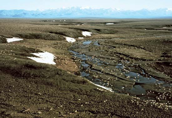
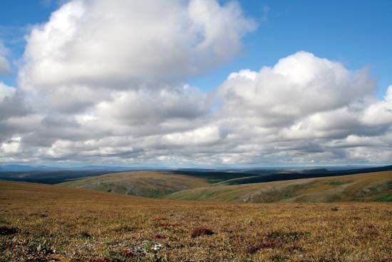
The Bering Land Bridge National Preserve, located on the Seward Peninsula in Alaska, contains a variety of distinct geological features shaped by the region’s volcanic history and environmental conditions.1
Key geological features include:
- Volcanic Formations: The preserve features ash explosion craters and extensive lava fields, which are remnants of past volcanic activity.1
- Maar Lakes: These are lakes formed within volcanic craters created when magma interacts with surface water or permafrost. The preserve is home to the Devil Mountain Lakes maar, which is recognized as the largest feature of its kind in the world.1
- Thermal Features and Tors: The Serpentine Hot Springs area contains natural thermal pools. Nearby, visitors can find tors, which are exposed, jointed, and broken masses of granite.1
- Topography: The landscape is characterized by low, tundra-covered coastal plains that transition into mountains as the terrain moves toward the interior of the peninsula.1
Sources
- Bering Land Bridge National Preserve — Encyclopædia Britannica
- Beringia — Encyclopædia Britannica
- Native American - Prehistory — Encyclopædia Britannica
- Arctic - History of settlement — Encyclopædia Britannica
- Arctic - Ethnic groups — Encyclopædia Britannica
- Arctic - Peoples and cultures of the American Arctic — Encyclopædia Britannica
- Bering Strait — Encyclopædia Britannica
- Pleistocene Epoch - Coastal environments and sea-level changes — Encyclopædia Britannica
Published on · 4 min read