Big Sandy River
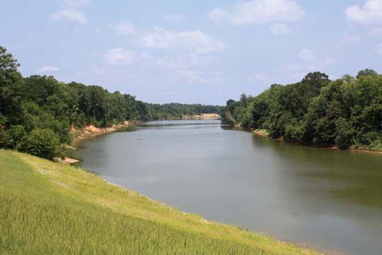
The Big Sandy River is a river located in the eastern United States, formed by the confluence of the Levisa and Tug forks at Louisa, Kentucky.
What is Big Sandy River?
The Big Sandy River is a river located in the eastern United States, formed by the confluence of the Levisa and Tug forks at Louisa, Kentucky.1
Flowing generally north for approximately 27 miles, the river serves as a boundary between Kentucky and West Virginia. It eventually empties into the Ohio River near Catlettsburg, Kentucky, at a point where the borders of Kentucky, West Virginia, and Ohio meet. The river has been made navigable through a system of locks and dams. Additionally, the river system includes the Breaks of Sandy, a notable 5-mile stretch of gorge and rapids located on its tributary, the Russell Fork.1
What is a river confluence?
A river confluence refers to the point where two or more streams or water bodies meet and flow together. This term can describe the act of these waters merging, the specific geographic location where the junction occurs, or the resulting combined stream itself.3
Confluences serve as fundamental building blocks for river networks of all scales. At these junctions, smaller streams—often referred to as tributaries or confluents—feed into a larger body of water. Beyond their physical role in hydrology, the term is also used metaphorically to describe the gathering of people, cultures, or events at a single point.34
How do locks and dams make a river navigable?
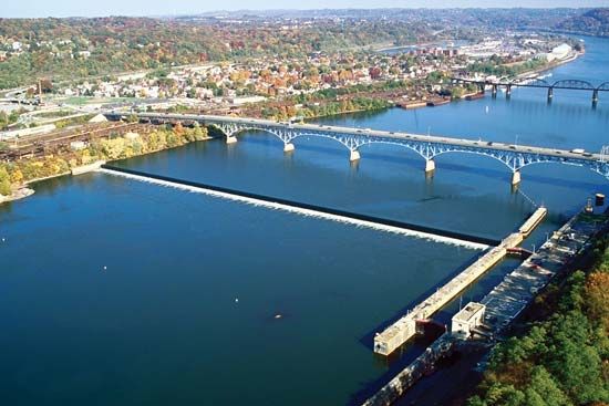
Locks and dams make a river navigable by transforming a natural, uneven riverbed into a series of controlled, level steps, a process known as canalization.67
How the System Works
- Impounding Barriers: Dams or weirs are constructed to create barriers that impound water, raising the water level to a consistent depth and creating “pounds” (level stretches of water) between the structures.67
- Navigation Locks: Because these barriers create significant differences in water elevation, locks are used to move vessels between the different levels.86
- The Process: A lock consists of a chamber with gates at both ends. To move a vessel, the chamber is filled or emptied using sluices until the water level matches the “pound” the vessel is entering. Once the levels are equalized, the gates open, allowing the vessel to pass safely to the next section of the river.87
This system effectively bypasses natural hazards like rapids or shallow areas, ensuring a reliable channel for transport regardless of the river’s natural gradient.67
What are the major tributaries of the Ohio River?
The Ohio River is formed at Pittsburgh by the confluence of the Allegheny and Monongahela rivers. Beyond these headwaters, the river is fed by numerous tributaries from both the north and the south.9
Major Tributaries
The Ohio River’s primary tributaries include:
- From the South:
- Tennessee River
- Cumberland River
- Kanawha River
- Big Sandy River
- Licking River
- Kentucky River
- Green River
- From the North:
- Muskingum River
- Miami River
- Wabash River
- Scioto River
The Ohio River contributes more water to the Mississippi River than any other tributary, draining a vast drainage basin of approximately 203,900 square miles.910
Sources
- Big Sandy River — Encyclopædia Britannica
- Big Sandy — Merriam-Webster
- Did you know? — Merriam-Webster
- confluent — Merriam-Webster
- river - Types of waterfalls — Encyclopædia Britannica
- lock — Encyclopædia Britannica
- canals and inland waterways - Characteristics of basic types — Encyclopædia Britannica
- canals and inland waterways - Locks — Encyclopædia Britannica
- Monongahela River — Encyclopædia Britannica
- Ohio River — Encyclopædia Britannica
- drainage basin — Encyclopædia Britannica
Published on · 2 min read