Bong Range
The Bong Range is a mountain chain located in west-central Liberia, West Africa. Extending approximately 25 miles (40 km) in a northeast–southwest direction…
What is Bong Range?
The Bong Range is a mountain chain located in west-central Liberia, West Africa. Extending approximately 25 miles (40 km) in a northeast–southwest direction, the range features average elevations between 600 and 1,000 feet (180–300 m), with its highest peak reaching 2,116 feet.1
The range serves as the source of the Farmington River. Geologically, the area is significant for its substantial iron ore deposits, which have been a key component of Liberia’s natural resource wealth. Since the mid-1960s, these deposits have been extracted by the German-Liberian Mining Corporation (Delimco) and transported via a dedicated company railroad to the Port of Monrovia for export.12
What other natural resources are found in Liberia?
Liberia possesses a diverse array of natural resources beyond iron ore, which has historically been a cornerstone of its economy. These resources are categorized into mineral wealth, agricultural products, and forestry assets.3
Mineral Resources
In addition to iron ore deposits found in the Bomi Hills, Mano Hills, and Mount Nimba, Liberia contains several other minerals:3
- Precious stones and metals: Diamonds and gold are significant, with the diamond trade now regulated under the Kimberley Process Certification Scheme to prevent the financing of conflict.32
- Industrial minerals: The country holds reserves of lead, manganese, graphite, cyanite, and barite.3
- Energy: There is potential for hydroelectric power development and possible offshore oil reserves.3
Agriculture and Forestry
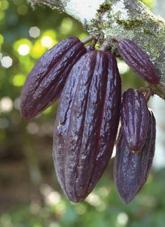
- Commercial Crops: Rubber is the country’s most valuable commercial crop. Other important exports include coffee and cacao.42
- Timber: The nation’s rainforests contain approximately 90 marketable species of trees, providing fine hardwood timber.4
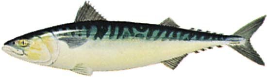
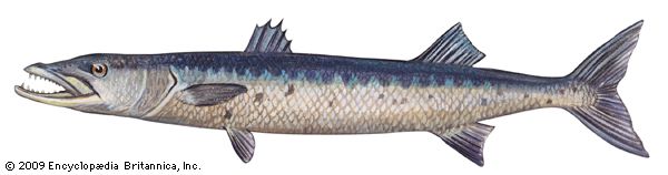
- Water and Marine Life: Liberia has abundant surface and groundwater. Its coastal waters support a fishing industry focused on mackerel, barracuda, and snapper.34
How does iron ore mining impact the environment?
Iron ore mining significantly impacts the environment, primarily through large-scale land alteration and resource consumption. The process often necessitates the removal of vast tracts of vegetation, as tropical forests frequently sit atop rich mineral deposits. This clearing is not only required to access the ore but also to provide fuel for processing facilities, such as iron smelters, which can lead to extensive deforestation.5
Operational activities in open-pit mines involve intensive drilling, blasting, and the movement of massive amounts of material—sometimes reaching one million tons per day. These operations generate significant waste rock, which must be transported to dedicated dumps, further altering the landscape. Additionally, mining can lead to the pollution of local waterways. While specific to gold extraction, the use of chemicals in mineral processing and the disturbance of riverbeds demonstrate how mining activities can contaminate water sources, rendering aquatic life unsafe for consumption.65
Ethically, the industry bears a responsibility to mitigate these ecological damages through sustainable land management and the implementation of rigorous waste-containment protocols to protect local ecosystems and communities.
What are the major rivers in Liberia?
Liberia’s drainage system is characterized by several major rivers that generally flow parallel to one another in a southwesterly direction toward the Atlantic Ocean. Many of these rivers are marked by waterfalls and rapids in their upstream sections, which limits their utility for inland navigation.
The major rivers of Liberia include:
- Mano River: Located in the northwest, it forms a portion of the country’s border.
- Cavalla River: Situated in the east and southeast, this river forms a significant section of the border between Liberia and Côte d’Ivoire.
- St. Paul River: This river flows through northern Liberia and discharges into the Atlantic near Monrovia. It is notable for the Mount Coffee hydroelectric station located on its course.
- St. John River: A major river flowing parallel to the St. Paul.
- Cestos River: Another significant river flowing perpendicular to the coast.
- Lofa River: Located in the north.
- Farmington River: Recognized for its role as a source of hydroelectric power.7892
Sources
- Bong Range — Encyclopædia Britannica
- Liberia - Resources and power — Encyclopædia Britannica
- Liberia - Agriculture, forestry, and fishing — Encyclopædia Britannica
- Liberia - Trade — Encyclopædia Britannica
- mining - Unit operations — Encyclopædia Britannica
- Status of the world’s tropical forests - Ranching and mining — Encyclopædia Britannica
- Liberia - Drainage — Encyclopædia Britannica
- Cavalla River — Encyclopædia Britannica
- Saint Paul River — Encyclopædia Britannica
- Côte d’Ivoire - Drainage — Encyclopædia Britannica
Published on · 3 min read