Brazos River
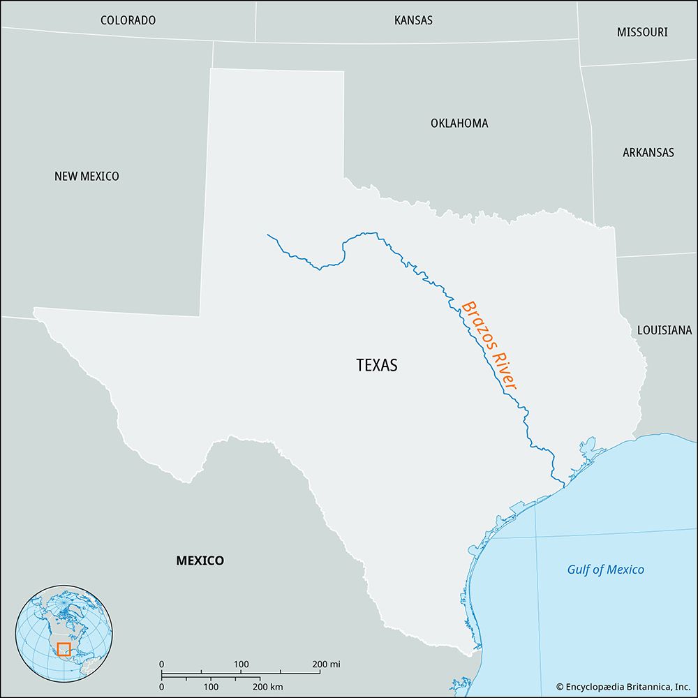
The Brazos River flows southeast across Texas, passing through several notable cities and historic settlements along its 1,280-mile course.
What are some of the major cities and towns located along the Brazos River?
The Brazos River flows southeast across Texas, passing through several notable cities and historic settlements along its 1,280-mile course.1
Key locations along the river include:
- Waco: Situated along the river’s path, this is one of the largest cities located on the Brazos.1
- Brazosport: Located at the river’s mouth, this industrial complex comprises several communities, including Freeport, Lake Jackson, Clute, Lake Barbara, Brazoria, and Richwood.2
- Historic Sites: The river valley was central to early Anglo-American settlement, notably at San Felipe de Austin, founded in 1822, and Washington-on-the-Brazos, where Texas declared its independence from Mexico in 1836.1
The river serves as a vital resource for the region, providing hydroelectric power and irrigation for agriculture, particularly in the cotton-growing areas of the valley.1
What role did the Brazos River play in early Texas settlements and the Texas Revolution?
The Brazos River served as a vital artery for early Anglo-American settlement and a central stage for the Texas Revolution.
Early Settlement
In the 1820s, the lower Brazos River valley became a primary destination for Stephen F. Austin and his colonists, who were granted land by the Mexican government. San Felipe de Austin, founded in 1824, served as the headquarters for these colonies and became known as the “birthplace of Anglo-American settlement in Texas”. The area provided essential resources for the growing population, which reached approximately 20,000 by the early 1830s.415
Role in the Texas Revolution
The river valley was instrumental in the political and military organization of the revolution:
- Political Hub: Washington-on-the-Brazos served as the site where the Texas Declaration of Independence was issued on March 2, 1836.67
- Strategic Planning: San Felipe hosted critical conventions in 1832 and 1833, as well as the Consultation of 1835, where leaders planned a provisional government.5
- Military Conflict: As Mexican forces under Antonio López de Santa Anna advanced, San Felipe was burned by retreating Texans in March 1836 to prevent its occupation.5
Where is the Brazos River located, and what is its length?
The Brazos River rises in eastern New Mexico and western Texas, specifically on the Llano Estacado near Lubbock. As the longest river in Texas, it flows generally southeast across the state, crossing the coastal plain before emptying into the Gulf of Mexico at Freeport.1
The river spans a total course of approximately 1,280 miles (2,060 km).1
What are the major tributaries of the Brazos River?
The Brazos River is fed by several significant watercourses that contribute to its flow across Texas.
The river’s primary upper forks include:
- Double Mountain Fork
- Salt Fork
- Clear Fork
The Brazos proper is formed by the confluence of the Double Mountain and Salt forks near the Caprock Escarpment. Additionally, the river’s chief tributaries along its course are:
- Paluxy River
- Little River
- Navasota River
Sources
- Brazos River — Encyclopædia Britannica
- Brazosport — Encyclopædia Britannica
- Brazos — Merriam-Webster
- San Felipe — Encyclopædia Britannica
- Washington-on-the-Brazos State Historical Site — Encyclopædia Britannica
- Texas - Settlement — Encyclopædia Britannica
- Texas - Revolution and the republic — Encyclopædia Britannica
Published on · 2 min read