Buka Island
The Bougainville conflict, which began in 1988 due to grievances over the Panguna mine, significantly impacted Buka Island and its people. As the conflict…
How has the Bougainville conflict impacted Buka Island and its people?
The Bougainville conflict, which began in 1988 due to grievances over the Panguna mine, significantly impacted Buka Island and its people. As the conflict escalated, Buka became a site of violent clashes in 1990.1
The broader civil war, which lasted for years and resulted in thousands of deaths across the region, led to severe disruptions, including the central government’s decision to cut off services and impose a naval blockade on the secessionist-held areas.2
Following the 2001 peace agreement, the political landscape of the region was transformed. Buka emerged as a central hub for the newly formed autonomous region:
- Administrative Role: Having served as the provincial headquarters since 1997, Buka became the administrative centre for the autonomous region of Bougainville.1
- Governance: In 2005, the newly elected government of the autonomous region was sworn in at Buka, marking a significant step in the transition toward local self-governance.3
Where is Buka Island located within Papua New Guinea?
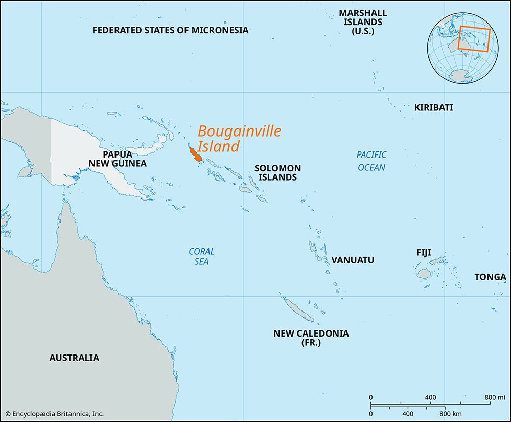
Buka Island is located in the Solomon Sea within the southwestern Pacific Ocean and is part of Papua New Guinea and is part of Papua New Guinea. Geographically, it is one of the northern Solomon Islands and is situated immediately northwest of Bougainville Island.13
The two islands are separated by the Buka Passage, a deep, narrow channel ranging from approximately 980 to 3,500 feet (300 to 1,070 metres) in width. Together with Bougainville and several smaller island groups, Buka forms the autonomous region of Bougainville.13
What is the geological history and formation of Buka Island?
Buka Island is a volcanic formation measuring 35 miles by 9 miles (56 km by 14 km), with a total land area of 190 square miles (492 square km). Geologically, Buka is part of the broader volcanic arc that extends from New Ireland in Papua New Guinea to Vanuatu.14
The island’s topography features hills in the southwest that rise to an elevation of 1,634 feet (498 metres). The landscape is characterized by dense interior forests, while the south and west coasts are fringed by coral reefs. The western coastline is notably marked by the deep indentation of Queen Carola Harbour. While the provided information identifies the island as a volcanic formation, specific details regarding the precise timeline or sequence of its geological emergence are not available in the current knowledge base.1
How has Buka Island’s history been affected by colonialism and World War II?
Buka Island’s history has been significantly shaped by shifting colonial administrations and the strategic conflicts of World War II.
Colonial Administration
The island’s colonial era began in 1885 when it was placed under a German protectorate. Following a British-American-German agreement at the turn of the century, the island remained under German administration until 1914, when it was seized by Australian troops. In 1920, the island was formally mandated to Australia, a status that continued until the outbreak of global conflict in the 1940s.1
Impact of World War II
During World War II, Buka Island became a strategic target for the Japanese military as they sought to expand their defensive perimeter and isolate Australia. The Japanese occupied the island on March 13, 1942, and held it until 1945. Following the war, the island was incorporated into the UN Trust Territory of New Guinea. It eventually became part of the independent nation of Papua New Guinea in 1975.16
Sources
- Buka Island — Encyclopædia Britannica
- Papua New Guinea - Attempts at secession — Encyclopædia Britannica
- Bougainville Island — Encyclopædia Britannica
- Solomon Islands - Land — Encyclopædia Britannica
- history of Solomon Islands - Prehistory of Solomon Islands — Encyclopædia Britannica
- Pacific War - The expansion of the Japanese perimeter — Encyclopædia Britannica
Published on · 3 min read