Canning Basin
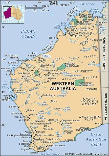
The Canning Basin is an arid sedimentary basin located in northwestern Western Australia. Covering approximately 150,000 square miles (400,000 square km), it…
What is Canning Basin?
The Canning Basin is an arid sedimentary basin located in northwestern Western Australia. Covering approximately 150,000 square miles (400,000 square km), it stretches from the Fitzroy River south to the De Grey River and extends southeast toward 128° E longitude.1
The basin underlies the western portion of the Great Sandy Desert, and its interior is characterized by parallel sand dunes interspersed with clay pans and spinifex vegetation. Geologically, the region features artesian water formations and experiences seismic activity due to crustal sag. Additionally, the area is home to the Blina oilfield.1
What is an artesian basin?
An artesian basin is a large-scale geological structure containing an aquifer—a water-bearing layer of permeable rock, such as sandstone—that is confined between layers of impermeable rock, like shale.3
Water enters this aquifer at an outcrop located at a higher elevation than the basin floor. Because the water is trapped between impermeable layers, the weight of the water at higher elevations creates hydrostatic pressure. When a well is drilled into this confined aquifer, this natural pressure forces the water to rise to the surface without the need for pumping.3
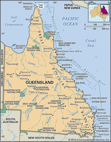
In some instances, if the overlying rock is fractured by faults or joints, the water may escape naturally to form artesian springs. A prominent example is the Great Artesian Basin, which covers a vast portion of Australia and serves as a critical water source for irrigation and livestock.34
How do sand dunes form in the Great Sandy Desert?
Sand dunes in the Great Sandy Desert form through the interaction of wind and sediment transport within the Canning Basin. The process begins with the erosion of sandstone and other rocks by spasmodic but violent desert rainwash and stream runoff. This sediment is transported to interior basins, where it is deposited as alluvium, providing the primary source of sand for dune formation.56
Once this loose sand is available, the wind acts as the primary agent of shaping. Sand grains move across the surface through saltation (a jumping motion) or creep. When wind velocity decreases upon encountering a small patch of sand, the wind deposits its load, initiating the growth of a mound. As the dune grows, the windward slope adjusts to the airflow, while the leeward side steepens until it reaches the angle of repose (approximately 32°), causing sand to slip down the face. This process allows the dune to maintain an equilibrium and migrate forward over time. In the Great Sandy Desert, these active, moving sand ridges are often interlaced with Triodia (Spinifex) grass.786
What are sedimentary basins and how do they form?
In geology, a basin is a broad, shallow trough or syncline—a structural depression in the bedrock that serves as a site for the accumulation of sediment.12
Formation Processes
Sedimentary basins form through various geological mechanisms that create depressions in the Earth’s surface:
- Crustal Movements: Nonlinear subsidence (the sinking of the Earth’s surface) often creates basins and irregular depressions. When this occurs in extensive belts, the resulting large-scale features are known as geosynclines.13
- Tectonic Activity: Basins can form through the downwarping of rock layers, often accompanied by the uplift of adjacent mountain ranges, as seen in the Wind River and Big Horn basins.12
- Solution Processes: The removal of soluble constituents (such as limestone, gypsum, or halite) from underlying strata by groundwater can cause the surface to collapse, creating basins or karst topography.1214
- Volcanic and Human Activity: Basins may also result from the collapse of volcanic cones or man-induced causes, such as mining and the extraction of water or petroleum.1213
Sources
- Canning Basin — Encyclopædia Britannica
- Eucla Basin — Encyclopædia Britannica
- Great Artesian Basin — Encyclopædia Britannica
- artesian well — Encyclopædia Britannica
- sand dune — Encyclopædia Britannica
- Great Sandy Desert — Encyclopædia Britannica
- sand dune - Winds — Encyclopædia Britannica
- sand dune - Sands — Encyclopædia Britannica
- sand dune - Fixed dunes in semiarid regions — Encyclopædia Britannica
- sand dune - Formation and growth of dunes — Encyclopædia Britannica
- Australia - The Western Plateau — Encyclopædia Britannica
- basin — Encyclopædia Britannica
- river - Deposits and stratigraphy — Encyclopædia Britannica
- subsidence — Encyclopædia Britannica
- lake - Basins formed by fluvial and marine processes — Encyclopædia Britannica
Published on · 3 min read