Carrantuohill
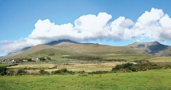
Carrantuohill is the highest mountain in Ireland, reaching an elevation of 3,414 feet (1,041 meters).
What is Carrantuohill?
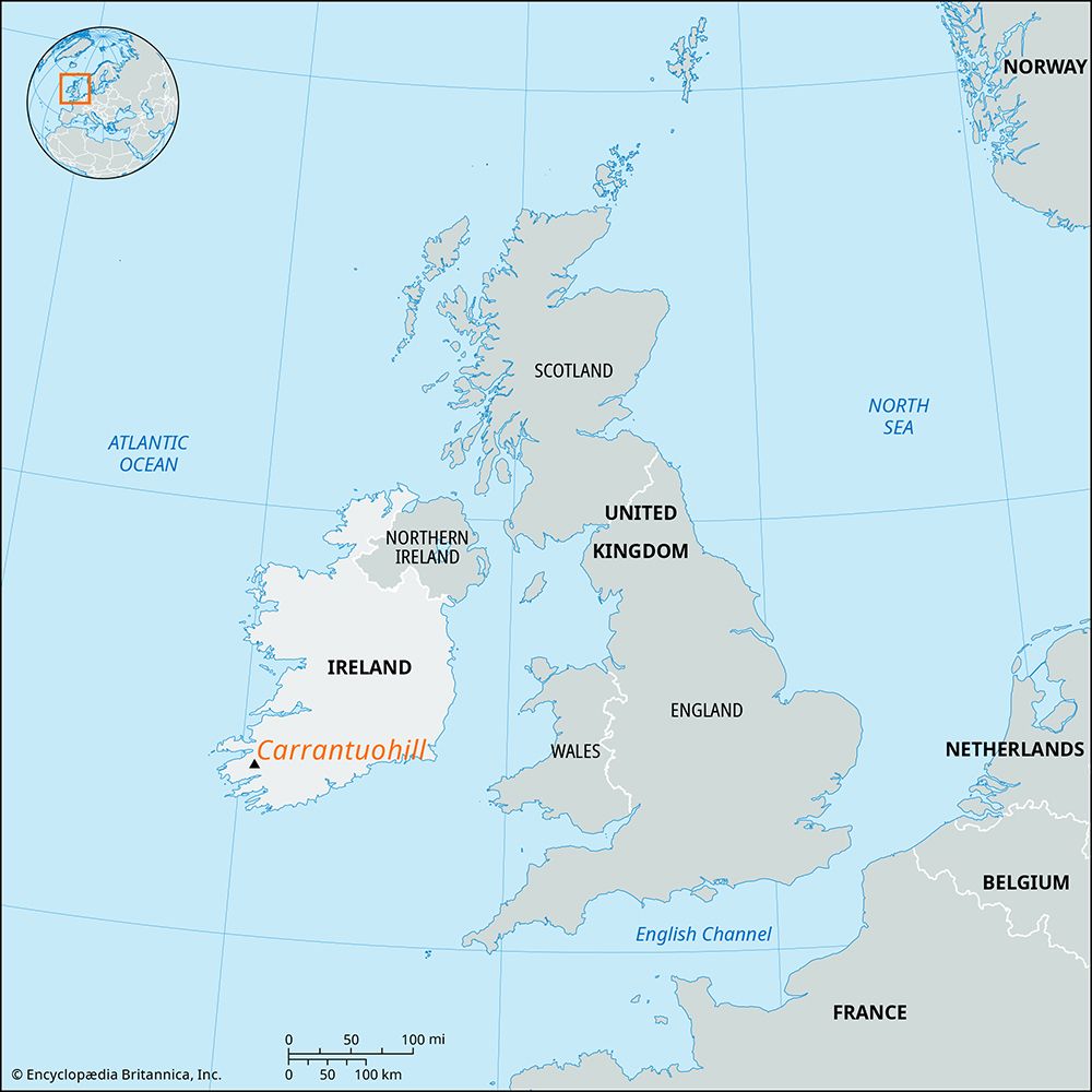
Carrantuohill is the highest mountain in Ireland, reaching an elevation of 3,414 feet (1,041 meters).12
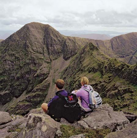
Located in County Kerry on the Iveragh Peninsula, it is part of the Macgillycuddy’s Reeks mountain range. The range is primarily composed of red sandstone and features a rugged landscape shaped by historical glacial activity, which created its characteristic sharp peaks and corries.12
What are the MacGillycuddy’s Reeks?
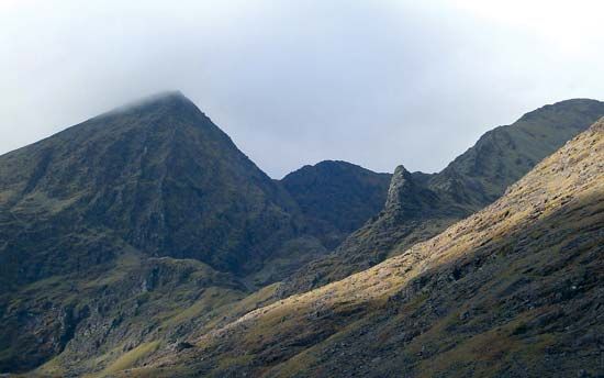
The Macgillycuddy’s Reeks (from the Irish for “ridge” or “crests”) are a prominent mountain range located on the Iveragh Peninsula in County Kerry, southwestern Ireland.23
The range is geologically defined by a long anticlinal formation of Devonian sandstones. Over time, the area was heavily shaped by glacial activity, which carved out its distinct landscape of deep valleys, serrated ridges, and sharp peaks. This range is home to Carrantuohill, which, at 3,414 feet (1,041 meters), stands as the highest mountain in Ireland.2
How do glaciers shape mountain landscapes?
Glaciers are powerful agents of landscape transformation, reshaping mountains through both erosion and the deposition of sediments.
Erosional Landforms
Glaciers drastically alter mountain terrain by carving out distinct features:
- Cirques and Tarns: Glaciers often begin in amphitheatre-shaped hollows called cirques. As ice scours the bedrock, it can create deep basins that fill with water to form tarns.4
- U-Shaped Valleys: Unlike rivers, which create narrow V-shaped valleys, glaciers widen and deepen existing valleys by removing debris and eroding bedrock, resulting in characteristic U-shaped profiles with steep sidewalls.4
- Arêtes and Horns: As glaciers erode parallel valleys, the remaining bedrock divides are narrowed into sharp, knife-edge ridges known as arêtes. When multiple cirques erode the flanks of a mountain, they leave behind a sharp, pyramid-shaped peak called a horn.4
Depositional Landforms
As glaciers melt, they leave behind various materials and landforms:
- Moraines: These are ridges of till (unsorted sediment) deposited at the margins of a glacier.5
- Drumlins and Eskers: Drumlins are streamlined hills aligned with ice movement, while eskers are long, sinuous ridges formed by streams flowing in tunnels beneath melting ice sheets.5
What is the Iveragh Peninsula known for?
The Iveragh Peninsula, located in County Kerry, Ireland, is a significant geographical feature known for its rugged, mountainous terrain. Stretching 30 miles long and 15 miles wide, it serves as a continuation of the hill lines extending from western County Cork toward Valencia Island.2
The peninsula is primarily recognized for:
- Highland Landscapes: It contains the Macgillycuddy’s Reeks, a mountain range formed by Devonian sandstones. This range includes Carrantuohill, which, at 3,414 feet (1,041 meters), is the highest peak in Ireland.62
- Cultural and Historical Sites: Off the peninsula’s west coast lies Skellig Michael, a rocky island home to the remains of an ancient monastery that was designated a UNESCO World Heritage site in 1996.2
- Geography: The area is characterized by mountainous ridges intersected by deep valleys, with human settlement largely confined to the lowlands and interior valleys.2
Sources
- Carrantuohill — Encyclopædia Britannica
- Macgillycuddy’s Reeks — Encyclopædia Britannica
- Macgillicuddy's Reeks — Merriam-Webster
- glacial landform - Cirques , tarns, U-shaped valleys, arêtes, and horns — Encyclopædia Britannica
- Quaternary - Landforms — Encyclopædia Britannica
- Kerry — Encyclopædia Britannica
Published on · 2 min read