Central Pacific Basin
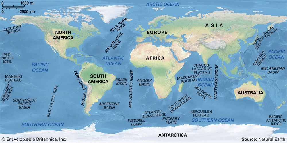
The Central Pacific Basin features a variety of significant underwater structures shaped by intense volcanic and seismic activity. Key features include:
Are there any significant underwater features or structures within the Central Pacific Basin?
The Central Pacific Basin features a variety of significant underwater structures shaped by intense volcanic and seismic activity. Key features include:
- Mid-Pacific Mountains: This submarine mountain range borders the basin to the north and consists of chains of seamounts, which are large volcanic mountains rising at least 1,000 meters above the seafloor.12
- Trenches: The basin extends westward to a zone of deep-sea trenches, including the Aleutian Trench, Kuril Trench, Japan Trench, and Yap Trench.1
- Hydrothermal Vents: Found in spreading centre zones, these features are localized discharges of heated seawater. They are often associated with neovolcanic zones and support unique ecosystems that rely on chemosynthesis rather than sunlight.34
- Abyssal Hills: In areas of active faulting, the seafloor is characterized by linear, fault-bounded abyssal hills and valleys.4
The basin’s floor is also covered with the remains of oceanic organisms that once inhabited its waters.1
How do scientists study and map the Central Pacific Basin?
Scientists study and map the Central Pacific Basin using a combination of acoustic, satellite, and physical sampling technologies to overcome the challenges of the deep, light-opaque ocean environment.6
Acoustic Mapping
Because light cannot penetrate deep water, sonar is the primary tool for mapping seafloor topography. Modern systems include:
- Multibeam Echo Sounders: Systems like Seabeam allow researchers to map two-dimensional swaths of the seafloor with high accuracy.67
- Scanning Sonar: Instruments such as GLORIA can image large regions of the seafloor morphology rapidly.67
- Near-Bottom Systems: Tools like the “Deep Tow” are operated close to the seafloor to provide high-resolution measurements of fine-scale features.6
Satellite and Geophysical Techniques
Earth-orbiting satellites equipped with radar altimeters, such as Seasat, measure the shape of the ocean surface. Because gravity causes the sea surface to bulge over massive seamounts and downwarp over deep-sea trenches, these measurements allow scientists to compute gravity maps that reveal previously uncharted submarine features.678
Physical Sampling
To understand the composition of the basin, researchers use:
- Bottom Samplers: Devices like dredges, grabbing devices, and coring tools retrieve rock and sediment samples for laboratory analysis.71
- Deep-Sea Drilling: Ships like the JOIDES Resolution use hydraulic piston corers to extract long, undisturbed sediment cores, which provide a historical record of Earth’s climate and ocean life.71
What is the average depth of the Central Pacific Basin?
The provided search results do not specify an average depth for the Central Pacific Basin. While the deepest section of the basin is noted to lie more than 21,300 feet (6,500 meters) below sea level, there is no data available regarding its mean depth.1
For context, the Pacific Ocean as a whole has a mean depth of approximately 14,040 feet (4,280 meters), but this figure encompasses the entire ocean rather than the specific Central Pacific Basin.11
How was the Central Pacific Basin formed geologically?
The Central Pacific Basin is a major submarine feature shaped by the long-term processes of plate tectonics and seafloor spreading.114
Geologically, the basin is part of the Pacific Plate, which has been moving northward for millions of years. Its formation is linked to a complex history of spreading centers that generated oceanic crust, as well as the consumption of older plates—such as the Izanagi, Farallon, and Phoenix plates—through subduction.14
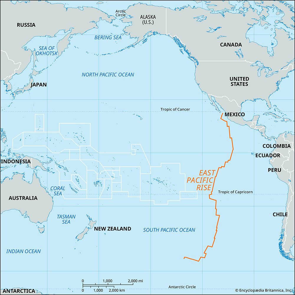
While the basin is characterized as the most geologically stable structural province of the Earth’s crust, its boundaries are defined by intense activity. To the west, the basin reaches a zone of trenches known as the Andesite Line, where subduction and back-arc spreading occur. To the east and south, the basin is influenced by the East Pacific Rise, a volcanic ridge where new oceanic crust is continuously created as plates diverge. Over time, the floor of the basin has accumulated the remains of oceanic organisms, which now cover much of its surface.1511617
Sources
- Central Pacific Basin — Encyclopædia Britannica
- seamount — Encyclopædia Britannica
- oceanic ridge - Hydrothermal vents — Encyclopædia Britannica
- Pacific mountain system — Encyclopædia Britannica
- oceanic ridge - Spreading centre zones — Encyclopædia Britannica
- ocean basin - Exploration of the ocean basins — Encyclopædia Britannica
- undersea exploration - Exploration of the seafloor and the Earth’s crust — Encyclopædia Britannica
- geoid - Radar altimetry of the ocean surface — Encyclopædia Britannica
- autonomous underwater vehicle — Merriam-Webster
- ocean basin - Deep-sea sediments — Encyclopædia Britannica
- Which ocean is deeper: The Atlantic or the Pacific? — Encyclopædia Britannica
- ocean basin - Sedimentation patterns — Encyclopædia Britannica
- Earth sciences - Ocean bathymetry — Encyclopædia Britannica
- plate tectonics - Back-arc basins — Encyclopædia Britannica
- ocean basin - Evolution of the ocean basins through plate movements — Encyclopædia Britannica
- East Pacific Rise — Encyclopædia Britannica
- Pacific mountain system - Geology — Encyclopædia Britannica
- Pacific Ocean - Central region — Encyclopædia Britannica
Published on · 3 min read